National Register of Historic Places listings in Hampden County, Massachusetts
This is a list of the National Register of Historic Places listings in Hampden County, Massachusetts.

This is a list of the properties and districts on the National Register of Historic Places in Hampden County, Massachusetts, United States. Latitude and longitude coordinates are provided for many National Register properties and districts; these locations may be seen together in a map.[1]
There are 165 properties and districts listed on the National Register in the county, including 3 National Historic Landmarks. The city of Springfield is the location of 90 of these properties and districts, including 1 of the National Historic Landmarks; they are listed separately, while the remaining 75 properties and districts, including 2 National Historic Landmarks, are listed here.
- This National Park Service list is complete through NPS recent listings posted January 29, 2021.[2]
Current listings
Springfield
Outside Springfield
| [3] | Name on the Register[4] | Image | Date listed[5] | Location | City or town | Description |
|---|---|---|---|---|---|---|
| 1 | Academy Historic District | 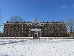 Academy Historic District |
April 20, 1979 (#79000351) |
Mountain Rd., Main and Faculty Sts. 42°07′29″N 72°25′56″W |
Wilbraham | |
| 2 | Agawam Center Historic District | 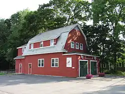 Agawam Center Historic District |
June 21, 2001 (#01000670) |
24-196 Elm St.; 551-1008 Main St. 42°04′00″N 72°37′05″W |
Agawam | |
| 3 | Al's Diner | 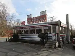 Al's Diner |
December 14, 2000 (#00001482) |
14 Yelle St. 42°11′30″N 72°35′58″W |
Chicopee | part of the Diners of Massachusetts Multiple Property Submission (MPS) |
| 4 | Ames Manufacturing Company |  Ames Manufacturing Company |
June 23, 1983 (#83000734) |
5-7 Springfield St. 42°08′57″N 72°36′24″W |
Chicopee | |
| 5 | Edward Bellamy House |  Edward Bellamy House |
November 11, 1971 (#71000091) |
91-93 Church St. 42°09′21″N 72°35′04″W |
Chicopee | |
| 6 | Brimfield Center Historic District | 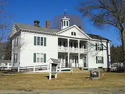 Brimfield Center Historic District |
June 22, 2006 (#06000524) |
Main St., Brookfled, Wales, Sturbridge and Warren Rds. 42°07′29″N 72°18′32″W |
Brimfield | |
| 7 | Thornton W. Burgess House | 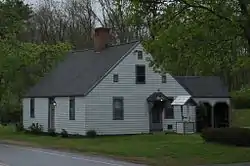 Thornton W. Burgess House |
April 21, 1983 (#83000740) |
789 Main St. 42°03′48″N 72°24′24″W |
Hampden | |
| 8 | Elijah Burt House |  Elijah Burt House |
April 26, 1976 (#76000240) |
201 Chestnut St. 42°03′15″N 72°30′54″W |
East Longmeadow | |
| 9 | Cabotville Common Historic District | 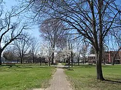 Cabotville Common Historic District |
May 28, 1999 (#99000558) |
School, Chestnut, Park and West Sts. 42°08′42″N 72°36′42″W |
Chicopee | |
| 10 | Caledonia Building | 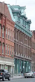 Caledonia Building |
July 3, 1979 (#79000346) |
185-193 High St. 42°12′27″N 72°36′27″W |
Holyoke | |
| 11 | Carreau Block | 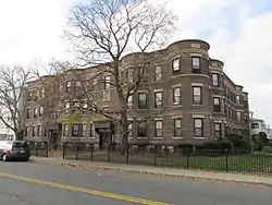 Carreau Block |
August 6, 1998 (#98000993) |
640-642 Chicopee St. 42°11′05″N 72°36′41″W |
Chicopee | |
| 12 | Chapin School |  Chapin School |
July 5, 2016 (#16000424) |
40 Meadow St. 42°11′05″N 72°36′36″W |
Chicopee | |
| 13 | Chester Center Historic District | 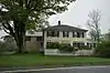 Chester Center Historic District |
February 25, 1988 (#88000161) |
Skyline Trail at intersection of Bromley and Lyman Rds. 42°17′26″N 72°55′27″W |
Chester | |
| 14 | Chester Factory Village Historic District | 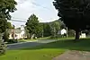 Chester Factory Village Historic District |
March 16, 1989 (#89000145) |
Roughly bounded by Middlefield Rd., River, Main, and Maple Sts., US 20, and Williams St. 42°16′52″N 72°58′54″W |
Chester | |
| 15 | City Hall | 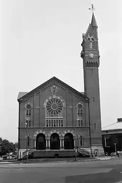 City Hall |
July 30, 1974 (#74002052) |
Market Sq. 42°08′55″N 72°36′52″W |
Chicopee | |
| 16 | Josiah Day House | 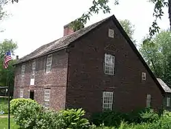 Josiah Day House |
April 16, 1975 (#75000265) |
70 Park St. 42°06′25″N 72°37′08″W |
West Springfield | |
| 17 | Joseph Dewey House |  Joseph Dewey House |
July 27, 2001 (#01000746) |
87 S. Maple St. 42°06′42″N 72°45′49″W |
Westfield | |
| 18 | Dwight Manufacturing Company Housing District | 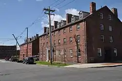 Dwight Manufacturing Company Housing District |
June 3, 1977 (#77000173) |
Front, Depot, Dwight, Exchange, Chestnut Sts. 42°08′48″N 72°36′44″W |
Chicopee | |
| 19 | First Congregational Church of Blandford |  First Congregational Church of Blandford |
October 24, 1985 (#85003371) |
North St. 42°10′55″N 72°55′45″W |
Blandford | |
| 20 | First Congregational Church of East Longmeadow | 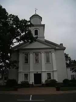 First Congregational Church of East Longmeadow |
January 3, 1978 (#78000444) |
7 Somers Rd. 42°03′51″N 72°30′46″W |
East Longmeadow | |
| 21 | Friedrich Block | 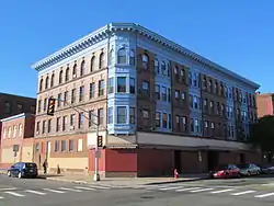 Friedrich Block |
December 5, 2002 (#02001473) |
449-461 Main St. 42°11′52″N 72°36′36″W |
Holyoke | |
| 22 | Granville Center Historic District |  Granville Center Historic District |
November 5, 1991 (#91001587) |
Main Rd. 42°04′02″N 72°52′33″W |
Granville | |
| 23 | Granville Village Historic District |  Granville Village Historic District |
November 5, 1991 (#91001588) |
Roughly, area around the junction of Maple St. and Main and Granby Rds., including part of Water St. 42°03′54″N 72°51′49″W |
Granville | |
| 24 | Hadley Falls Company Housing District |  Hadley Falls Company Housing District |
November 9, 1972 (#72000133) |
Center, N. Canal, Grover, and Lyman Sts. 42°12′27″N 72°35′55″W |
Holyoke | |
| 25 | Hampden County Training School | 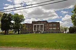 Hampden County Training School |
August 16, 2018 (#100002781) |
702 S Westfield St. 42°02′39″N 72°40′21″W |
Agawam | |
| 26 | Hampden Park Historic District | 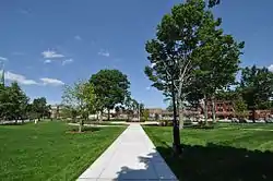 Hampden Park Historic District |
September 10, 2012 (#12000781) |
Roughly bounded by Hampden, Chestnut, Maple, & Dwight Sts. 42°12′30″N 72°36′30″W |
Holyoke | |
| 27 | Holyoke Canal System | .jpg.webp) Holyoke Canal System |
December 3, 1980 (#80000473) |
Front and South Sts. and the Connecticut River 42°12′06″N 72°36′21″W |
Holyoke | |
| 28 | Holyoke City Hall |  Holyoke City Hall |
December 6, 1975 (#75000259) |
536 Dwight St. 42°12′23″N 72°36′28″W |
Holyoke | |
| 29 | Laflin-Phelps Homestead | 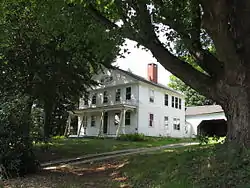 Laflin-Phelps Homestead |
December 6, 2005 (#05001371) |
20 Depot St. 42°03′14″N 72°46′02″W |
Southwick | |
| 30 | Landlord Fowler Tavern | 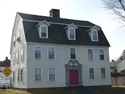 Landlord Fowler Tavern |
August 11, 1982 (#82001914) |
171 Main St. 42°07′03″N 72°44′10″W |
Westfield | |
| 31 | Capt. Charles Leonard House | 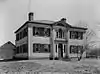 Capt. Charles Leonard House |
March 10, 1975 (#75000273) |
663 Main St. 42°04′14″N 72°36′53″W |
Agawam | |
| 32 | Longmeadow Historic District | 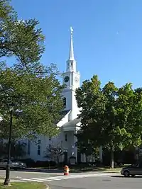 Longmeadow Historic District |
November 12, 1982 (#82000490) |
Roughly Longmeadow St. from Birdie Rd. to Wheelmeadow Brook 42°02′57″N 72°34′59″W |
Longmeadow | |
| 33 | Longmeadow Street-North Historic District | 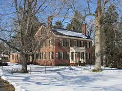 Longmeadow Street-North Historic District |
October 28, 1994 (#94001262) |
Bounded by Longmeadow St., Springfield Town Line, Westmoreland Ave. and Colley Dr. 42°04′01″N 72°34′41″W |
Longmeadow | |
| 34 | Ludlow Center Historic District | 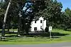 Ludlow Center Historic District |
October 21, 1988 (#88001999) |
Along Center, Church and Booth Sts. 42°11′31″N 72°27′35″W |
Ludlow | |
| 35 | Ludlow Village Historic District | 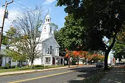 Ludlow Village Historic District |
February 22, 1993 (#93000009) |
Roughly bounded by Winsor, Sewall and State Sts. and the Chicopee River, and crossing the Chicopee, above Red Bridge Rd. 42°09′55″N 72°26′32″W |
Ludlow | |
| 36 | Maplewood Hotel | 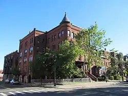 Maplewood Hotel |
November 10, 1983 (#83003980) |
328-330 Maple St. 42°12′13″N 72°36′44″W |
Holyoke | |
| 37 | Mechanic Street Cemetery |  Mechanic Street Cemetery |
June 26, 2002 (#02000632) |
Mechanic St. 42°07′23″N 72°44′41″W |
Westfield | |
| 38 | Memorial Town Hall |  Memorial Town Hall |
May 17, 1984 (#84002449) |
Main St. 42°05′51″N 72°18′48″W |
Monson | |
| 39 | Middlefield-Becket Stone Arch Railroad Bridge District | 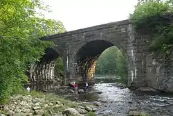 Middlefield-Becket Stone Arch Railroad Bridge District |
April 11, 1980 (#80000502) |
Middlefield vicinity 42°18′44″N 73°01′10″W |
Chester | Extends into Middlefield and Becket. |
| 40 | Monson Center Historic District | Monson Center Historic District |
May 6, 1991 (#90000788) |
Main and Cushman Streets 42°05′53″N 72°18′50″W |
Monson | |
| 41 | Monson Developmental Center | 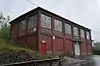 Monson Developmental Center |
January 21, 1994 (#93001483) |
200 State Ave. 42°08′43″N 72°20′04″W |
Monson | |
| 42 | Moseley School | September 4, 2020 (#100005525) |
25 Dartmouth St. 42°07′57″N 72°44′22″W |
Westfield | ||
| 43 | William Norcross House |  William Norcross House |
March 29, 1984 (#84002450) |
14 Cushman St. 42°05′56″N 72°18′47″W |
Monson | |
| 44 | North Chester Historic District |  North Chester Historic District |
December 6, 1996 (#96001465) |
Roughly bounded by E. River, Smith, and N. Chester Rds. 42°19′35″N 72°55′53″W |
Chester | |
| 45 | North High Street Historic District |  North High Street Historic District |
June 26, 1986 (#86001376) |
High St. between Dwight and Lyman Sts.; also 233-411 High St.; also 580 Dwight St. and 230, 234, and 236 Maple St. 42°12′29″N 72°36′26″W |
Holyoke | Second and third sets of boundaries represent boundary increases of December 24, 1992 and September 12, 2008, respectively |
| 46 | Octagon House | 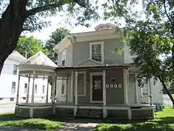 Octagon House |
April 1, 1982 (#82004967) |
28 King St. 42°07′17″N 72°45′19″W |
Westfield | |
| 47 | Our Mother of Sorrows Monastery and Retreat Center | 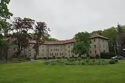 Our Mother of Sorrows Monastery and Retreat Center |
August 30, 2002 (#02000904) |
110 Monastery Ave. 42°07′07″N 72°37′57″W |
West Springfield | Now a senior housing facility. |
| 48 | Thomas D. Page House |  Thomas D. Page House |
October 25, 1988 (#87001782) |
105 East St. 42°09′22″N 72°34′39″W |
Chicopee | |
| 49 | Palmer Memorial Hall | 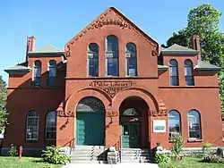 Palmer Memorial Hall |
September 3, 1999 (#99001082) |
1029 Central St. 42°09′23″N 72°19′39″W |
Palmer | |
| 50 | Polish National Home | 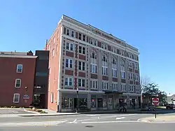 Polish National Home |
November 14, 1980 (#80000475) |
136-144 Cabot St. 42°08′41″N 72°36′35″W |
Chicopee | |
| 51 | Prospect Hill School |  Prospect Hill School |
November 19, 2008 (#08001069) |
33 Montgomery St. 42°08′03″N 72°44′46″W |
Westfield | |
| 52 | Prospect Park |  Prospect Park |
September 10, 2004 (#04000931) |
Maple St., Arbor Way, and the Connecticut River 42°12′43″N 72°36′21″W |
Holyoke | Now called Pulaski Park |
| 53 | Purchase-Ferre House |  Purchase-Ferre House |
November 29, 1990 (#90001805) |
1289 Main St. 42°02′58″N 72°36′58″W |
Agawam | |
| 54 | Clovis Robert Block |  Clovis Robert Block |
December 5, 2002 (#02001472) |
338-348 Main St. 42°11′59″N 72°36′28″W |
Holyoke | |
| 55 | John and Ruth Rose House | 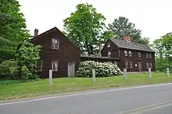 John and Ruth Rose House |
August 10, 2018 (#100002772) |
944 Main Rd. 42°04′22″N 72°54′03″W |
Granville | |
| 56 | Russell Center Historic District | 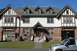 Russell Center Historic District |
December 27, 1996 (#96001524) |
Junction of Main and Lincoln Ave. 42°11′22″N 72°51′24″W |
Russell | |
| 57 | Sanford Whip Factory | 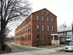 Sanford Whip Factory |
December 10, 2008 (#08001176) |
330 Elm St. 42°07′39″N 72°44′50″W |
Westfield | |
| 58 | School Street Barn | 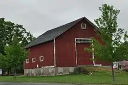 School Street Barn |
September 10, 2012 (#12000782) |
551 School St. 42°04′27″N 72°35′34″W |
Agawam | |
| 59 | Thomas and Esther Smith House |  Thomas and Esther Smith House |
June 2, 2005 (#05000217) |
251 North West St. 42°04′31″N 72°41′44″W |
Agawam | |
| 60 | Springfield Street Historic District | 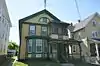 Springfield Street Historic District |
January 25, 1991 (#90002217) |
Roughly bounded by Springfield St., Gaylord St. and Fairview Ave. 42°08′38″N 72°36′14″W |
Chicopee | |
| 61 | State Normal Training School |  State Normal Training School |
July 7, 1983 (#83000769) |
27 Washington St. 42°07′20″N 72°45′06″W |
Westfield | |
| 62 | Swetland-Pease House |  Swetland-Pease House |
April 9, 1980 (#80000505) |
Southeast of East Longmeadow at 191 Pease Rd. 42°02′38″N 72°29′41″W |
East Longmeadow | |
| 63 | Jacob Thompson House | March 13, 2020 (#100005078) |
7 Main St. 42°06′31″N 72°18′59″W |
Monson | ||
| 64 | Union Station | 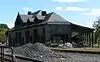 Union Station |
June 9, 1988 (#88000715) |
Depot St. 42°09′20″N 72°19′47″W |
Palmer | |
| 65 | United States Whip Company Complex | 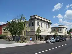 United States Whip Company Complex |
November 29, 1983 (#83003983) |
24 Main St. 42°07′12″N 72°44′53″W |
Westfield | |
| 66 | US Post Office-Holyoke Main | 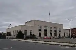 US Post Office-Holyoke Main |
January 21, 1986 (#86000122) |
650 Dwight St. 42°12′29″N 72°36′38″W |
Holyoke | |
| 67 | US Post Office-Palmer Main |  US Post Office-Palmer Main |
December 12, 1985 (#85003336) |
Park and Central Sts. 42°09′28″N 72°19′39″W |
Palmer | |
| 68 | Valentine School | 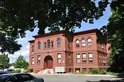 Valentine School |
September 16, 1983 (#83000774) |
Grape and Elm Sts. 42°08′46″N 72°36′12″W |
Chicopee | |
| 69 | H. M. Van Deusen Whip Company |  H. M. Van Deusen Whip Company |
February 18, 1987 (#87000037) |
42 Arnold St. 42°07′22″N 72°45′03″W |
Westfield | |
| 70 | West Granville Historic District |  West Granville Historic District |
November 5, 1991 (#91001589) |
Roughly, Main Rd. from west of Beach Hill Rd. to South Ln. No. 2 42°04′39″N 72°56′18″W |
Granville | |
| 71 | Western Railroad Stone Arch Bridges and Chester Factory Village Depot |  Western Railroad Stone Arch Bridges and Chester Factory Village Depot |
January 13, 2021 (#100006273) |
Vicinity of Herbert Cross Road, Middlefield/Becket Line (Bridges and Roadbed); 10 Prospect Street (Depot) 42°16′49″N 72°58′42″W |
Chester | Extends into Becket and Middlefield; includes a subset of the Middlefield-Becket Stone Arch Railroad Bridge District. |
| 72 | Westfield Center Historic District |  Westfield Center Historic District |
June 25, 2013 (#13000441) |
0-362 Elm Street, 2-86 Broad Street, 0-83 Court Street, 2-24 Main Street, 0-71 North Elm Street, Chestnut Street on the west, West Silver Street on the South, Union Street on the north 42°07′22″N 72°44′55″W |
Westfield | Expansion and rename of Westfield Center Commercial Historic District |
| 73 | Westfield Municipal Building |  Westfield Municipal Building |
March 8, 1978 (#78000449) |
59 Court St. 42°07′12″N 72°45′01″W |
Westfield | 430 buildings, 39 sites, 14 structures, and 19 objects. |
| 74 | Westfield Whip Manufacturing Company | 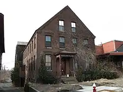 Westfield Whip Manufacturing Company |
October 17, 1985 (#85003233) |
360 Elm St. 42°07′41″N 72°44′50″W |
Westfield | |
| 75 | Wistariahurst | 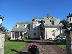 Wistariahurst |
April 23, 1973 (#73000295) |
238 Cabot St. 42°12′17″N 72°37′04″W |
Holyoke |
Former listing
| [3] | Name on the Register | Image | Date listed | Date removed | Location | City or town | Summary |
|---|---|---|---|---|---|---|---|
| 1 | Kendall Block | 1976 (#76002293) | 1976 | 6-20 Springfield St. |
Chicopee | Also known as the Market Street Hotel. During consideration for addition to the Register, the Hotel suffered a fire that destroyed the top two floors. The site was eventually added to the Register, but was subsequently removed after losing is historic characteristics.[6] |
See also
| Wikimedia Commons has media related to National Register of Historic Places in Hampden County, Massachusetts. |
References
- The latitude and longitude information provided in this table was derived originally from the National Register Information System, which has been found to be fairly accurate for about 99% of listings. Some locations in this table may have been corrected to current GPS standards.
- "National Register of Historic Places: Weekly List Actions". National Park Service, United States Department of the Interior. Retrieved on January 29, 2021.
- Numbers represent an alphabetical ordering by significant words. Various colorings, defined here, differentiate National Historic Landmarks and historic districts from other NRHP buildings, structures, sites or objects.
- "National Register Information System". National Register of Historic Places. National Park Service. March 13, 2009.
- The eight-digit number below each date is the number assigned to each location in the National Register Information System database, which can be viewed by clicking the number.
| Topics | 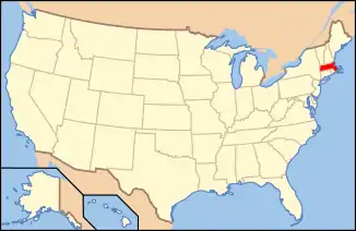 | ||||||||||||||||
|---|---|---|---|---|---|---|---|---|---|---|---|---|---|---|---|---|---|
| Lists by county | |||||||||||||||||
| Lists by city |
| ||||||||||||||||
| Other lists | |||||||||||||||||
| |||||||||||||||||
Municipalities and communities of Hampden County, Massachusetts, United States | ||
|---|---|---|
| Cities | | |
| Towns | ||
| CDPs | ||
| Other villages | ||
| Footnotes | ‡This populated place also has portions in an adjacent county or counties | |
| ||