National Register of Historic Places listings in Waltham, Massachusetts
This is a list of properties and historic districts in Waltham, Massachusetts, that are listed on the National Register of Historic Places.
The locations of National Register properties and districts (at least for all showing latitude and longitude coordinates below) may be seen in an online map by clicking on "Map of all coordinates".[1]
- This National Park Service list is complete through NPS recent listings posted January 29, 2021.[2]
Current listings
| [3] | Name on the Register | Image | Date listed[4] | Location | City or town | Description |
|---|---|---|---|---|---|---|
| 1 | American Waltham Watch Company Historic District | 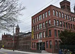 American Waltham Watch Company Historic District |
September 28, 1989 (#89001501) |
185–241 Crescent St. 42°22′01″N 71°14′39″W |
||
| 2 | American Watch Tool Company | American Watch Tool Company |
September 28, 1989 (#89001574) |
169 Elm St. 42°22′18″N 71°13′56″W |
||
| 3 | Joseph Andrews House | 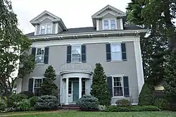 Joseph Andrews House |
September 28, 1989 (#89001554) |
258 Linden St. 42°23′00″N 71°13′04″W |
||
| 4 | Charles Baker House | 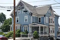 Charles Baker House |
September 28, 1989 (#89001484) |
107 Adams St. 42°22′02″N 71°14′28″W |
||
| 5 | Charles Baker Property | 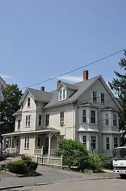 Charles Baker Property |
September 28, 1989 (#89001485) |
119–121 Adams St. 42°22′00″N 71°14′29″W |
||
| 6 | E. Sybbill Banks House |  E. Sybbill Banks House |
September 28, 1989 (#89001488) |
27 Appleton St. 42°22′33″N 71°13′57″W |
||
| 7 | Josiah Beard House |  Josiah Beard House |
September 28, 1989 (#89001529) |
70 School St. 42°22′40″N 71°14′03″W |
||
| 8 | Beth Eden Baptist Church |  Beth Eden Baptist Church |
September 28, 1989 (#89001544) |
82 Maple St. 42°22′04″N 71°14′20″W |
||
| 9 | Boston Manufacturing Company |  Boston Manufacturing Company |
December 22, 1977 (#77001412) |
144 Moody St. 42°22′23″N 71°14′09″W |
||
| 10 | Boston Manufacturing Company Housing |  Boston Manufacturing Company Housing |
September 28, 1989 (#89001534) |
380–410 River St. 42°22′25″N 71°13′55″W |
||
| 11 | Boston Manufacturing Company Housing |  Boston Manufacturing Company Housing |
September 28, 1989 (#89001535) |
153–165 River St. 42°22′13″N 71°13′20″W |
||
| 12 | Brigham House |  Brigham House |
September 28, 1989 (#89001551) |
235 Main St. 42°22′37″N 71°13′05″W |
||
| 13 | Building at 202–204 Charles Street |  Building at 202–204 Charles Street |
September 28, 1989 (#89001493) |
202–204 Charles St. 42°22′24″N 71°14′45″W |
||
| 14 | Francis Buttrick House |  Francis Buttrick House |
September 28, 1989 (#89001566) |
44 Harvard St. 42°22′28″N 71°14′38″W |
||
| 15 | Francis Buttrick Library |  Francis Buttrick Library |
September 28, 1989 (#89001547) |
741 Main St. 42°22′35″N 71°14′23″W |
||
| 16 | Charles Byam House |  Charles Byam House |
September 28, 1989 (#89001576) |
337 Crescent St. 42°21′46″N 71°14′35″W |
||
| 17 | The Castle |  The Castle |
April 9, 1979 (#79000359) |
415 South St. 42°22′01″N 71°15′22″W |
This is on the campus of Brandeis University. | |
| 18 | Central Square Historic District |  Central Square Historic District |
September 28, 1989 (#89001526) |
Roughly bounded by Church, Carter, Moody, Main and Lexington Sts. 42°22′32″N 71°14′10″W |
||
| 19 | Charles River Reservation Parkways |  Charles River Reservation Parkways |
January 18, 2006 (#05001530) |
Soldiers Field, Nonantum, Leo Birmingham, Arsenal, Greenough, N. Beacon, Charles River, Norumbega, Recreation 42°21′42″N 71°09′31″W |
Extends into Cambridge and Newton, Watertown and Weston, elsewhere in Middlesex County, and into Boston in Suffolk County | |
| 20 | Charles Street Workers' Housing Historic District |  Charles Street Workers' Housing Historic District |
September 28, 1989 (#89001503) |
128–144 Charles St. 42°22′25″N 71°14′37″W |
||
| 21 | Christ Episcopal Church |  Christ Episcopal Church |
September 28, 1989 (#89001546) |
750 Main St. 42°22′32″N 71°14′27″W |
||
| 22 | Benjamin F. Clough House |  Benjamin F. Clough House |
September 28, 1989 (#89001536) |
42–44 Prospect St. 42°22′21″N 71°14′49″W |
||
| 23 | Gilbert Colburn House |  Gilbert Colburn House |
September 28, 1989 (#89001578) |
110–112 Crescent St. 42°22′11″N 71°14′29″W |
||
| 24 | Company F State Armory |  Company F State Armory |
September 28, 1989 (#89001571) |
Curtis and Sharon Sts. 42°22′10″N 71°14′53″W |
||
| 25 | Lenoir Dow House |  Lenoir Dow House |
September 28, 1989 (#89001487) |
215 Adams St. 42°21′48″N 71°14′33″W |
||
| 26 | Dunbar–Stearns House |  Dunbar–Stearns House |
March 9, 1990 (#89001517) |
209 Linden St. 42°22′54″N 71°13′06″W |
||
| 27 | East Main Street Historic District |  East Main Street Historic District |
September 28, 1989 (#89001498) |
Roughly E. Main St. from Townsend St. to Chamberlain Ter. 42°22′37″N 71°13′39″W |
||
| 28 | Eastern Middlesex County Second District Court |  Eastern Middlesex County Second District Court |
September 28, 1989 (#89001516) |
38 Linden St. 42°22′40″N 71°13′30″W |
||
| 29 | Walter E. Fernald State School |  Walter E. Fernald State School |
January 21, 1994 (#93001487) |
200 Trapelo Rd. 42°23′28″N 71°12′38″W |
||
| 30 | First Congregational Church |  First Congregational Church |
September 28, 1989 (#89001548) |
730 Main St. 42°22′32″N 71°14′24″W |
||
| 31 | First Parish Church |  First Parish Church |
September 28, 1989 (#89001507) |
87 School St. 42°22′42″N 71°14′07″W |
||
| 32 | Henry N. Fisher House |  Henry N. Fisher House |
September 28, 1989 (#89001577) |
120 Crescent St. 42°22′09″N 71°14′30″W |
||
| 33 | Elijah Fiske House |  Elijah Fiske House |
September 28, 1989 (#89001514) |
457 Lincoln St. 42°24′10″N 71°14′55″W |
||
| 34 | Frederick Flagg House |  Frederick Flagg House |
September 28, 1989 (#89001573) |
65 Fairmont Ave. 42°22′19″N 71°15′25″W |
||
| 35 | Daniel French School |  Daniel French School |
September 28, 1989 (#89001581) |
38–40 Common St. 42°22′39″N 71°14′15″W |
Now a residential duplex. | |
| 36 | Fuller–Bemis House |  Fuller–Bemis House |
March 9, 1990 (#89001495) |
41–43 Cherry St. 42°22′01″N 71°14′29″W |
||
| 37 | Gale–Banks House |  Gale–Banks House |
March 9, 1990 (#89001545) |
935 Main St. 42°22′33″N 71°14′58″W |
||
| 38 | William Gibbs House |  William Gibbs House |
September 28, 1989 (#89001561) |
14 Liberty St. 42°22′37″N 71°14′01″W |
||
| 39 | Gilbrae Inn |  Gilbrae Inn |
September 28, 1989 (#89001550) |
403 River St. 42°22′26″N 71°13′58″W |
||
| 40 | Gore Place |  Gore Place |
December 30, 1970 (#70000542) |
52 Gore St. 42°22′20″N 71°12′41″W |
||
| 41 | Grove Hill Cemetery | 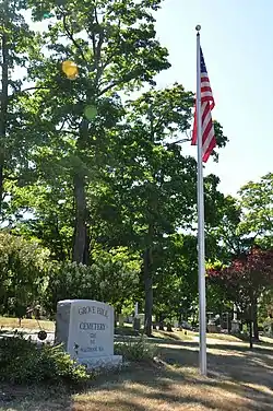 Grove Hill Cemetery |
September 28, 1989 (#89001549) |
290 Main St. 42°22′34″N 71°13′17″W |
||
| 42 | Hagar–Smith–Livermore–Sanderson House |  Hagar–Smith–Livermore–Sanderson House |
September 28, 1989 (#89001532) |
51 Sanders Ln. 42°23′19″N 71°14′43″W |
||
| 43 | Hager–Mead House |  Hager–Mead House |
September 28, 1989 (#89001572) |
411 Main St. 42°22′40″N 71°13′38″W |
||
| 44 | Henry C. Hall House |  Henry C. Hall House |
September 28, 1989 (#89001579) |
107 Crescent St. 42°22′11″N 71°14′30″W |
||
| 45 | Ephraim Hammond House |  Ephraim Hammond House |
September 28, 1989 (#89001490) |
265 Beaver St. 42°23′10″N 71°12′51″W |
||
| 46 | Jonathan Hammond House |  Jonathan Hammond House |
September 28, 1989 (#89001491) |
311 Beaver St. 42°23′06″N 71°13′00″W |
||
| 47 | Nahum Hardy House |  Nahum Hardy House |
September 28, 1989 (#89001562) |
724 Lexington St. 42°23′59″N 71°14′05″W |
||
| 48 | Harrington Block |  Harrington Block |
September 28, 1989 (#89001543) |
376–390 Moody St. 42°22′10″N 71°14′15″W |
||
| 49 | Samuel Harrington House |  Samuel Harrington House |
September 28, 1989 (#89001508) |
Old South St. 42°21′47″N 71°15′35″W |
||
| 50 | Rev. Thomas Hill House |  Rev. Thomas Hill House |
September 28, 1989 (#89001528) |
132 Church St. 42°22′49″N 71°13′57″W |
||
| 51 | Hobbs Brook Basin Gate House | 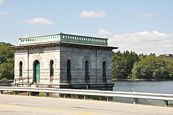 Hobbs Brook Basin Gate House |
September 28, 1989 (#89001524) |
Off Winter St. at the mouth of Hobbs Brook 42°23′55″N 71°16′25″W |
||
| 52 | Richard Holbrook Houses |  Richard Holbrook Houses |
September 28, 1989 (#89001565) |
29–31 Heard St. 42°22′34″N 71°13′51″W |
||
| 53 | Edwin C. Johnson House |  Edwin C. Johnson House |
September 28, 1989 (#89001522) |
177 Weston St./8 Caldwell St. 42°22′27″N 71°15′26″W |
||
| 54 | Newell D. Johnson House |  Newell D. Johnson House |
September 28, 1989 (#89001564) |
428 Lexington St. 42°23′27″N 71°14′23″W |
||
| 55 | Phineas Lawrence House |  Phineas Lawrence House |
August 20, 1987 (#87001397) |
257 Trapelo Rd. 42°23′43″N 71°12′25″W |
||
| 56 | Lawton Place Historic District | 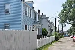 Lawton Place Historic District |
September 28, 1989 (#89001504) |
Lawton Pl. between Amory Rd. and Jackson St. 42°22′29″N 71°13′51″W |
||
| 57 | Nelson F. Libby House | 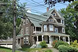 Nelson F. Libby House |
September 28, 1989 (#89001521) |
147–149 Weston St. 42°22′25″N 71°15′18″W |
||
| 58 | Linden Street Bridge | 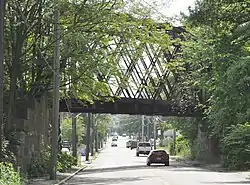 Linden Street Bridge |
September 28, 1989 (#89001515) |
Boston & Maine railroad line over Linden St. 42°22′48″N 71°13′15″W |
||
| 59 | Lord's Castle | 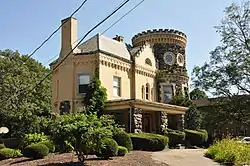 Lord's Castle |
September 28, 1989 (#89001567) |
211 Hammond St. 42°23′01″N 71°14′50″W |
||
| 60 | Lyman Street Historic District |  Lyman Street Historic District |
September 28, 1989 (#89001505) |
Roughly Lyman St. from Church to Main Sts. 42°22′44″N 71°13′53″W |
||
| 61 | Aaron Martin House |  Aaron Martin House |
September 28, 1989 (#89001540) |
786 Moody St. 42°21′45″N 71°14′20″W |
||
| 62 | Aaron Martin Houses |  Aaron Martin Houses |
September 28, 1989 (#89001486) |
188–194 Adams St. 42°21′51″N 71°14′30″W |
||
| 63 | Metropolitan State Hospital |  Metropolitan State Hospital |
January 21, 1994 (#93001482) |
475 Trapelo Rd. 42°24′14″N 71°12′40″W |
Extends into Lexington and Belmont | |
| 64 | Moody Street Fire Station |  Moody Street Fire Station |
September 28, 1989 (#89001541) |
533 Moody St. 42°22′02″N 71°14′18″W |
||
| 65 | Moody Street Historic District | 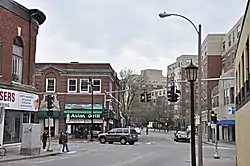 Moody Street Historic District |
March 9, 1990 (#89001502) |
Moody and Crescent Sts. 42°22′18″N 71°14′16″W |
||
| 66 | Mount Feake Cemetery | 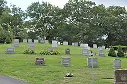 Mount Feake Cemetery |
September 28, 1989 (#89001497) |
203 Prospect St. 42°21′52″N 71°14′58″W |
||
| 67 | Mt. Prospect School for Boys | 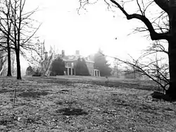 Mt. Prospect School for Boys |
March 9, 1990 (#89001525) |
90 Worcester Ln. 42°23′23″N 71°14′39″W |
Demolished. | |
| 68 | Robert Murray House | 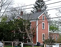 Robert Murray House |
September 28, 1989 (#89001580) |
85 Crescent St. 42°22′13″N 71°14′27″W |
||
| 69 | Newton Street Bridge | 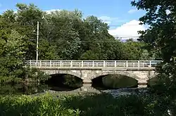 Newton Street Bridge |
September 28, 1989 (#89001539) |
Newton St. at River St. over the Charles River 42°22′20″N 71°13′45″W |
||
| 70 | North Lexington Street Historic District |  North Lexington Street Historic District |
September 28, 1989 (#89001500) |
508–536 N. Lexington St. 42°23′35″N 71°14′19″W |
||
| 71 | O'Hara Waltham Dial Company |  O'Hara Waltham Dial Company |
September 28, 1989 (#89001533) |
74 Rumford Ave. 42°22′06″N 71°14′38″W |
||
| 72 | John E. Olcott House |  John E. Olcott House |
September 28, 1989 (#89001492) |
35–37 Central St. 42°22′21″N 71°13′51″W |
||
| 73 | The Oxford | 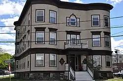 The Oxford |
September 28, 1989 (#89001483) |
4 Adams St. 42°22′16″N 71°14′21″W |
||
| 74 | Robert Treat Paine Jr. House | 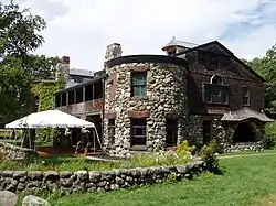 Robert Treat Paine Jr. House |
October 7, 1975 (#75000291) |
100 Robert Treat Paine Drive 42°23′19″N 71°13′50″W |
||
| 75 | John M. Peck House | 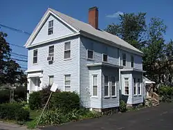 John M. Peck House |
September 28, 1989 (#89001559) |
27 Liberty St. 42°22′40″N 71°14′00″W |
||
| 76 | Piety Corner Historic District | 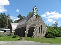 Piety Corner Historic District |
March 9, 1990 (#89001499) |
Roughly Bacon and Lexington Sts. 42°23′20″N 71°14′19″W |
||
| 77 | Potter–O'Brian House |  Potter–O'Brian House |
September 28, 1989 (#89001538) |
206 Newton St. 42°22′12″N 71°13′48″W |
Demolished. | |
| 78 | Prospect House |  Prospect House |
September 28, 1989 (#89001568) |
11 Hammond St. 42°22′36″N 71°14′46″W |
||
| 79 | Royal E. Robbins School |  Royal E. Robbins School |
September 28, 1989 (#89001496) |
58 Chestnut St. 42°22′08″N 71°14′21″W |
||
| 80 | John Sanderson House |  John Sanderson House |
September 28, 1989 (#89001563) |
564 Lexington St. 42°23′41″N 71°14′15″W |
||
| 81 | Nathan Sanderson I House |  Nathan Sanderson I House |
September 28, 1989 (#89001556) |
107 Lincoln St. 42°23′37″N 71°14′35″W |
||
| 82 | Nathan Sanderson II House |  Nathan Sanderson II House |
September 28, 1989 (#89001513) |
111 Lincoln St. 42°23′36″N 71°14′36″W |
||
| 83 | Sanderson–Clark Farmhouse |  Sanderson–Clark Farmhouse |
September 28, 1989 (#89001557) |
75 Lincoln St. 42°23′36″N 71°14′29″W |
||
| 84 | Marshall Smith House |  Marshall Smith House |
September 28, 1989 (#89001560) |
26 Liberty St. 42°22′40″N 71°14′01″W |
||
| 85 | Perez Smith House |  Perez Smith House |
September 28, 1989 (#89001558) |
46 Lincoln St. 42°23′31″N 71°14′27″W |
||
| 86 | St. Charles Borromeo Church | 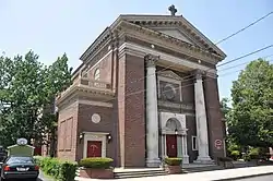 St. Charles Borromeo Church |
September 28, 1989 (#89001569) |
Hall and Cushing Sts. 42°22′08″N 71°14′10″W |
||
| 87 | St. Mary's Roman Catholic Church Complex | 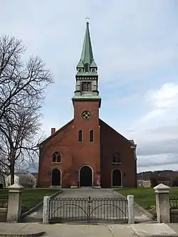 St. Mary's Roman Catholic Church Complex |
September 28, 1989 (#89001527) |
133 School St. 42°22′44″N 71°14′14″W |
||
| 88 | Leonard W. Stanley House | 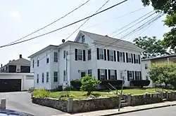 Leonard W. Stanley House |
September 28, 1989 (#89001509) |
23–25 Taylor St. 42°22′11″N 71°14′12″W |
||
| 89 | Stark Building | 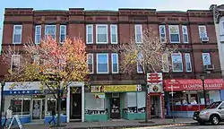 Stark Building |
September 28, 1989 (#89001542) |
416–424 Moody St. 42°22′08″N 71°14′15″W |
||
| 90 | Robert M. Stark House |  Robert M. Stark House |
September 28, 1989 (#89001552) |
176 Main St. 42°22′34″N 71°12′59″W |
||
| 91 | Amos Stearns House |  Amos Stearns House |
September 28, 1989 (#89001518) |
1081 Trapelo Rd. 42°24′42″N 71°14′12″W |
||
| 92 | Henry Stewart House |  Henry Stewart House |
September 28, 1989 (#89001553) |
294 Linden St. 42°23′05″N 71°13′02″W |
||
| 93 | James Swasey House |  James Swasey House |
September 28, 1989 (#89001530) |
30 Common St. 42°22′38″N 71°14′15″W |
Probably demolished | |
| 94 | Frank J. Tyler House |  Frank J. Tyler House |
September 28, 1989 (#89001555) |
238 Linden St. 42°22′59″N 71°13′06″W |
||
| 95 | United States Watch Company |  United States Watch Company |
September 28, 1989 (#89001494) |
256 Charles St. 42°22′21″N 71°14′57″W |
||
| 96 | US Post Office–Waltham Main | 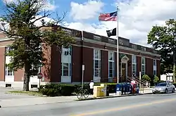 US Post Office–Waltham Main |
May 30, 1986 (#86001248) |
774 Main St. 42°22′33″N 71°14′31″W |
||
| 97 | The Vale | 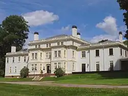 The Vale |
December 30, 1970 (#70000737) |
Lyman and Beaver Sts. 42°23′01″N 71°13′44″W |
||
| 98 | Waltham Gas and Electric Company Generating Plant | 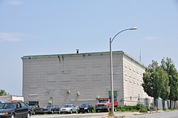 Waltham Gas and Electric Company Generating Plant |
September 28, 1989 (#89001537) |
96 Pine St. 42°22′15″N 71°14′00″W |
||
| 99 | Waltham Gas Light Company | 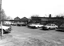 Waltham Gas Light Company |
September 28, 1989 (#89001506) |
2 Cooper St. 42°22′19″N 71°14′01″W |
Demolished. | |
| 100 | Waltham High School | 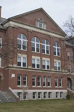 Waltham High School |
September 28, 1989 (#89001531) |
55 School St. 42°22′44″N 71°14′03″W |
||
| 101 | Waltham Water Works Shop | 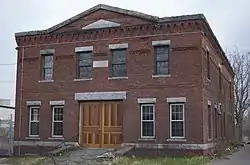 Waltham Water Works Shop |
September 28, 1989 (#89001570) |
92 Felton St. 42°22′24″N 71°14′28″W |
||
| 102 | Nathan Warren House |  Nathan Warren House |
March 9, 1990 (#89001520) |
50 Weston St. 42°22′27″N 71°15′12″W |
Demolished. | |
| 103 | Benjamin Wellington House |  Benjamin Wellington House |
September 28, 1989 (#89001523) |
56 Whittier St. 42°24′48″N 71°14′31″W |
||
| 104 | William Wellington House |  William Wellington House |
September 28, 1989 (#89001512) |
785 Trapelo Rd. 42°24′24″N 71°13′13″W |
||
| 105 | Wellington–Castner House |  Wellington–Castner House |
September 28, 1989 (#89001511) |
685 Trapelo Rd. 42°24′22″N 71°13′11″W |
||
| 106 | Wetherbee House | 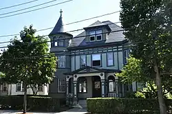 Wetherbee House |
September 28, 1989 (#89001575) |
357 Crescent St. 42°21′43″N 71°14′32″W |
||
| 107 | Warren White House |  Warren White House |
September 28, 1989 (#89001519) |
192 Warren St. 42°22′45″N 71°12′23″W |
||
| 108 | Whitney–Farrington–Cook House |  Whitney–Farrington–Cook House |
September 28, 1989 (#89001510) |
385 Trapelo Rd. 42°23′54″N 71°12′40″W |
Demolished. | |
| 109 | Wilson's Diner | 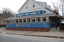 Wilson's Diner |
September 22, 1999 (#99001126) |
507 Main St. 42°23′10″N 71°13′53″W |
References
| Wikimedia Commons has media related to National Register of Historic Places in Waltham, Massachusetts. |
- The latitude and longitude information provided in this table was derived originally from the National Register Information System, which has been found to be fairly accurate for about 99% of listings. Some locations in this table may have been corrected to current GPS standards.
- "National Register of Historic Places: Weekly List Actions". National Park Service, United States Department of the Interior. Retrieved on January 29, 2021.
- Numbers represent an alphabetical ordering by significant words. Various colorings, defined here, differentiate National Historic Landmarks and historic districts from other NRHP buildings, structures, sites or objects.
- The eight-digit number below each date is the number assigned to each location in the National Register Information System database, which can be viewed by clicking the number.
| Topics |  | ||||||||||||||||
|---|---|---|---|---|---|---|---|---|---|---|---|---|---|---|---|---|---|
| Lists by county | |||||||||||||||||
| Lists by city |
| ||||||||||||||||
| Other lists | |||||||||||||||||
| |||||||||||||||||
This article is issued from Wikipedia. The text is licensed under Creative Commons - Attribution - Sharealike. Additional terms may apply for the media files.