National Register of Historic Places listings in Barnstable, Massachusetts
Barnstable, Massachusetts, has more than 75 entries on the National Register of Historic Places. For listings elsewhere in Barnstable County, see National Register of Historic Places listings in Barnstable County, Massachusetts.
- This National Park Service list is complete through NPS recent listings posted January 29, 2021.[1]
Current listings
| [2] | Name on the Register[3] | Image | Date listed[4] | Location | City or town | Description |
|---|---|---|---|---|---|---|
| 1 | Adams-Crocker-Fish House | 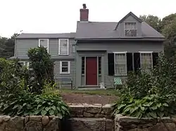 Adams-Crocker-Fish House |
March 13, 1987 (#87000219) |
449 Willow St. 41°42′07″N 70°23′22″W |
Barnstable | |
| 2 | Josiah A. Ames House | 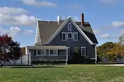 Josiah A. Ames House |
September 18, 1987 (#87000300) |
145 Bridge St. 41°37′20″N 70°23′46″W |
Barnstable | |
| 3 | Ancient Burying Ground | 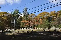 Ancient Burying Ground |
March 13, 1987 (#87000283) |
Phinney's Ln. 41°39′17″N 70°20′38″W |
Barnstable | |
| 4 | Benjamin Baker Jr. House | 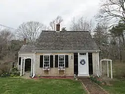 Benjamin Baker Jr. House |
November 10, 1987 (#87000352) |
1579 Hyannis Rd. 41°41′42″N 70°18′12″W |
Barnstable | |
| 5 | Capt. Seth Baker Jr. House | 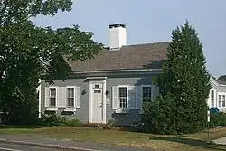 Capt. Seth Baker Jr. House |
September 18, 1987 (#87000299) |
35 Main St. 41°39′22″N 70°16′22″W |
Barnstable | |
| 6 | Nathaniel Baker House | 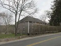 Nathaniel Baker House |
March 13, 1987 (#87000229) |
1606 Hyannis Rd. 41°41′45″N 70°18′08″W |
Barnstable | |
| 7 | Barnstable County Courthouse |  Barnstable County Courthouse |
June 11, 1981 (#81000104) |
Main St. 41°42′05″N 70°18′17″W |
Barnstable | |
| 8 | Capt. Rodney J. Baxter House |  Capt. Rodney J. Baxter House |
March 13, 1987 (#87000273) |
South and Pearl Sts. 41°39′00″N 70°17′06″W |
Barnstable | |
| 9 | Capt. Sylvester Baxter House | 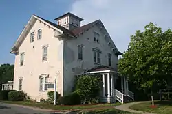 Capt. Sylvester Baxter House |
March 13, 1987 (#87000313) |
156 Main St. 41°39′19″N 70°16′39″W |
Barnstable | |
| 10 | Charles L. Baxter House |  Charles L. Baxter House |
March 13, 1987 (#87000315) |
77 Main St. 41°38′08″N 70°27′02″W |
Barnstable | |
| 11 | Shubael Baxter House |  Shubael Baxter House |
September 18, 1987 (#87000304) |
9 E. Bay Rd. 41°37′39″N 70°22′49″W |
Barnstable | |
| 12 | Capt. Allen H. Bearse House |  Capt. Allen H. Bearse House |
March 13, 1987 (#87000264) |
48 Camp St. 41°39′25″N 70°16′33″W |
Barnstable | |
| 13 | Capt. Oliver Bearse House |  Capt. Oliver Bearse House |
March 13, 1987 (#87000276) |
39 Pearl St. 41°39′03″N 70°17′07″W |
Barnstable | Damaged by fire in 2011 and subsequently demolished. |
| 14 | Blish-Garret House |  Blish-Garret House |
March 13, 1987 (#87000327) |
350 Plum St. 41°41′41″N 70°21′21″W |
Barnstable | |
| 15 | Building at 237–239 Main Street |  Building at 237–239 Main Street |
March 13, 1987 (#87000293) |
237–239 Main St. 41°39′16″N 70°16′49″W |
Barnstable | |
| 16 | Building at 600 Main Street |  Building at 600 Main Street |
March 13, 1987 (#87000286) |
600 Main St. 41°38′56″N 70°17′28″W |
Barnstable | |
| 17 | Building at 606 Main Street | Building at 606 Main Street |
March 13, 1987 (#87000287) |
606 Main St. 41°38′56″N 70°17′28″W |
Barnstable | |
| 18 | Building at 614 Main Street |  Building at 614 Main Street |
March 13, 1987 (#87000285) |
614 Main St. 41°38′56″N 70°17′28″W |
Barnstable | |
| 19 | Collen C. Campbell House | 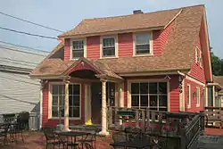 Collen C. Campbell House |
March 13, 1987 (#87000297) |
599 Main St. 41°38′55″N 70°17′27″W |
Barnstable | |
| 20 | Canary-Hartnett House | 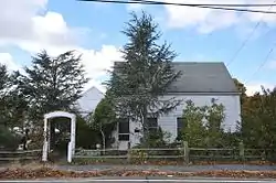 Canary-Hartnett House |
March 13, 1987 (#87000260) |
113 Winter St. 41°39′10″N 70°17′14″W |
Barnstable | |
| 21 | Centerville Historic District |  Centerville Historic District |
November 10, 1987 (#87002587) |
Main St. 41°38′56″N 70°20′53″W |
Barnstable | |
| 22 | Lemuel B. Chase House | 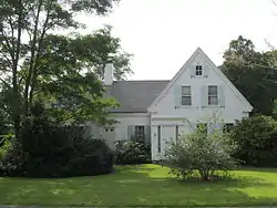 Lemuel B. Chase House |
March 13, 1987 (#87000267) |
340 Scudder Ave. 41°38′21″N 70°18′14″W |
Barnstable | |
| 23 | Col. Charles Codman Estate | 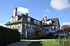 Col. Charles Codman Estate |
March 13, 1987 (#87000321) |
Bluff Point Dr. 41°36′41″N 70°25′58″W |
Barnstable | |
| 24 | Cotuit Historic District | 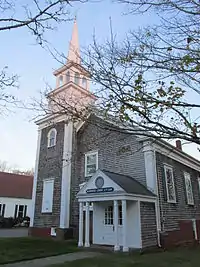 Cotuit Historic District |
November 10, 1987 (#87000317) |
Main St., Lowell and Ocean View Aves. bounded by Osterville Harbor, Nantucket Sound, and Popponessett Bay 41°36′57″N 70°26′14″W |
Barnstable | |
| 25 | Craigville Historic District |  Craigville Historic District |
November 10, 1987 (#87000275) |
Centerville Harbor, Nantucket Sound, Red Lily Pond, and Lake Elizabeth 41°38′29″N 70°19′58″W |
Barnstable | |
| 26 | Benomi and Barnabas Crocker House | 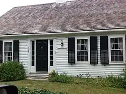 Benomi and Barnabas Crocker House |
March 13, 1987 (#87000216) |
325 Willow St. 41°42′18″N 70°23′10″W |
Barnstable | |
| 27 | Capt. Alexander Crocker House | 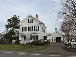 Capt. Alexander Crocker House |
March 13, 1987 (#87000274) |
358 Sea St. 41°38′20″N 70°17′27″W |
Barnstable | |
| 28 | Ebenezer Crocker Jr. House | 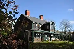 Ebenezer Crocker Jr. House |
November 10, 1987 (#87000323) |
49 Putnam Ave. 41°37′17″N 70°26′03″W |
Barnstable | |
| 29 | Lot Crocker House | 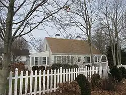 Lot Crocker House |
March 13, 1987 (#87000263) |
284 Gosnold St. 41°38′19″N 70°17′27″W |
Barnstable | |
| 30 | Daniel Crosby House |  Daniel Crosby House |
September 18, 1987 (#87000306) |
18 Bay St. 41°37′44″N 70°23′18″W |
Barnstable | |
| 31 | Crowell-Smith House |  Crowell-Smith House |
March 13, 1987 (#87000272) |
33 Pine St. 41°38′57″N 70°17′19″W |
Barnstable | |
| 32 | Fuller House |  Fuller House |
March 13, 1987 (#87000325) |
Parker Rd. 41°41′42″N 70°22′01″W |
Barnstable | |
| 33 | Gifford Farm | 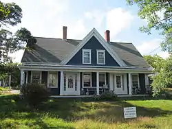 Gifford Farm |
March 13, 1987 (#87000245) |
261 Cotuit Rd. 41°39′26″N 70°24′43″W |
Barnstable | |
| 34 | Dr. Edward Francis Gleason House | 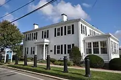 Dr. Edward Francis Gleason House |
September 18, 1987 (#87000262) |
88 Lewis Bay Rd. 41°39′10″N 70°16′30″W |
Barnstable | |
| 35 | Goodspeed House |  Goodspeed House |
March 13, 1987 (#87000235) |
271 River Rd. 41°39′32″N 70°25′10″W |
Barnstable | |
| 36 | Capt. Thomas Gray House | 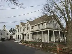 Capt. Thomas Gray House |
March 13, 1987 (#87000280) |
14 Main St. 41°39′25″N 70°16′20″W |
Barnstable | |
| 37 | Capt. William Hallett House | 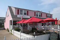 Capt. William Hallett House |
September 18, 1987 (#87000296) |
570 Main St. 41°38′59″N 70°17′24″W |
Barnstable | |
| 38 | Seth Hallett House | Seth Hallett House |
September 18, 1987 (#87000298) |
110 Main St. 41°39′22″N 70°16′32″W |
Barnstable | |
| 39 | Harlow Homestead | 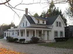 Harlow Homestead |
September 18, 1987 (#87000324) |
391 Main St. 41°37′42″N 70°26′35″W |
Barnstable | |
| 40 | Gideon Hawley House | 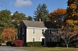 Gideon Hawley House |
March 13, 1987 (#87000312) |
4766 Falmouth Rd. 41°38′11″N 70°27′16″W |
Barnstable | |
| 41 | Hinckley Homestead | 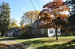 Hinckley Homestead |
September 18, 1987 (#87000248) |
1740 S. County Rd. 41°38′57″N 70°23′52″W |
Barnstable | |
| 42 | Capt. Joseph Hinckley House | 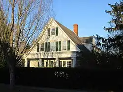 Capt. Joseph Hinckley House |
March 13, 1987 (#87000249) |
142 Old Stage Rd. 41°39′14″N 70°21′02″W |
Barnstable | |
| 43 | Nymphus Hinckley House | 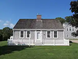 Nymphus Hinckley House |
March 13, 1987 (#87000250) |
38 Bay St. 41°37′44″N 70°23′18″W |
Barnstable | |
| 44 | S. Alexander Hinckley House |  S. Alexander Hinckley House |
September 18, 1987 (#87000279) |
151 Pine St. 41°38′48″N 70°17′13″W |
Barnstable | |
| 45 | Hyannis Port Historic District | 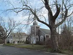 Hyannis Port Historic District |
November 10, 1987 (#87000259) |
Roughly bounded by Massachusetts Ave.and Edgehill Rd., Hyannis Ave., Hyannis Harbor, and Scudder Ave. 41°37′52″N 70°17′55″W |
Barnstable | |
| 46 | Hyannis Road Historic District |  Hyannis Road Historic District |
March 13, 1987 (#87000231) |
Bounded by Old King's Highway, Bow Ln., Cape Cod Branch railroad tracks, and Hyannis Rd. 41°41′23″N 70°18′04″W |
Barnstable | |
| 47 | Herman Isham House | 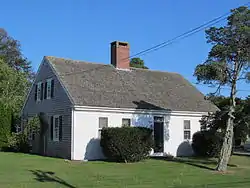 Herman Isham House |
March 13, 1987 (#87000295) |
1322 Main St. 41°38′27″N 70°23′34″W |
Barnstable | |
| 48 | John Jenkins Homestead | 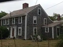 John Jenkins Homestead |
March 13, 1987 (#87000318) |
Church St. 41°41′41″N 70°22′12″W |
Barnstable | |
| 49 | Joseph Jenkins House | 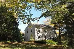 Joseph Jenkins House |
March 13, 1987 (#87000322) |
310 Pine St. 41°41′29″N 70°22′15″W |
Barnstable | |
| 50 | Jenkins-Whelden Farmstead | 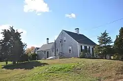 Jenkins-Whelden Farmstead |
March 13, 1987 (#87000320) |
221 Pine St. 41°41′30″N 70°22′29″W |
Barnstable | |
| 51 | Kennedy Compound | 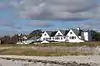 Kennedy Compound |
November 28, 1972 (#72001302) |
Irving and Marchant Aves. 41°37′49″N 70°18′12″W |
Hyannis Port | Historic homes of the Kennedy family |
| 52 | Liberty Hall | 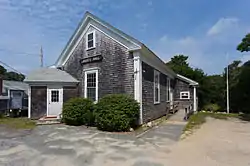 Liberty Hall |
March 13, 1987 (#87000246) |
Main St. 41°39′15″N 70°24′46″W |
Barnstable | |
| 53 | Lincoln House Club |  Lincoln House Club |
March 13, 1987 (#87000301) |
135 Bridge St. 41°37′19″N 70°23′47″W |
Barnstable | |
| 54 | Capt. George Lovell House |  Capt. George Lovell House |
November 10, 1987 (#87000290) |
8 E. Bay Rd. 41°37′40″N 70°22′46″W |
Barnstable | |
| 55 | Nehemiah Lovell House | 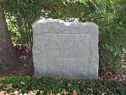 Nehemiah Lovell House |
September 18, 1987 (#87000291) |
691 Main St. 41°37′38″N 70°22′51″W |
Barnstable | |
| 56 | William Marston House | 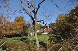 William Marston House |
March 13, 1987 (#87000234) |
71 Cotuit Rd. 41°39′08″N 70°24′53″W |
Barnstable | |
| 57 | Marstons Mills Hearse House and Cemetery |  Marstons Mills Hearse House and Cemetery |
March 13, 1987 (#87000302) |
MA 149 41°39′43″N 70°24′31″W |
Barnstable | |
| 58 | Merrill Estate |  Merrill Estate |
September 18, 1987 (#87000268) |
1874 S. County Rd. 41°39′06″N 70°24′11″W |
Barnstable | |
| 59 | Methodist Church | 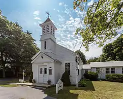 Methodist Church |
March 13, 1987 (#87000247) |
2135 Main St. 41°39′14″N 70°24′43″W |
Barnstable | Now the Marstons Mills Community Church |
| 60 | Mill Way Historic District |  Mill Way Historic District |
November 10, 1987 (#87000271) |
Mill Way Rd. 41°42′12″N 70°18′01″W |
Barnstable | |
| 61 | Municipal Group Historic District |  Municipal Group Historic District |
November 10, 1987 (#87000288) |
Roughly bounded by Main, Municipal Buildings, South, and Pearl Sts. 41°39′06″N 70°17′02″W |
Barnstable | |
| 62 | Old Jail |  Old Jail |
July 2, 1971 (#71000078) |
U.S. Route 6A 41°42′00″N 70°17′56″W |
Barnstable | |
| 63 | Old King's Highway Historic District |  Old King's Highway Historic District |
March 12, 1987 (#87000314) |
Old King's Highway between the Sandwich town line on the west to the Yarmouth town line on the east 41°42′24″N 70°20′20″W |
Barnstable | |
| 64 | Osterville Baptist Church |  Osterville Baptist Church |
September 18, 1987 (#87000292) |
Main St. 41°37′41″N 70°23′09″W |
Barnstable | |
| 65 | William and Jane Phinney House |  William and Jane Phinney House |
March 13, 1987 (#87000284) |
555 Phinney's Ln. 41°39′47″N 70°19′42″W |
Barnstable | |
| 66 | Pleasant-School Street Historic District | 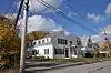 Pleasant-School Street Historic District |
November 10, 1987 (#87000257) |
Roughly bounded by Main, School, South, and Pleasant Sts. 41°39′12″N 70°16′42″W |
Barnstable | |
| 67 | Nelson Rhodehouse House | 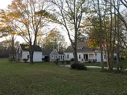 Nelson Rhodehouse House |
March 13, 1987 (#87000308) |
131 Main St. 41°38′02″N 70°26′59″W |
Barnstable | |
| 68 | John Richardson House | 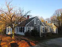 John Richardson House |
September 18, 1987 (#87000281) |
242 Phinney's Ln. 41°39′28″N 70°20′21″W |
Barnstable | |
| 69 | Joseph Robbins House | 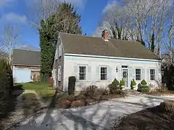 Joseph Robbins House |
November 10, 1987 (#87000289) |
12 Bay St. 41°37′44″N 70°23′18″W |
Barnstable | |
| 70 | Round House | 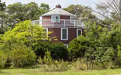 Round House |
March 13, 1987 (#87000282) |
971 W. Main St. 41°39′23″N 70°19′46″W |
Barnstable | |
| 71 | Sampson's Folly-Josiah Sampson House | 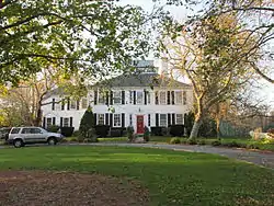 Sampson's Folly-Josiah Sampson House |
September 18, 1987 (#87000326) |
40 Old King's Rd. 41°37′49″N 70°26′53″W |
Barnstable | |
| 72 | Sandy Neck Cultural Resources District |  Sandy Neck Cultural Resources District |
November 10, 1987 (#87000305) |
Sandy Neck Peninsula 41°43′57″N 70°20′25″W |
Barnstable | |
| 73 | Santuit Historic District | 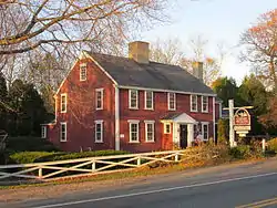 Santuit Historic District |
November 10, 1987 (#87000319) |
MA 28 41°38′16″N 70°27′04″W |
Barnstable | |
| 74 | Santuit Post Office | 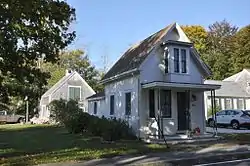 Santuit Post Office |
November 10, 1987 (#87000309) |
Main St. 41°38′06″N 70°27′01″W |
Barnstable | |
| 75 | Matthias Smith House | 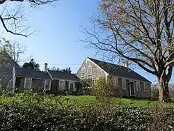 Matthias Smith House |
March 13, 1987 (#87000240) |
375 Cedar St. 41°42′23″N 70°23′36″W |
Barnstable | |
| 76 | Town Boundary Marker | 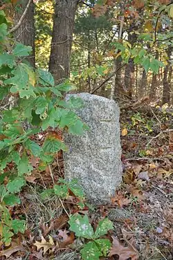 Town Boundary Marker |
September 18, 1987 (#87000269) |
Race Ln.at Sandwich town line 41°41′11″N 70°26′12″W |
Barnstable | |
| 77 | Town Line Boundary Marker | 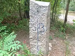 Town Line Boundary Marker |
September 18, 1987 (#87000242) |
Great Hill Rd. 41°43′19″N 70°24′04″W |
Barnstable | |
| 78 | Town Line Boundary Marker | 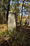 Town Line Boundary Marker |
September 18, 1987 (#87000243) |
410 High St. 41°43′19″N 70°24′04″W |
Barnstable | |
| 79 | U.S. Customshouse |  U.S. Customshouse |
November 12, 1975 (#75000239) |
Cobbs Hill, MA 6A 41°42′01″N 70°17′57″W |
Barnstable | |
| 80 | Barzillai Weeks House | 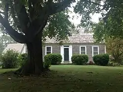 Barzillai Weeks House |
March 13, 1987 (#87000241) |
313 High St. 41°43′15″N 70°23′59″W |
Barnstable | |
| 81 | West Barnstable Village-Meetinghouse Way Historic District | 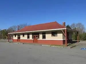 West Barnstable Village-Meetinghouse Way Historic District |
November 10, 1987 (#87000255) |
Meetinghouse Way from County Rd. to Meetinghouse 41°42′10″N 70°22′45″W |
Barnstable | |
| 82 | Josiah B. Whitman House | 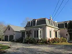 Josiah B. Whitman House |
March 13, 1987 (#87000236) |
210 Maple St. 41°42′31″N 70°23′21″W |
Barnstable | |
| 83 | Wianno Club | 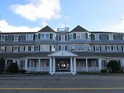 Wianno Club |
March 2, 1979 (#79000325) |
Seaview Ave. 41°36′58″N 70°22′17″W |
Osterville | |
| 84 | Wianno Historic District | 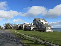 Wianno Historic District |
November 10, 1987 (#87000316) |
Roughly E. Bay Rd., Wianno and Sea View Aves. between Nantucket Sound and Crystal Lake 41°37′03″N 70°22′24″W |
Barnstable | |
| 85 | Yarmouth Camp Ground Historic District | 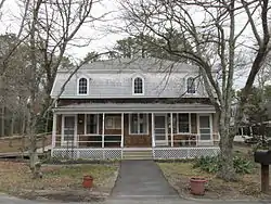 Yarmouth Camp Ground Historic District |
August 28, 1990 (#90001244) |
South of mid-Cape Highway (U.S. Route 6) and roughly bounded by County Ave., Willow St., Wood Rd., and Camp Ground Pond 41°40′59″N 70°15′44″W |
Barnstable and Yarmouth |
Former listings
| [2] | Name on the Register | Image | Date listed | Date removed | Location | City or town | Summary |
|---|---|---|---|---|---|---|---|
| 1 | Barnstable Fair Hall | 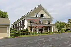 Barnstable Fair Hall |
March 7, 1979[5] (#80000436) | June 12, 1980 | 3512 Main St. |
Barnstable | Demolished |
See also
| Wikimedia Commons has media related to National Register of Historic Places in Barnstable County, Massachusetts. |
References
- "National Register of Historic Places: Weekly List Actions". National Park Service, United States Department of the Interior. Retrieved on January 29, 2021.
- Numbers represent an alphabetical ordering by significant words. Various colorings, defined here, differentiate National Historic Landmarks and historic districts from other NRHP buildings, structures, sites or objects.
- "National Register Information System". National Register of Historic Places. National Park Service. April 24, 2008.
- The eight-digit number below each date is the number assigned to each location in the National Register Information System database, which can be viewed by clicking the number.
- NRHP 1979 list, page 17460
| Topics |  | ||||||||||||||||
|---|---|---|---|---|---|---|---|---|---|---|---|---|---|---|---|---|---|
| Lists by county | |||||||||||||||||
| Lists by city |
| ||||||||||||||||
| Other lists | |||||||||||||||||
| |||||||||||||||||

This article is issued from Wikipedia. The text is licensed under Creative Commons - Attribution - Sharealike. Additional terms may apply for the media files.