National Register of Historic Places listings in Bucks County, Pennsylvania
This is a list of the National Register of Historic Places listings in Bucks County, Pennsylvania.
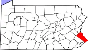
Location of Bucks County in Pennsylvania
This is intended to be a complete list of the properties and districts on National Register of Historic Places in Bucks County, Pennsylvania. The locations of National Register properties and districts for which the latitude and longitude coordinates are included below, may be seen in a map.[1]
There are 162 properties and districts listed on the National Register in the county, including 12 National Historic Landmarks. Another 3 sites were once listed on the Register but have since been removed.
- This National Park Service list is complete through NPS recent listings posted January 29, 2021.[2]
Current listings
| [3] | Name on the Register | Image | Date listed[4] | Location | City or town | Description |
|---|---|---|---|---|---|---|
| 1 | Andalusia | %252C_Andalusia_(Bucks_County%252C_Pennsylvania).jpg.webp) Andalusia |
November 13, 1966 (#66000649) |
1.4 miles (2.3 km) north of Philadelphia on U.S. Route 13 40°03′53″N 74°57′31″W |
Bensalem Township | 1794 estate, modified several times later, was home to Nicholas Biddle |
| 2 | Atkinson Road Bridge | 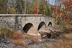 Atkinson Road Bridge |
March 20, 2002 (#02000222) |
Atkinson Road and Pidcock's Creek 40°19′38″N 74°58′44″W |
Solebury Township | |
| 3 | Belmont | 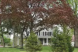 Belmont |
May 3, 1988 (#88000460) |
3779 Bristol Road 40°08′27″N 74°57′05″W |
Bensalem Township | |
| 4 | Bridge in Buckingham Township | 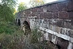 Bridge in Buckingham Township |
June 22, 1988 (#88000786) |
Forest Grove Road over Mill Creek 40°16′53″N 75°01′19″W |
Buckingham Township | |
| 5 | Bridge in Solebury Township | 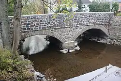 Bridge in Solebury Township |
June 22, 1988 (#88000783) |
Carversville Road over Paunacussing Creek 40°23′09″N 75°03′50″W |
Solebury Township | |
| 6 | Bridge in Tinicum Township | 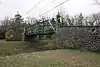 Bridge in Tinicum Township |
June 22, 1988 (#88000814) |
Legislative Route 920 over Pennsylvania Canal 40°25′24″N 75°03′55″W |
Tinicum Township | |
| 7 | Bridge in Yardley Borough | 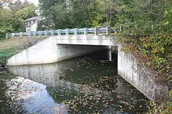 Bridge in Yardley Borough |
June 22, 1988 (#88000770) |
Reading Avenue over VanHorn Creek 40°14′03″N 74°50′02″W |
Yardley | |
| 8 | Bridge Valley Bridge |  Bridge Valley Bridge |
May 10, 1984 (#84003120) |
Spans Neshaminy Creek north of Jamison 40°16′34″N 75°05′01″W |
Warwick Township | |
| 9 | Bristol Historic District | 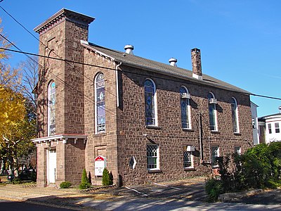 Bristol Historic District |
April 30, 1987 (#87000665) |
Roughly bounded by Pond, Cedar, E. Lincoln Streets, the Delaware River, and E. Mill Street 40°05′53″N 74°51′10″W |
Bristol | |
| 10 | Bristol Industrial Historic District | 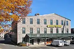 Bristol Industrial Historic District |
November 16, 1987 (#87002016) |
Roughly bounded by Pennsylvania Canal, Jefferson Avenue, Canal Street, Pennsylvania Railroad and Beaver Street 40°06′07″N 74°51′15″W |
Bristol | |
| 11 | Brownsburg Village Historic District | 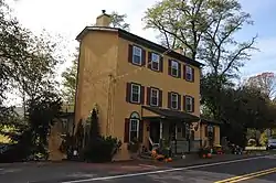 Brownsburg Village Historic District |
May 26, 1994 (#94000445) |
Junction of River and Brownsburg Rds. 40°19′07″N 74°55′12″W |
Upper Makefield Township | |
| 12 | Buckingham Friends Meeting House | 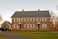 Buckingham Friends Meeting House |
March 28, 1997 (#97000291) |
5684 Lower York Road 40°20′56″N 75°02′27″W |
Buckingham Township | |
| 13 | Buckmanville Historic District | 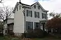 Buckmanville Historic District |
March 20, 2002 (#02000224) |
Street Road between Windy Bush and Buckmanville Roads 40°18′51″N 74°58′33″W |
Upper Makefield Township | |
| 14 | John Burroughs Homestead | 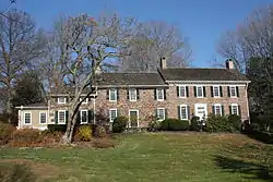 John Burroughs Homestead |
March 5, 1984 (#84003163) |
Wrightstown-Taylorsville Road 40°17′04″N 74°54′02″W |
Upper Makefield Township | |
| 15 | Byecroft Farm Complex |  Byecroft Farm Complex |
September 9, 1983 (#83002219) |
Off U.S. Route 202 40°20′13″N 75°02′20″W |
Buckingham Township | |
| 16 | Cabin Run Covered Bridge | 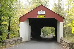 Cabin Run Covered Bridge |
December 1, 1980 (#80003443) |
South of Tinicum on Legislative Route 09099 40°14′33″N 75°06′45″W |
Plumstead Township | |
| 17 | Campbell's Bridge | .jpg.webp) Campbell's Bridge |
June 22, 1988 (#88000733) |
Allentown Road over Unami Creek 40°25′42″N 75°23′54″W |
Milford Township | Replaced in 2005 |
| 18 | Carversville Historic District |  Carversville Historic District |
December 13, 1978 (#78003418) |
Off Pennsylvania Route 32 40°23′09″N 75°03′35″W |
Solebury Township | |
| 19 | Center Bridge Historic District | 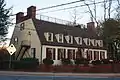 Center Bridge Historic District |
March 26, 1985 (#85000673) |
Bounded by Ely and Laurel Roads on River Road 40°24′02″N 74°58′48″W |
Solebury Township | |
| 20 | Chalfont Historic District |  Chalfont Historic District |
December 18, 2006 (#06001148) |
Roughly bounded by Chestnut Street Park Avenue, Main Street, Butler Avenue and Sunset Avenue 40°17′25″N 75°12′38″W |
Chalfont | |
| 21 | John Chapman House |  John Chapman House |
January 24, 1974 (#74001757) |
South of New Hope off Pennsylvania Route 232 on Eagle Road 40°18′46″N 74°56′57″W |
Upper Makefield Township | |
| 22 | Churchville Historic District | 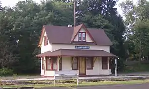 Churchville Historic District |
July 21, 1995 (#95000887) |
Roughly along Bristol Road, Bustleton Pike and Cornell and Knowles Avenues, in Northampton and Upper Southampton Townships 40°10′56″N 75°00′49″W |
Northampton and Upper Southampton Townships | |
| 23 | Cintra | 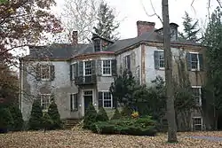 Cintra |
March 6, 1985 (#85000460) |
181 W. Bridge Street 40°21′50″N 74°57′35″W |
New Hope | |
| 24 | Gershom Craft House |  Gershom Craft House |
October 16, 1986 (#86002892) |
105 Barnsley Avenue 40°12′08″N 74°47′25″W |
Morrisville | |
| 25 | Craven Hall |  Craven Hall |
October 11, 2007 (#07001078) |
599 Newtown Road 40°11′29″N 75°04′26″W |
Warminster Township | |
| 26 | Cuttalossa Valley Historic District |  Cuttalossa Valley Historic District |
June 27, 2002 (#02000705) |
Cuttalossa Road from Sugan Road to the Delaware River 40°23′38″N 75°01′26″W |
Solebury Township | |
| 27 | Delaware Division of the Pennsylvania Canal |  Delaware Division of the Pennsylvania Canal |
October 29, 1974 (#74001756) |
Parallels the west bank of the Delaware River from Easton to Bristol 40°41′17″N 75°12′18″W |
Bristol | Extends into Northampton County |
| 28 | Delbar Products, Inc. |  Delbar Products, Inc. |
April 26, 2018 (#100002369) |
601 Spruce St. 40°22′10″N 75°17′48″W |
Lower | |
| 29 | Dolington Village Historic District | 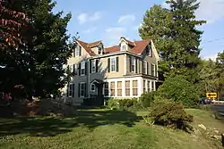 Dolington Village Historic District |
May 26, 1994 (#94000444) |
Junction of Pennsylvania Route 532 and Mt. Eyre Road (Washington Crossing Road) 40°15′58″N 74°53′46″W |
Lower and Upper Makefield Townships | |
| 30 | Dorrance Mansion | 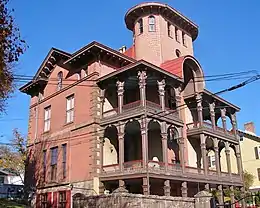 Dorrance Mansion |
October 16, 1986 (#86002891) |
300 Radcliffe Street 40°05′45″N 74°51′15″W |
Bristol | |
| 31 | Doylestown Historic District |  Doylestown Historic District |
May 10, 1985 (#85001012) |
Roughly bounded by Union, Cottage and E. Ashland Streets, Hillside Avenue and S. and N. West Streets 40°18′35″N 75°08′14″W |
Doylestown | |
| 32 | Pugh Dungan House |  Pugh Dungan House |
March 20, 1980 (#80003430) |
33 W. Court Street 40°18′37″N 75°07′54″W |
Doylestown | |
| 33 | Durham Mill and Furnace |  Durham Mill and Furnace |
November 21, 1976 (#76001608) |
Durham Road 40°34′35″N 75°13′27″W |
Durham Township | |
| 34 | Dyerstown Historic District |  Dyerstown Historic District |
January 15, 1987 (#86003574) |
Along Old Easton Road near the junction of Stony Lane 40°20′28″N 75°07′34″W |
Plumstead Township | |
| 35 | Eagle Tavern |  Eagle Tavern |
April 20, 1978 (#78002353) |
South of New Hope 40°17′29″N 74°56′24″W |
Upper Makefield Township | |
| 36 | John Eakin Farm |  John Eakin Farm |
February 24, 2005 (#05000100) |
3298 Pennsylvania Route 212, Main Street, Springtown 40°33′05″N 75°16′57″W |
Springfield Township | |
| 37 | Edgemont |  Edgemont |
December 16, 1977 (#77001126) |
North of Langhorne on Bridgetown Road 40°11′30″N 74°55′25″W |
Middletown Township | |
| 38 | Joshua Ely House |  Joshua Ely House |
March 6, 1985 (#85000463) |
Rittenhouse Circle 40°21′21″N 74°57′30″W |
New Hope | |
| 39 | Erwinna Covered Bridge |  Erwinna Covered Bridge |
December 1, 1980 (#80003434) |
North of Erwinna on Legislative Route 09098 40°30′09″N 75°04′29″W |
Erwinna | |
| 40 | Fallsington Historic District | 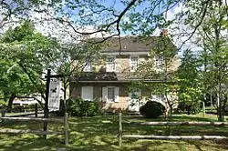 Fallsington Historic District |
June 19, 1972 (#72001099) |
South of U.S. Route 1, east of New Tyburn Road 40°08′40″N 74°48′58″W |
Falls Township | |
| 41 | Fonthill | 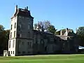 Fonthill |
June 1, 1972 (#72001094) |
E. Court Street at the intersection of Pennsylvania Route 313 40°19′16″N 75°07′26″W |
Doylestown | |
| 42 | Fonthill, Mercer Museum and Moravian Pottery and Tile Works | 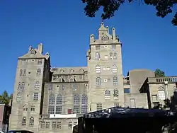 Fonthill, Mercer Museum and Moravian Pottery and Tile Works |
February 4, 1985 (#85002366) |
Court Street and Swamp Road and Pine and Ashland Streets 40°19′01″N 75°07′30″W |
Doylestown | |
| 43 | Fordhook Farm | 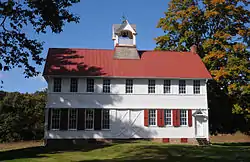 Fordhook Farm |
April 30, 1987 (#87000674) |
105 New Britain Road 40°17′52″N 75°09′01″W |
Doylestown Township | |
| 44 | Forest Grove Historic District |  Forest Grove Historic District |
April 20, 1982 (#82003765) |
Forest Grove and Lower Mountain Roads 40°17′34″N 75°03′39″W |
Buckingham Township | |
| 45 | Fountain House |  Fountain House |
March 16, 1972 (#72001095) |
State and Main Streets 40°18′36″N 75°07′51″W |
Doylestown | |
| 46 | Frankenfield Covered Bridge |  Frankenfield Covered Bridge |
December 1, 1980 (#80003444) |
North of Tinicum on Township 421 40°28′32″N 75°05′59″W |
Tinicum Township | |
| 47 | John and Alice Fullam House |  John and Alice Fullam House |
March 15, 2019 (#100003519) |
372 Brownsburg Rd. 40°16′59″N 74°58′12″W |
Wrightstown Township | |
| 48 | Jacob Funk House and Barn |  Jacob Funk House and Barn |
February 7, 2007 (#07000030) |
3609 Pennsylvania Route 212 40°33′32″N 75°16′04″W |
Springfield Township | |
| 49 | Gardenville-North Branch Rural Historic District | 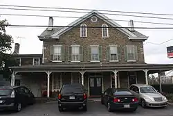 Gardenville-North Branch Rural Historic District |
November 7, 1991 (#91000954) |
Roughly bounded by Durham Road, Point Pleasant Pike, Valley Park Road and North Branch Neshaminy Creek 40°22′35″N 75°06′57″W |
Plumstead Township | |
| 50 | General Stores and Mold Loft Building-Harriman Yard of the Merchant Shipbuilding Corporation |  General Stores and Mold Loft Building-Harriman Yard of the Merchant Shipbuilding Corporation |
July 31, 2003 (#03000722) |
1414 Radcliffe Street 40°06′15″N 74°50′29″W |
Bristol | |
| 51 | Thomas and Lydia Gilbert Farm |  Thomas and Lydia Gilbert Farm |
May 5, 1989 (#89000351) |
5042 Anderson Road 40°20′14″N 75°03′36″W |
Buckingham Township | |
| 52 | Green Hills Farm |  Green Hills Farm |
February 27, 1974 (#74001755) |
Southwest of Dublin on Dublin Road 40°21′36″N 75°13′11″W |
Hilltown Township | |
| 53 | Grundy Mill Complex |  Grundy Mill Complex |
January 9, 1986 (#86000013) |
Western corner of Jefferson Avenue and Canal Street 40°06′15″N 74°51′08″W |
Bristol | |
| 54 | Half-Moon Inn | 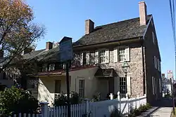 Half-Moon Inn |
December 6, 1977 (#77001128) |
101 and 105 Court Street 40°13′40″N 74°56′11″W |
Newtown | |
| 55 | Oscar Hammerstein II Farm | 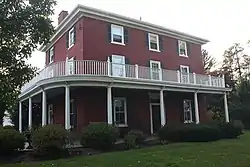 Oscar Hammerstein II Farm |
November 17, 1988 (#88002374) |
70 East Road 40°18′35″N 75°06′45″W |
Doylestown | |
| 56 | Hampton Hill | 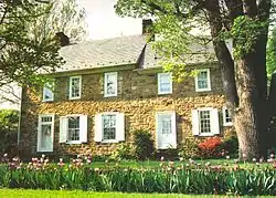 Hampton Hill |
April 2, 1973 (#73001594) |
1269 Second Street Pike 40°13′25″N 75°00′34″W |
Northampton Township | |
| 57 | Harewood and Beechwood | 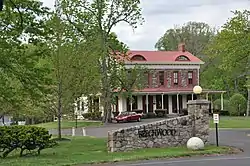 Harewood and Beechwood |
February 1, 1980 (#80003436) |
East of Langhorne off Pennsylvania Route 213 40°10′43″N 74°54′45″W |
Middletown Township | |
| 58 | Harriman Historic District |  Harriman Historic District |
April 30, 1987 (#87000673) |
Roughly bounded by Trenton Avenue, Cleveland and McKinley Streets, Farragut Avenue, and West Circle 40°06′29″N 74°50′42″W |
Bristol | Neighborhood mostly built to house workers at nearby shipyard during World War I |
| 59 | Hayhurst Farm |  Hayhurst Farm |
February 12, 1974 (#74001759) |
Northeast of Wrightstown on Eagle Road 40°17′24″N 74°56′43″W |
Upper Makefield Township | |
| 60 | Highland Park Camp Meeting |  Highland Park Camp Meeting |
April 10, 2017 (#100000854) |
415 Highland Park Rd. 40°20′47″N 75°18′10″W |
West Rockhill Township | |
| 61 | Holicong Village Historic District |  Holicong Village Historic District |
March 20, 1980 (#80003435) |
U.S. Route 202 and Holicong Road 40°20′09″N 75°02′55″W |
Buckingham Township | |
| 62 | Honey Hollow Watershed |  Honey Hollow Watershed |
August 4, 1969 (#69000155) |
2.5 miles (4.0 km) south of the Delaware River on Pennsylvania Route 263 40°22′11″N 75°20′45″W |
New Hope | |
| 63 | John and Phineas Hough House |  John and Phineas Hough House |
December 24, 1992 (#92001721) |
20 Moyer Road 40°13′43″N 74°50′01″W |
Lower Makefield Township | |
| 64 | Hulmeville Historic District |  Hulmeville Historic District |
July 17, 1986 (#86001677) |
2-4 Beaver Street, 946-1101 Bellevue Avenue, 1-111 Green, 4 Hulme, 3-342 Main Streets, 1-131 Trenton Avenue, and 2-9 Water Street 40°08′34″N 74°54′35″W |
Hulmeville | |
| 65 | Ivyland Historic District |  Ivyland Historic District |
March 21, 2002 (#02000225) |
Bounded by Jacksonbille Road, Wilson, Greeley, and Chase Aves. 40°12′31″N 75°04′25″W |
Ivyland | |
| 66 | Morgan James Homestead |  Morgan James Homestead |
December 27, 1977 (#77001127) |
Northwest of New Britain on Ferry Road 40°18′19″N 75°12′04″W |
New Britain Township | |
| 67 | James-Lorah House |  James-Lorah House |
October 17, 1972 (#72001096) |
132 N. Main Street 40°18′46″N 75°07′52″W |
Doylestown | |
| 68 | Jefferson Avenue School | 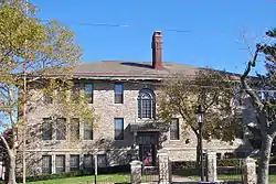 Jefferson Avenue School |
July 18, 1985 (#85001569) |
Jefferson Avenue and Pond Street 40°06′02″N 74°50′43″W |
Bristol | |
| 69 | Jefferson Land Association Historic District | 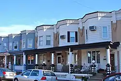 Jefferson Land Association Historic District |
November 5, 1987 (#87001994) |
Bounded by Spring Street, Jefferson Avenue, Garden, and Mansion Streets, and Beaver Dam Road 40°06′24″N 74°51′17″W |
Bristol | |
| 70 | Keith House-Washington's Headquarters |  Keith House-Washington's Headquarters |
November 14, 1978 (#78002356) |
East of Pineville on Pineville Road 40°17′44″N 74°56′49″W |
Upper Makefield Township | |
| 71 | William Kitchen House | 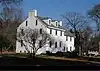 William Kitchen House |
March 6, 1985 (#85000464) |
332 S. Sugan Road 40°21′06″N 74°57′50″W |
New Hope | |
| 72 | Knecht's Mill Covered Bridge | 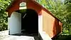 Knecht's Mill Covered Bridge |
December 1, 1980 (#80003432) |
Northeast of Springtown on Township 424 40°34′11″N 75°15′04″W |
Springfield Township | |
| 73 | Gen. John Lacey Homestead | 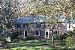 Gen. John Lacey Homestead |
December 2, 1980 (#80003448) |
Forest Grove Road 40°16′57″N 75°01′15″W |
Buckingham Township | |
| 74 | Langhorne Historic District | 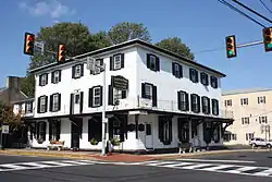 Langhorne Historic District |
November 20, 1987 (#87001993) |
Summit and Marshall Avenues, Pine Street, Richardson Avenue, and Green Street 40°10′33″N 74°55′16″W |
Langhorne | |
| 75 | Langhorne Library | 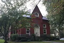 Langhorne Library |
January 9, 1986 (#86000038) |
160 W. Maple Avenue 40°10′31″N 74°55′24″W |
Langhorne | |
| 76 | Langhorne Manor School | 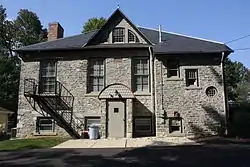 Langhorne Manor School |
June 10, 2008 (#08000518) |
618 Hulmeville Avenue 40°09′52″N 74°55′16″W |
Langhorne Manor | |
| 77 | David Leedom Farm | 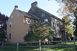 David Leedom Farm |
January 1, 1976 (#76001609) |
Southwest of Newtown off Richboro Road 40°13′19″N 74°57′25″W |
Newtown Township | |
| 78 | Liberty Hall | 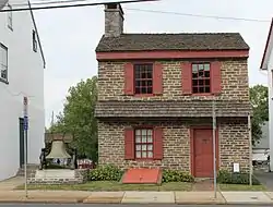 Liberty Hall |
January 26, 1978 (#78002358) |
1237 W. Broad Street 40°26′34″N 75°21′07″W |
Quakertown | |
| 79 | Little Jerusalem AME Church | 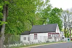 Little Jerusalem AME Church |
December 3, 1980 (#80003429) |
1200 Bridgewater Road 40°05′57″N 74°55′26″W |
Bensalem Township | |
| 80 | Longland | 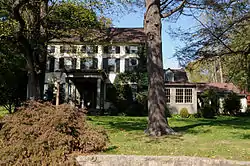 Longland |
December 20, 1999 (#99001498) |
2909 Holicong Road 40°20′37″N 75°03′26″W |
Buckingham Township | |
| 81 | Loux Covered Bridge | .jpg.webp) Loux Covered Bridge |
December 1, 1980 (#80003442) |
Southeast of Pipersville on Legislative Route 09060 40°25′21″N 75°07′41″W |
Plumstead Township | |
| 82 | Lumberville Historic District | 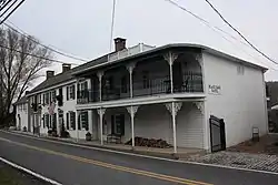 Lumberville Historic District |
August 9, 1984 (#84003165) |
Fleecy Dale, Carversville, River, and Green Hill Roads 40°24′15″N 75°02′14″W |
Solebury Township | |
| 83 | Makefield Meeting | 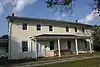 Makefield Meeting |
January 18, 1974 (#74001758) |
Northeast of Newtown at Mt. Eyre Road and Dolington Road 40°15′57″N 74°53′14″W |
Upper Makefield Township | |
| 84 | Mechanicsville Village Historic District | 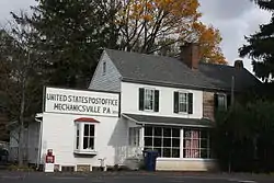 Mechanicsville Village Historic District |
January 4, 1989 (#88003049) |
Junction of Mechanicsville Road and Pennsylvania Route 413 40°20′40″N 75°04′36″W |
Buckingham Township | |
| 85 | Mercer Museum |  Mercer Museum |
March 16, 1972 (#72001097) |
Pine and Ashland Streets 40°18′28″N 75°07′38″W |
Doylestown | |
| 86 | Moland House | 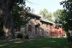 Moland House |
May 19, 1989 (#89000352) |
1641 Old York Road 40°14′10″N 75°05′34″W |
Warwick Township | |
| 87 | Moravian Pottery and Tile Works | 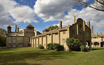 Moravian Pottery and Tile Works |
June 1, 1972 (#72001098) |
Court Street and Pennsylvania Route 313 40°19′23″N 75°07′25″W |
Doylestown | |
| 88 | George Nakashima House, Studio and Workshop | George Nakashima House, Studio and Workshop |
August 14, 2008 (#08000782) |
1847 and 1858 Aquetong Road 40°20′23″N 74°57′19″W |
Solebury Township | |
| 89 | New Hope Village District | 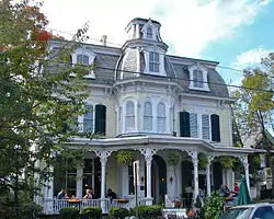 New Hope Village District |
March 6, 1985 (#85000462) |
Old Mill Road, Stockton Avenue, Ferry, Bridge, Mechanic, Randolph, Main, Coryell, and Waterloo Streets 40°21′30″N 74°57′09″W |
New Hope | |
| 90 | Newtown Creek Bridge |  Newtown Creek Bridge |
June 22, 1988 (#88000787) |
Richboro Road over Newtown Creek 40°13′40″N 74°56′20″W |
Newtown | |
| 91 | Newtown Friends Meetinghouse and Cemetery | 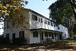 Newtown Friends Meetinghouse and Cemetery |
July 21, 1977 (#77001129) |
Court Street 40°13′32″N 74°56′10″W |
Newtown | |
| 92 | Newtown Historic District | 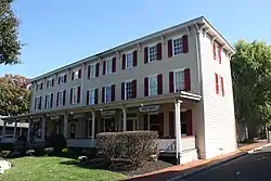 Newtown Historic District |
December 17, 1979 (#79002174) |
Pennsylvania Routes 332 and 413; also the eastern side of Sycamore St. from Frost Ln. to St. Andrew's Catholic Church; also parts of Congress, Chancellor and Liberty Sts. north of Washington Ave., and Chancellor St. south of Penn St. to S. State St. 40°13′39″N 74°56′11″W |
Newtown | Second and third sets of boundaries represent boundary increases of February 25, 1986 and October 28, 1986 |
| 93 | Newtown Presbyterian Church | 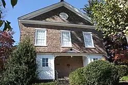 Newtown Presbyterian Church |
July 16, 1987 (#87001212) |
Sycamore Street 40°13′56″N 74°56′20″W |
Newtown | |
| 94 | Amos Palmer House | 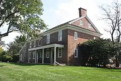 Amos Palmer House |
November 18, 1988 (#88002661) |
Township Line Road 40°12′44″N 74°52′53″W |
Lower Makefield Township | |
| 95 | Isaiah Paxson Farm | 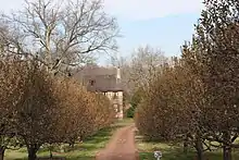 Isaiah Paxson Farm |
August 23, 1984 (#84003167) |
Along River Road across from its junction with Laurel Road[5] 40°24′14″N 74°59′22″W |
Solebury Township | |
| 96 | Phineas Pemberton House |  Phineas Pemberton House |
September 28, 1971 (#71000684) |
Holly Drive in Levittown 40°09′37″N 74°50′23″W |
Bristol Township | |
| 97 | Penn's Park General Store Complex |  Penn's Park General Store Complex |
January 8, 1985 (#85000072) |
2310-2324 Second Street Pike 40°15′57″N 74°59′56″W |
Wrightstown Township | |
| 98 | Penns Park Historic District |  Penns Park Historic District |
March 13, 1986 (#86000349) |
Intersection of Second Street Pike and Penns Park Road 40°15′59″N 74°59′50″W |
Wrightstown Township | |
| 99 | Pennsbury Manor |  Pennsbury Manor |
October 28, 1969 (#69000154) |
On the Delaware River south of Bordentown Road 40°08′00″N 74°46′12″W |
Falls Township | |
| 100 | Perkasie Park Camp Meeting |  Perkasie Park Camp Meeting |
August 29, 2016 (#16000571) |
200 S. 9th St. 40°22′26″N 75°18′05″W |
Perkasie | |
| 101 | Phillips Mill Historic District |  Phillips Mill Historic District |
June 30, 1983 (#83002220) |
River Road between Limeport and Chapel Road 40°22′58″N 74°58′10″W |
Solebury Township | |
| 102 | Pine Valley Covered Bridge |  Pine Valley Covered Bridge |
December 1, 1980 (#80003437) |
North of New Britain on Township 340 40°18′19″N 75°11′16″W |
New Britain Township | |
| 103 | Point Pleasant Historic District |  Point Pleasant Historic District |
October 5, 1989 (#89001652) |
River Road and Point Pleasant Pike 40°25′20″N 75°03′58″W |
Plumstead and Tinicum Townships | |
| 104 | Quakertown Historic District |  Quakertown Historic District |
April 20, 2011 (#11000200) |
Roughly bounded by Main and Broad Streets; Hellertown, Tichikon, and Park Avenues 40°26′30″N 75°20′30″W |
Quakertown | |
| 105 | Quakertown Passenger and Freight Station | 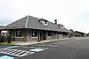 Quakertown Passenger and Freight Station |
April 14, 2000 (#00000382) |
Front and E. Broad Streets 40°26′23″N 75°20′04″W |
Quakertown | |
| 106 | Red Hill Church and School | 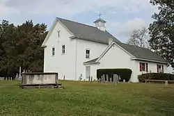 Red Hill Church and School |
May 22, 1978 (#78002355) |
Durham Road 40°28′09″N 75°09′27″W |
Tinicum Township | |
| 107 | Rhoads Homestead | 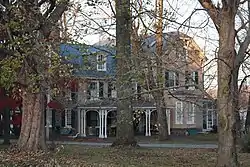 Rhoads Homestead |
August 8, 1996 (#85003655) |
102-106 W. Bridge Street 40°22′13″N 74°57′28″W |
New Hope | |
| 108 | Joseph Richardson House | 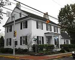 Joseph Richardson House |
December 26, 1985 (#85003159) |
Bellevue and Maple Avenues 40°10′33″N 74°55′12″W |
Langhorne | |
| 109 | Ridge Valley Rural Historic District | 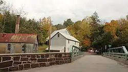 Ridge Valley Rural Historic District |
July 24, 1992 (#92000944) |
Roughly all of Sheep Hole Road and parts of Headquarters, Geigel Hill, Red Hill, Tabor and Bunker Hill Roads 40°28′31″N 75°08′29″W |
Tinicum Township | |
| 110 | Benjamin Riegel House | 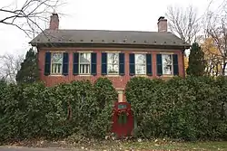 Benjamin Riegel House |
January 6, 1987 (#86003569) |
29 Delaware Road 40°35′41″N 75°11′35″W |
Riegelsville | |
| 111 | Riverside Farm | 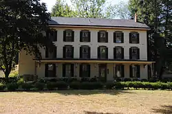 Riverside Farm |
April 21, 1988 (#88000461) |
River and Headquarters Roads 40°30′01″N 75°04′06″W |
Erwinna | |
| 112 | Enoch Roberts House | 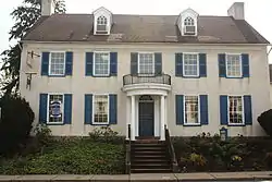 Enoch Roberts House |
April 24, 1986 (#86000856) |
1226 W. Broad Street 40°26′32″N 75°21′07″W |
Quakertown | |
| 113 | St. Elizabeth's Convent | 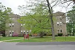 St. Elizabeth's Convent |
March 21, 1978 (#78002352) |
1663 Bristol Pike 40°04′23″N 74°57′26″W |
Bensalem Township | Now the Saint Katharine Drexel Shrine |
| 114 | Shaw Historic District | 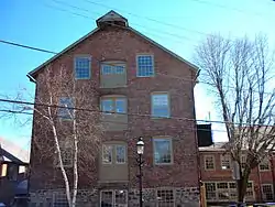 Shaw Historic District |
December 17, 1979 (#79002172) |
Bounded by S. Main, Ashland, Bridge, and S. Clinton Streets 40°18′25″N 75°07′48″W |
Doylestown | |
| 115 | Sheard's Mill Covered Bridge |  Sheard's Mill Covered Bridge |
December 1, 1980 (#80003445) |
East of Quakertown on Legislative Route 09129 40°27′17″N 75°16′44″W |
East Rockhill and Haycock Townships | |
| 116 | Levi Sheard Mill |  Levi Sheard Mill |
December 20, 2006 (#06001149) |
8308 Covered Bridge Road 40°27′24″N 75°16′40″W |
East Rockhill Township | |
| 117 | Shelly School |  Shelly School |
February 22, 2011 (#11000037) |
130 Richlandtown Pike (Pennsylvania Route 212) 40°27′10″N 75°19′36″W |
Richland Township | |
| 118 | Slate Hill Cemetery |  Slate Hill Cemetery |
April 28, 1992 (#92000397) |
Junction of Yardley-Morrisville Road and Mahlon Drive 40°13′56″N 74°49′39″W |
Lower Makefield Township | |
| 119 | Smith Family Farmstead | 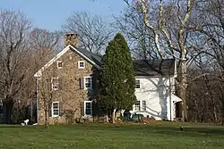 Smith Family Farmstead |
January 30, 1978 (#78002354) |
South of New Hope on River Road 40°19′06″N 74°55′39″W |
Upper Makefield Township | |
| 120 | William Smith House | 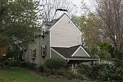 William Smith House |
April 13, 1977 (#77001131) |
Mud and Penns Park Road 40°15′56″N 74°59′08″W |
Wrightstown Township | |
| 121 | Sotcher Farmhouse | 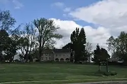 Sotcher Farmhouse |
December 27, 1977 (#77001125) |
335 Trenton Road 40°10′41″N 74°51′27″W |
Falls Township | |
| 122 | South Perkasie Covered Bridge | 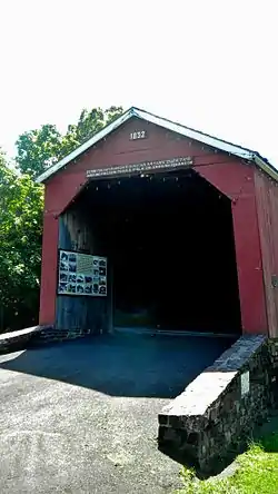 South Perkasie Covered Bridge |
December 1, 1980 (#80003441) |
South of Perkasie in Lenape Park, South Perkasie 40°22′03″N 75°17′43″W |
Perkasie | |
| 123 | Southampton Baptist Church and Cemetery | 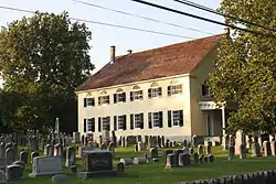 Southampton Baptist Church and Cemetery |
September 18, 1978 (#78002359) |
2nd Street Pike and Maple Avenue 40°11′01″N 75°02′10″W |
Upper Southampton Township | |
| 124 | Spinner House |  Spinner House |
June 22, 1979 (#79002175) |
Spinnerstown and Sleepy Hollow Rds. 40°26′20″N 75°26′16″W |
Milford Township | |
| 125 | Spring Valley Historic District |  Spring Valley Historic District |
January 7, 1988 (#88000140) |
Mill Road and U.S. Route 202 40°19′07″N 75°04′59″W |
Buckingham Township | |
| 126 | Springdale Historic District |  Springdale Historic District |
March 6, 1985 (#85000461) |
Mechanic Street, Old York, S. Sugan, and Stoney Hill Roads 40°21′43″N 74°57′50″W |
New Hope | |
| 127 | Springhouse Farm |  Springhouse Farm |
August 8, 2007 (#07000796) |
2184 Springhouse Lane 40°31′44″N 75°16′27″W |
Springfield Township | |
| 128 | Springtown Historic District |  Springtown Historic District |
January 10, 2008 (#07001379) |
Main Street between Drifting Drive and Springtown Hill Road 40°33′24″N 75°17′16″W |
Springfield Township | |
| 129 | Stover Mill |  Stover Mill |
October 18, 1979 (#79002173) |
Pennsylvania Route 32 40°29′48″N 75°04′06″W |
Erwinna | |
| 130 | Isaac Stover House |  Isaac Stover House |
April 26, 1990 (#90000702) |
River Road south of Geigel Hill Road 40°29′49″N 75°04′07″W |
Erwinna | |
| 131 | Jacob Stover Farmstead | 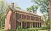 Jacob Stover Farmstead |
December 16, 2019 (#100004762) |
921 River Rd. 40°32′43″N 75°04′36″W |
Upper Black Eddy | |
| 132 | Stover-Myers Mill |  Stover-Myers Mill |
September 13, 1978 (#78002357) |
North of Pipersville on Dark Hollow Road 40°26′15″N 75°07′26″W |
Bedminster Township | |
| 133 | Reuben and Elizabeth Strassburger Farmstead | 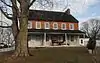 Reuben and Elizabeth Strassburger Farmstead |
January 17, 2017 (#100000501) |
407 Keystone Dr. 40°20′15″N 75°18′12″W |
Hilltown Township | |
| 134 | Lewis Summers Farm | 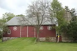 Lewis Summers Farm |
August 27, 1991 (#91001124) |
60 Headquarters Road 40°28′08″N 75°09′01″W |
Tinicum Township | |
| 135 | Summerseat | %252C_Morrisville_(Bucks_County%252C_Pennsylvania).jpg.webp) Summerseat |
July 17, 1971 (#71000685) |
Clymer Street and Morris Avenue 40°12′28″N 74°46′48″W |
Morrisville | |
| 136 | Tabor Home for Needy and Destitute Children | 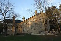 Tabor Home for Needy and Destitute Children |
July 16, 1987 (#87001207) |
601 New Britain Road 40°17′32″N 75°07′47″W |
Doylestown Township | |
| 137 | Benjamin Taylor Homestead |  Benjamin Taylor Homestead |
December 6, 1975 (#75001622) |
Northeast of Newtown off Pennsylvania Route 532 40°15′26″N 74°54′43″W |
Lower Makefield Township | |
| 138 | Peter Taylor Farmstead |  Peter Taylor Farmstead |
May 5, 1989 (#89000353) |
229 Wrights Road 40°15′16″N 74°56′07″W |
Newtown Township | |
| 139 | Teller Cigar Factory |  Teller Cigar Factory |
January 6, 1987 (#86003567) |
340 N. Main Street 40°21′43″N 75°18′48″W |
Sellersville | |
| 140 | John Thompson House |  John Thompson House |
July 16, 1973 (#73001595) |
1925 Second Street Pike 40°14′44″N 75°00′32″W |
Northampton Township | |
| 141 | Tomlinson-Huddleston House | 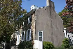 Tomlinson-Huddleston House |
November 10, 1983 (#83004200) |
109 W. Maple Avenue 40°10′34″N 74°55′17″W |
Langhorne | |
| 142 | Trenton City/Calhoun Street Bridge | 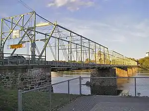 Trenton City/Calhoun Street Bridge |
November 20, 1975 (#75001621) |
Spans the Delaware River between Trenton, New Jersey and Morrisville 40°13′11″N 74°46′42″W |
Morrisville | |
| 143 | Trevose Manor |  Trevose Manor |
May 24, 1976 (#76001607) |
5408 Neshaminy Valley Road 40°08′45″N 74°56′01″W |
Bensalem Township | Also known as Growden Mansion |
| 144 | Twin Trees Farm |  Twin Trees Farm |
June 5, 1975 (#75001623) |
905 2nd Street Pike 40°12′41″N 75°00′39″W |
Northampton Township | |
| 145 | Twining Farm |  Twining Farm |
July 1, 1982 (#82003766) |
Buck Road 40°13′09″N 74°56′22″W |
Newtown Township | |
| 146 | George F. Tyler Mansion | 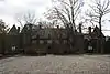 George F. Tyler Mansion |
July 16, 1987 (#87001210) |
Western side of Swamp Road/Pennsylvania Route 313 40°14′22″N 74°58′09″W |
Newtown | |
| 147 | Uhlerstown Historic District | 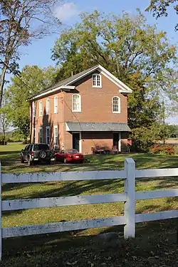 Uhlerstown Historic District |
May 26, 1994 (#94000517) |
Roughly bounded by the Delaware River, Jugtown Hill Road, and the Delaware Canal 40°31′44″N 75°04′20″W |
Tinicum Township | |
| 148 | Uneek Havana Cigar Company | 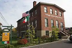 Uneek Havana Cigar Company |
November 7, 2007 (#07001160) |
1259 Pennsylvania Route 113 40°22′07″N 75°15′02″W |
Hilltown Township | |
| 149 | Upper Aquetong Valley Historic District | 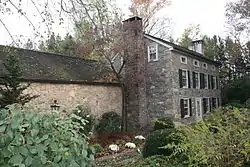 Upper Aquetong Valley Historic District |
July 30, 1987 (#87001216) |
Meeting House and Aquetong Roads, between U.S. Route 202 and Sugan Road 40°21′44″N 75°00′07″W |
Solebury Township | |
| 150 | Van Sant Covered Bridge |  Van Sant Covered Bridge |
December 1, 1980 (#80003438) |
South of New Hope on Township 392 40°19′37″N 74°57′29″W |
Solebury Township | |
| 151 | Vansant Farmhouse |  Vansant Farmhouse |
August 2, 1977 (#77001130) |
North of Rushland on Ceder Lane 40°16′14″N 75°01′08″W |
Wrightstown Township | |
| 152 | Village of Edgewood Historic District |  Village of Edgewood Historic District |
November 28, 1980 (#80003433) |
Yardley, Langhorne, Edgewood and Stony Hill Roads 40°13′22″N 74°52′31″W |
Lower Makefield Township | |
| 153 | Waldenmark |  Waldenmark |
August 30, 2001 (#01000924) |
1280 and 1300 Wrightstown Road 40°16′32″N 74°58′13″W |
Wrightstown Township | |
| 154 | Walt Disney Elementary School |  Walt Disney Elementary School |
August 30, 2007 (#07000889) |
200 Lakeside Drive N., Levittown 40°09′13″N 74°49′08″W |
Tullytown | |
| 155 | Isaiah Warner Farmstead |  Isaiah Warner Farmstead |
August 20, 2004 (#04000883) |
60 Thompson Mill Road 40°17′16″N 74°58′40″W |
Wrightstown Township | |
| 156 | Washington Crossing State Park | 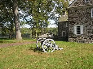 Washington Crossing State Park |
October 15, 1966 (#66000650) |
Between Yardley and New Hope, on the Delaware River 40°17′57″N 74°52′07″W |
Yardley | |
| 157 | White Hall of Bristol College | 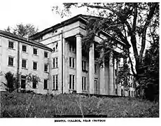 White Hall of Bristol College |
January 12, 1984 (#84003177) |
701-721 Shadyside Avenue 40°04′48″N 74°54′08″W |
Bristol Township | |
| 158 | Willow Mill Complex |  Willow Mill Complex |
May 9, 2002 (#02000476) |
570, 559, and 569 Bustleton Pike 40°11′58″N 75°00′38″W |
Northampton Township | |
| 159 | Wrightstown Friends Meeting Complex | 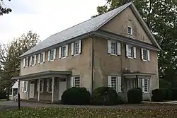 Wrightstown Friends Meeting Complex |
October 29, 1975 (#75001624) |
Pennsylvania Route 413 40°15′55″N 74°59′00″W |
Wrightstown Township | |
| 160 | Wrightstown Octagonal Schoolhouse | 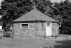 Wrightstown Octagonal Schoolhouse |
November 9, 2007 (#07000586) |
2091 Second Street Pike 40°15′24″N 75°00′23″W |
Wrightstown Township | |
| 161 | Wycombe Village Historic District | 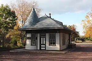 Wycombe Village Historic District |
January 31, 1985 (#85000177) |
Roughly bounded by township line, Mill Creek and Forest Grove Roads, Cherry Lane, Washington and Park Avenues 40°16′57″N 75°01′07″W |
Buckingham and Wrightstown Townships | |
| 162 | Yardley Historic District |  Yardley Historic District |
May 10, 2005 (#05000417) |
Roughly bounded by Main Street, Afton Avenue, Letchworth Avenue, Canal Street, S. Edgewater Avenue, and the Delaware Canal 40°14′34″N 74°50′11″W |
Yardley |
Former listings
| [3] | Name on the Register | Image | Date listed | Date removed | Location | City or town | Summary |
|---|---|---|---|---|---|---|---|
| 1 | Bristol Carpet Mills | October 16, 1986 (#86002893) | April 13, 1994 | Beaver Dam and Canal Streets |
Bristol | ||
| 2 | Fretz Farm | 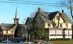 Fretz Farm |
March 7, 1985 (#85000459) | August 16, 2012 | Almshouse Road and Pennsylvania Route 611 40°16′15″N 75°07′44″W |
Doylestown Township | |
| 3 | Haupt's Mill Covered Bridge | 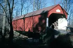 Haupt's Mill Covered Bridge |
December 1, 1980 (#80003446) | June 27, 1986 | Legislative Route 09061 in Durham |
Springfield Township | Destroyed by arson, January 1985. |
| 4 | Mood's Covered Bridge | 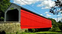 Mood's Covered Bridge |
December 1, 1980 (#80003440) | August 19, 2004 | East of Perkasie of Legislative Route 09118 |
East Rockhill Township | Destroyed by arson, 22 June 2004. |
| 5 | Twining Ford Covered Bridge | 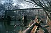 Twining Ford Covered Bridge |
December 1, 1980 (#80003439) | June 1, 1994 | West of Newtown in Tyler State Park |
Newtown and Northampton Townships | Photo from 1981. Destroyed by arson, 1991. A replica bridge was erected in 1997.[6] |
| Wikimedia Commons has media related to National Register of Historic Places in Bucks County, Pennsylvania. |
References
- The latitude and longitude information provided in this table was derived originally from the National Register Information System, which has been found to be fairly accurate for about 99% of listings. Some locations in this table may have been corrected to current GPS standards.
- "National Register of Historic Places: Weekly List Actions". National Park Service, United States Department of the Interior. Retrieved on January 29, 2021.
- Numbers represent an alphabetical ordering by significant words. Various colorings, defined here, differentiate National Historic Landmarks and historic districts from other NRHP buildings, structures, sites or objects.
- The eight-digit number below each date is the number assigned to each location in the National Register Information System database, which can be viewed by clicking the number.
- Location derived from its NRHP nomination form; the NRIS lists the site as "Address Restricted"
- Schofield Ford Covered Bridge, from Visit PA.
| Topics | 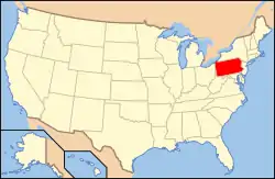 | |
|---|---|---|
| Lists by county |
| |
| Lists by city | ||
| Other lists | ||
| ||
This article is issued from Wikipedia. The text is licensed under Creative Commons - Attribution - Sharealike. Additional terms may apply for the media files.