National Register of Historic Places listings in Columbia County, Pennsylvania
This is a list of the National Register of Historic Places listings in Columbia County, Pennsylvania.
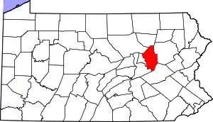
Location of Columbia County in Pennsylvania
This is intended to be a complete list of the properties and districts on the National Register of Historic Places in Columbia County, Pennsylvania, United States. The locations of National Register properties and districts for which the latitude and longitude coordinates are included below, may be seen in a map.[1]
There are 31 properties and districts listed on the National Register in the county. Another property was once listed but has been removed.
- This National Park Service list is complete through NPS recent listings posted January 29, 2021.[2]
Current listings
| [3] | Name on the Register | Image | Date listed[4] | Location | City or town | Description |
|---|---|---|---|---|---|---|
| 1 | Berwick Armory | 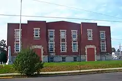 Berwick Armory |
November 14, 1991 (#91001692) |
201 Pine Street 41°03′28″N 76°14′01″W |
Berwick | |
| 2 | Bloomsburg Historic District |  Bloomsburg Historic District |
September 8, 1983 (#83002229) |
Roughly bounded by Penn, 5th, West, Willow, Millville and Light Streets 41°00′09″N 76°27′13″W |
Bloomsburg | |
| 3 | Bridge in Fishing Creek Township | 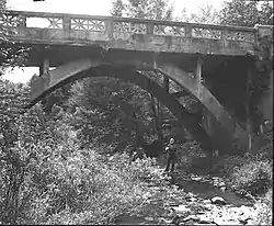 Bridge in Fishing Creek Township |
June 22, 1988 (#88000738) |
Legislative Route 19078 over Little Pine Creek, east of Bendertown 41°09′05″N 76°17′45″W |
Fishing Creek Township | |
| 4 | Catawissa Friends Meetinghouse | 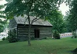 Catawissa Friends Meetinghouse |
June 9, 1978 (#78002379) |
South and 3rd Streets 40°57′12″N 76°27′41″W |
Catawissa | |
| 5 | Jud Christie Covered Bridge No. 95 | 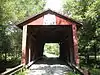 Jud Christie Covered Bridge No. 95 |
November 29, 1979 (#79003184) |
T-685, northeast of Millville 41°11′45″N 76°28′24″W |
Jackson and Pine Townships | |
| 6 | Creasyville Covered Bridge | 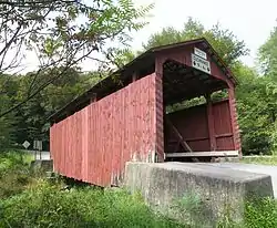 Creasyville Covered Bridge |
November 29, 1979 (#79003198) |
T-683, northeast of Millville 41°12′43″N 76°27′42″W |
Jackson and Pine Townships | |
| 7 | Davis Covered Bridge | 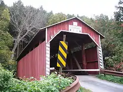 Davis Covered Bridge |
November 29, 1979 (#79003191) |
T-371, south of Catawissa 40°54′40″N 76°26′24″W |
Cleveland Township | |
| 8 | Sam Eckman Covered Bridge No. 92 | 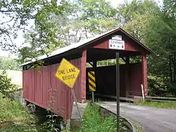 Sam Eckman Covered Bridge No. 92 |
November 29, 1979 (#79003183) |
T-548, northeast of Millville 41°10′39″N 76°29′26″W |
Greenwood and Pine Townships | |
| 9 | Fowlersville Covered Bridge | 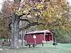 Fowlersville Covered Bridge |
November 29, 1979 (#79003182) |
Legislative Route 19039, south of Fowlersville 41°03′39″N 76°17′01″W |
North Centre Township | In 1986 the bridge was moved to Briar Creek Park in North Centre Township.[5] |
| 10 | Furnace Covered Bridge No. 11 | 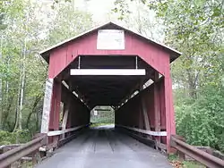 Furnace Covered Bridge No. 11 |
November 29, 1979 (#79003190) |
T-373 40°54′24″N 76°27′37″W |
Cleveland Township | |
| 11 | Josiah Hess Covered Bridge No. 122 | 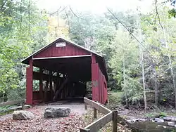 Josiah Hess Covered Bridge No. 122 |
November 29, 1979 (#79003181) |
T-563, east of Forks 41°06′53″N 76°20′23″W |
Fishing Creek Township | |
| 12 | Hollingshead Covered Bridge No. 40 | 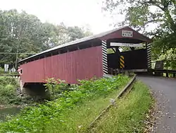 Hollingshead Covered Bridge No. 40 |
November 29, 1979 (#79003187) |
T-405, east of Catawissa 40°57′06″N 76°26′52″W |
Catawissa Township | |
| 13 | Jackson Mansion and Carriage House | 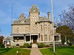 Jackson Mansion and Carriage House |
September 5, 1985 (#85001965) |
344 Market Street 41°03′27″N 76°14′07″W |
Berwick | |
| 14 | Johnson Covered Bridge No. 28 | 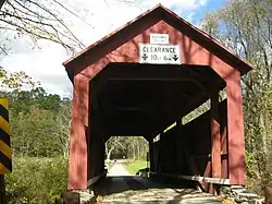 Johnson Covered Bridge No. 28 |
November 29, 1979 (#79003185) |
T-320, south of Catawissa 40°52′40″N 76°29′02″W |
Cleveland Township | |
| 15 | Lawrence L. Knoebel Covered Bridge | 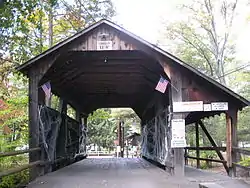 Lawrence L. Knoebel Covered Bridge |
August 8, 1979 (#79002309) |
Knoebel's Grove 40°52′38″N 76°30′21″W |
Cleveland Township | Extends into Ralpho Township in Northumberland County |
| 16 | Kramer Covered Bridge No. 113 | 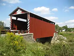 Kramer Covered Bridge No. 113 |
November 29, 1979 (#79003194) |
T-572, southwest of Rohrsburg 41°07′16″N 76°25′56″W |
Greenwood Township | The bridge was "totally rebuilt in 2007".[6] |
| 17 | Kreigbaum Covered Bridge | 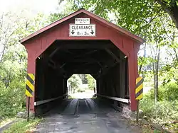 Kreigbaum Covered Bridge |
August 8, 1979 (#79002316) |
East of Elysburg on Township 459 40°50′51″N 76°30′29″W |
Cleveland Township | Extends into Ralpho Township in Northumberland County |
| 18 | Parr's Mill Covered Bridge No. 10 | 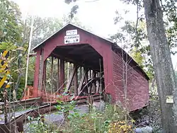 Parr's Mill Covered Bridge No. 10 |
November 29, 1979 (#79003189) |
T-371 at Parr's Mill 40°54′23″N 76°28′23″W |
Cleveland Township and Franklin Township | |
| 19 | Patterson Covered Bridge No. 112 | 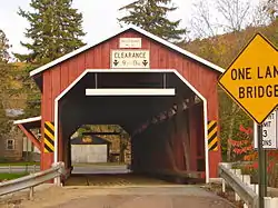 Patterson Covered Bridge No. 112 |
November 29, 1979 (#79003193) |
T-575, north of Orangeville 41°06′34″N 76°25′03″W |
Orange Township | |
| 20 | Richards Covered Bridge | 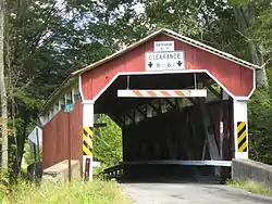 Richards Covered Bridge |
August 8, 1979 (#79002308) |
East of Elysburg on Township 804 40°52′03″N 76°30′29″W |
Cleveland Township | Extends into Ralpho Township in Northumberland County |
| 21 | Riegel Covered Bridge No. 6 | 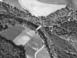 Riegel Covered Bridge No. 6 |
November 29, 1979 (#79003196) |
T-312, southwest of Catawissa 40°54′44″N 76°30′49″W |
Franklin Township | The bridge was destroyed in an arson fire on May 30, 1979.[7] |
| 22 | Rohrbach Covered Bridge No. 24 | 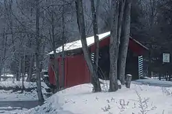 Rohrbach Covered Bridge No. 24 |
November 29, 1979 (#79003197) |
T-369, southwest of Catawissa 40°54′00″N 76°30′43″W |
Franklin Township | The bridge was dismantled in October 1986 and the pieces are in storage at Knoebels Amusement Resort.[8] |
| 23 | Rupert Covered Bridge No. 56 | 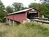 Rupert Covered Bridge No. 56 |
November 29, 1979 (#79003186) |
T-449 at Rupert 40°58′53″N 76°28′23″W |
Bloomsburg and Montour Township | |
| 24 | Shoemaker Covered Bridge | 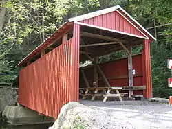 Shoemaker Covered Bridge |
November 29, 1979 (#79003192) |
Legislative Route 19053, north of Iola 41°09′05″N 76°32′11″W |
Pine Township | |
| 25 | Snyder Covered Bridge No. 17 | 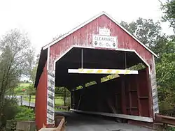 Snyder Covered Bridge No. 17 |
November 29, 1979 (#79003188) |
T-361, southeast of Slabtown 40°54′05″N 76°23′41″W |
Locust Township | |
| 26 | Stillwater Covered Bridge No. 134 | 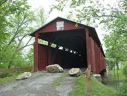 Stillwater Covered Bridge No. 134 |
November 29, 1979 (#79003177) |
T-629 41°09′07″N 76°21′39″W |
Stillwater | |
| 27 | Twin Bridges-East Paden Covered Bridge No. 120 | 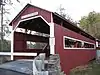 Twin Bridges-East Paden Covered Bridge No. 120 |
November 29, 1979 (#79003180) |
Off Pennsylvania Route 487, east of Forks 41°06′25″N 76°21′25″W |
Fishing Creek Township | |
| 28 | Twin Bridges-West Paden Covered Bridge No. 121 | 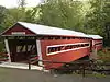 Twin Bridges-West Paden Covered Bridge No. 121 |
November 29, 1979 (#79003179) |
Off Pennsylvania Route 487, east of Forks 41°06′25″N 76°21′25″W |
Fishing Creek Township | The bridge was destroyed in a flood on June 28, 2006, and an identical replacement was built and dedicated on October 15, 2008.[9] |
| 29 | Wagner Covered Bridge No. 19 | 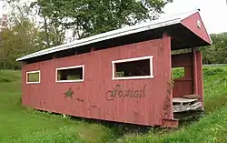 Wagner Covered Bridge No. 19 |
November 29, 1979 (#79003178) |
T-468 40°59′56″N 76°28′58″W |
Locust Township | The bridge was dismantled on March 23, 1981, and the pieces stored at Knoebels Amusement Resort until it was rebuilt at the entrance to a housing development in Hemlock Township in 1994.[10][11] |
| 30 | Wanich Covered Bridge No. 69 | 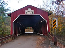 Wanich Covered Bridge No. 69 |
November 29, 1979 (#79003195) |
Off Pennsylvania Route 42, north of Fernville 41°02′23″N 76°29′01″W |
Hemlock and Mount Pleasant Townships | |
| 31 | Y Covered Bridge No. 156 | 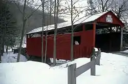 Y Covered Bridge No. 156 |
November 29, 1979 (#79003176) |
T-757, southeast of Central 41°17′23″N 76°21′52″W |
Sugarloaf Township | The bridge was destroyed in a suspicious fire on August 15, 1983.[12] |
Former listing
| [3] | Name on the Register | Image | Date listed | Date removed | Location | City or town | Summary |
|---|---|---|---|---|---|---|---|
| 1 | Welle Hess Covered Bridge No. S1 | 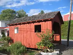 Welle Hess Covered Bridge No. S1 |
November 29, 1979 (#79003175) | June 27, 1986 | South of Grassmere Park |
Sugarloaf Township | The bridge collapsed on July 19, 1981,[13] and was removed from the NRHP in 1986. Photo is of a model constructed from original bridge materials. |
See also
| Wikimedia Commons has media related to National Register of Historic Places in Columbia County, Pennsylvania. |
References
- The latitude and longitude information provided in this table was derived originally from the National Register Information System, which has been found to be fairly accurate for about 99% of listings. Some locations in this table may have been corrected to current GPS standards.
- "National Register of Historic Places: Weekly List Actions". National Park Service, United States Department of the Interior. Retrieved on January 29, 2021.
- Numbers represent an alphabetical ordering by significant words. Various colorings, defined here, differentiate National Historic Landmarks and historic districts from other NRHP buildings, structures, sites or objects.
- The eight-digit number below each date is the number assigned to each location in the National Register Information System database, which can be viewed by clicking the number.
- "Fowlersville Bridge". Columbia County, Commonwealth of Pennsylvania. Retrieved December 12, 2012.
- "Kramer Bridge". Columbia County, Commonwealth of Pennsylvania. Retrieved December 11, 2012.
- "Reuben Reigel's, Columbia County". Covered Spans of Yesteryear - www.lostbridges.org. Retrieved December 11, 2012.
- "Rohrbach, Columbia County". Covered Spans of Yesteryear - www.lostbridges.org. Retrieved December 11, 2012.
- Robert Parks (November 2010). "Trials and Tribulations of a Historic Pair of Covered Bridges" (PDF). Columbia-Montour Visitors Bureau. Archived from the original (PDF) on February 22, 2014. Retrieved December 11, 2012.
- "Wagner (relocated), Columbia County". Covered Spans of Yesteryear - www.lostbridges.org. Retrieved December 11, 2012.
- "Covered bridges of Columbia and Montour Counties, Pennsylvania" (PDF). Columbia-Montour Visitors Bureau. November 2010. p. 6. Archived from the original (PDF) on June 2, 2012. Retrieved December 10, 2012.
- "Y, Columbia County". Covered Spans of Yesteryear - www.lostbridges.org. Retrieved December 11, 2012.
- "Welle Hess or Laubach, Columbia County". Covered Spans of Yesteryear - www.lostbridges.org. Retrieved December 11, 2012.
| Topics |  | |
|---|---|---|
| Lists by county |
| |
| Lists by city | ||
| Other lists | ||
| ||
Municipalities and communities of Columbia County, Pennsylvania, United States | ||
|---|---|---|
| Town | | |
| Boroughs | ||
| Townships | ||
| CDPs | ||
| Unincorporated communities | ||
| Ghost Towns | ||
| Footnotes | ‡This populated place also has portions in an adjacent county or counties | |
| ||
This article is issued from Wikipedia. The text is licensed under Creative Commons - Attribution - Sharealike. Additional terms may apply for the media files.