National Register of Historic Places listings in Mercer County, Pennsylvania
This is a list of the National Register of Historic Places listings in Mercer County, Pennsylvania.

Location of Mercer County in Pennsylvania
This is intended to be a complete list of the properties and districts on the National Register of Historic Places in Mercer County, Pennsylvania, United States. The locations of National Register properties and districts for which the latitude and longitude coordinates are included below, may be seen in a map.[1]
There are 15 properties and districts listed on the National Register in the county.
- This National Park Service list is complete through NPS recent listings posted January 29, 2021.[2]
Current listings
| [3] | Name on the Register | Image | Date listed[4] | Location | City or town | Description |
|---|---|---|---|---|---|---|
| 1 | Wendell August Forge | 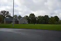 Wendell August Forge |
November 7, 1996 (#96001192) |
620 Madison Street 41°09′58″N 80°04′34″W |
Grove City | |
| 2 | Big Bend Historical Area | 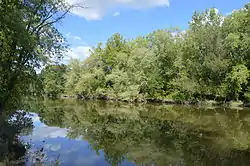 Big Bend Historical Area |
April 21, 1975 (#75001654) |
6 miles (9.7 km) northwest of Mercer on the Shenango River 41°17′05″N 80°19′14″W |
Jefferson Township | |
| 3 | Bridge in French Creek Township | 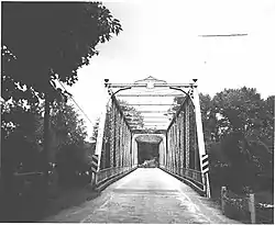 Bridge in French Creek Township |
June 22, 1988 (#88000862) |
Legislative Route 43074 over French Creek near Carlton 41°28′17″N 80°01′07″W |
French Creek Township | |
| 4 | Frank H. Buhl Mansion | 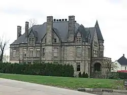 Frank H. Buhl Mansion |
December 2, 1977 (#77001175) |
422 East State Street 41°13′56″N 80°29′58″W |
Sharon | |
| 5 | First Universalist Church of Sharpsville |  First Universalist Church of Sharpsville |
May 29, 2003 (#03000491) |
131 North Mercer Avenue 41°16′00″N 80°28′32″W |
Sharpsville | |
| 6 | Gibson House | 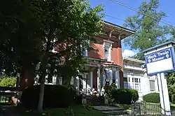 Gibson House |
December 1, 1978 (#78002430) |
210 Liberty Street 41°29′05″N 80°26′22″W |
Jamestown | |
| 7 | Greenville Commercial Historic District | .jpg.webp) Greenville Commercial Historic District |
August 10, 2000 (#00000964) |
Centered on Main, Canal, and Clinton Streets 41°24′26″N 80°23′20″W |
Greenville | |
| 8 | Johnston's Tavern | 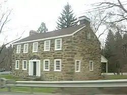 Johnston's Tavern |
March 24, 1972 (#72001136) |
6 miles (9.7 km) south of Mercer on U.S. Route 19 41°09′00″N 80°13′23″W |
Springfield Township | |
| 9 | Kidd's Mills Covered Bridge Historic District | 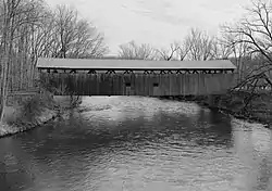 Kidd's Mills Covered Bridge Historic District |
December 2, 1974 (#74001793) |
5 miles (8.0 km) south of Greenville off Pennsylvania Route 58 41°21′15″N 80°23′48″W |
Pymatuning Township | |
| 10 | Christiana Lindsey House | 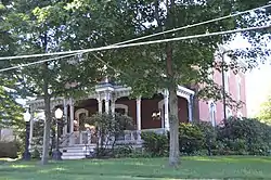 Christiana Lindsey House |
January 15, 1998 (#97001655) |
313 East Butler Street 41°13′32″N 80°14′07″W |
Mercer | |
| 11 | Mercer County Court House |  Mercer County Court House |
November 12, 1998 (#98001369) |
Roughly along Diamond, Erie and Pitt Streets 41°13′36″N 80°12′49″W |
Mercer | |
| 12 | New Hamburg Historical Area | 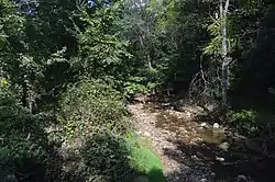 New Hamburg Historical Area |
December 2, 1974 (#74001794) |
7 miles south of Greenville off Pennsylvania Route 58 41°19′14″N 80°20′17″W |
Delaware Township | |
| 13 | Jonas J. Pierce House | 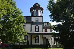 Jonas J. Pierce House |
October 24, 1996 (#96001206) |
18 East Shenango Street 41°15′57″N 80°28′28″W |
Sharpsville | |
| 14 | Quaker Bridge | 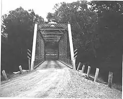 Quaker Bridge |
June 22, 1988 (#88000863) |
Legislative Route 43135 over the Little Shenango River near Greenville 41°25′33″N 80°22′22″W |
Hempfield Township | |
| 15 | Alexander P. and James S. Waugh House | 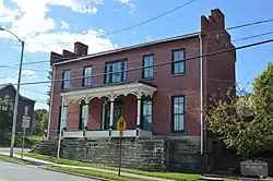 Alexander P. and James S. Waugh House |
April 23, 1998 (#98000402) |
23 West Main Street 41°24′12″N 80°23′38″W |
Greenville |
See also
| Wikimedia Commons has media related to National Register of Historic Places in Mercer County, Pennsylvania. |
References
- The latitude and longitude information provided in this table was derived originally from the National Register Information System, which has been found to be fairly accurate for about 99% of listings. Some locations in this table may have been corrected to current GPS standards.
- "National Register of Historic Places: Weekly List Actions". National Park Service, United States Department of the Interior. Retrieved on January 29, 2021.
- Numbers represent an alphabetical ordering by significant words. Various colorings, defined here, differentiate National Historic Landmarks and historic districts from other NRHP buildings, structures, sites or objects.
- The eight-digit number below each date is the number assigned to each location in the National Register Information System database, which can be viewed by clicking the number.
| Topics | 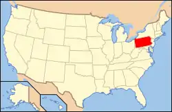 | |
|---|---|---|
| Lists by county |
| |
| Lists by city | ||
| Other lists | ||
| ||
Municipalities and communities of Mercer County, Pennsylvania, United States | ||
|---|---|---|
| Cities | | |
| Boroughs | ||
| Townships |
| |
| CDPs | ||
| Unincorporated communities | ||
| ||
This article is issued from Wikipedia. The text is licensed under Creative Commons - Attribution - Sharealike. Additional terms may apply for the media files.