National Register of Historic Places listings in Lancaster, Pennsylvania
This is a list of the National Register of Historic Places listings in Lancaster, Pennsylvania.
This is intended to be a complete list of the properties and districts on National Register of Historic Places in the city of Lancaster, Pennsylvania, United States. The locations of National Register properties and districts for which the latitude and longitude coordinates are included below, may be seen in a Google map.[1]
There are 207 properties and districts listed on the National Register in Lancaster County. The city of Lancaster is the location of 57 of these properties and districts; they are listed here, while the 151 properties and districts in the other parts of the county are listed separately. One property straddles the Lancaster city limits and appears on both lists. Another two sites are further designated as National Historic Landmarks. Yet another property was formerly listed but has been removed.
- This National Park Service list is complete through NPS recent listings posted January 29, 2021.[2]
Current listings
| [3] | Name on the Register | Image | Date listed[4] | Location | Neighborhood | Description |
|---|---|---|---|---|---|---|
| 1 | American/Consolidated Tobacco Companies | 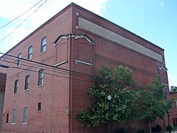 American/Consolidated Tobacco Companies |
September 21, 1990 (#90001398) |
820-830 North Prince Street 40°03′01″N 76°18′38″W |
Stadium District | |
| 2 | B.F. Good & Company Leaf Tobacco Warehouse |  B.F. Good & Company Leaf Tobacco Warehouse |
January 3, 1985 (#85000035) |
49-53 West James Street 40°02′45″N 76°18′32″W |
Stadium District | |
| 3 | Basch & Fisher Tobacco Warehouse | 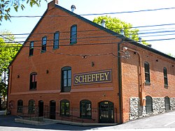 Basch & Fisher Tobacco Warehouse |
September 21, 1990 (#90001399) |
348 New Holland Avenue 40°02′40″N 76°17′56″W |
Musser Park | |
| 4 | Jacob Bowman Tobacco Warehouse | 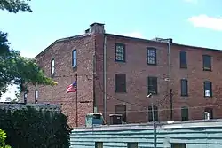 Jacob Bowman Tobacco Warehouse |
September 21, 1990 (#90001400) |
226-230 East Grant Street 40°02′22″N 76°18′03″W |
Musser Park | |
| 5 | John Brimmer Tobacco Warehouse | 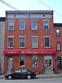 John Brimmer Tobacco Warehouse |
September 21, 1990 (#90001390) |
226 North Prince Street 40°02′30″N 76°17′31″W |
Chestnut Hill | |
| 6 | Central Market |  Central Market |
July 12, 1972 (#72001127) |
William Henry Place, Penn Square 40°02′18″N 76°18′23″W |
Central Business District | |
| 7 | Conestoga Cork Works Building | 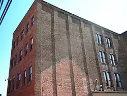 Conestoga Cork Works Building |
March 28, 1996 (#96000324) |
215-235 East Fulton Street 40°02′32″N 76°18′04″W |
Musser Park | |
| 8 | Eisenlohr-Bayuk Tobacco Historic District | 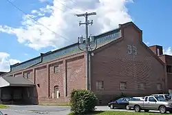 Eisenlohr-Bayuk Tobacco Historic District |
September 21, 1990 (#90001397) |
North Water Street, at West Liberty Street 40°03′04″N 76°18′43″W |
Stadium District | |
| 9 | Andrew Ellicott House | 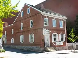 Andrew Ellicott House |
January 13, 1972 (#72001128) |
123 North Prince Street 40°02′24″N 76°18′29″W |
Central Business District | |
| 10 | Farmer's Southern Market | 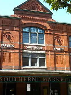 Farmer's Southern Market |
November 10, 1986 (#86003090) |
106 South Queen Street 40°02′10″N 76°18′20″W |
Central Business District | |
| 11 | Follmer, Clogg and Company Umbrella Factory | 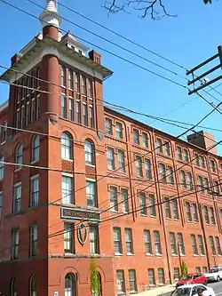 Follmer, Clogg and Company Umbrella Factory |
August 21, 1986 (#86001775) |
254-260 West King Street 40°02′14″N 76°18′37″W |
Stadium District | |
| 12 | Franklin and Marshall College Campus Historic District |  Franklin and Marshall College Campus Historic District |
November 21, 2003 (#03001190) |
College Avenue 40°02′46″N 76°19′12″W |
College Park | |
| 13 | Jacob L. Frey Tobacco Warehouse | 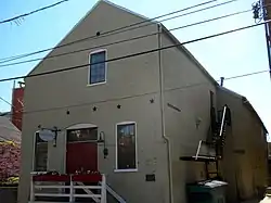 Jacob L. Frey Tobacco Warehouse |
September 21, 1990 (#90001396) |
210 West Grant Street 40°02′18″N 76°18′33″W |
Central Business District | |
| 14 | Henry B. Friedman Tobacco Warehouse | 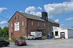 Henry B. Friedman Tobacco Warehouse |
September 21, 1990 (#90001392) |
309-311 Harrisburg Avenue, rear 40°02′53″N 76°18′42″W |
Stadium District | |
| 15 | Fulton Opera House | 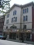 Fulton Opera House |
August 11, 1969 (#69000156) |
12-14 North Prince Street 40°02′17″N 76°18′29″W |
Central Business District | |
| 16 | Germania Turnverein Building | 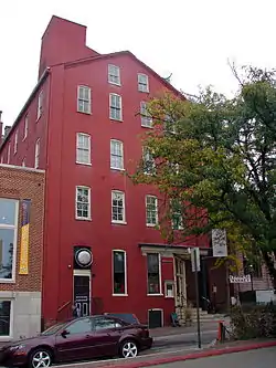 Germania Turnverein Building |
April 10, 1980 (#80003524) |
33-35 North Market Street 40°02′19″N 76°18′24″W |
Central Business District | |
| 17 | W.W. Griest Building |  W.W. Griest Building |
June 25, 1999 (#99000755) |
8 North Queen Street 40°02′18″N 76°18′21″W |
Central Business District | |
| 18 | Hager Building | 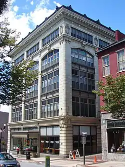 Hager Building |
October 16, 1979 (#79002255) |
25 West King Street 40°02′17″N 76°18′25″W |
Central Business District | |
| 19 | Hamilton Apartments | 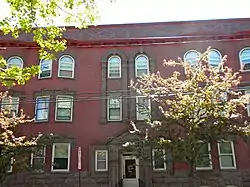 Hamilton Apartments |
June 28, 1984 (#84003430) |
247-249 North Duke Street and 104-118 East Walnut Street 40°02′34″N 76°18′15″W |
Musser Park | |
| 20 | Harrisburg Avenue Tobacco Historic District | 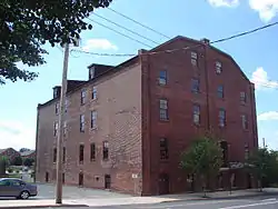 Harrisburg Avenue Tobacco Historic District |
September 21, 1990 (#90001393) |
Harrisburg Avenue at North Mulberry Street 40°02′49″N 76°18′45″W |
Stadium District | |
| 21 | A.B. Hess Cigar Factory, and Warehouses | 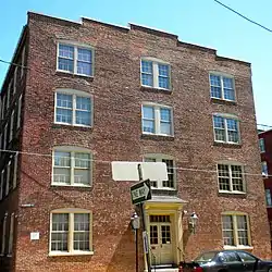 A.B. Hess Cigar Factory, and Warehouses |
August 24, 1982 (#82003792) |
231 North Shippen Street 40°02′35″N 76°18′00″W |
Musser Park | |
| 22 | Kirk Johnson Building | 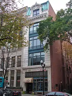 Kirk Johnson Building |
July 7, 1983 (#83002252) |
16-18 West King Street 40°02′16″N 76°18′23″W |
Central Business District | |
| 23 | Henry Krauskap House | 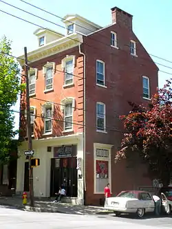 Henry Krauskap House |
October 7, 1982 (#82001539) |
301-303½ West King Street 40°02′15″N 76°18′38″W |
Chestnut Hill | |
| 24 | Lancaster Armory | 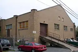 Lancaster Armory |
November 14, 1991 (#91001699) |
438 North Queen Street 40°02′43″N 76°18′26″W |
Ross | |
| 25 | Lancaster City Historic District |  Lancaster City Historic District |
September 7, 2001 (#01000956) |
Roughly bounded by Liberty Street, Broad Street, Greenwood Avenue, Race Avenue, 40°02′29″N 76°18′25″W |
All neighborhoods | Extends into Manheim Township, elsewhere in Lancaster County |
| 26 | Lancaster County Courthouse |  Lancaster County Courthouse |
November 7, 1978 (#78002415) |
43 East King Street 40°02′19″N 76°18′14″W |
Central Business District | |
| 27 | Lancaster Crematorium |  Lancaster Crematorium |
April 14, 1983 (#83002253) |
Greenwood Cemetery, 719 Highland Avenue 40°01′37″N 76°18′02″W |
Conestoga Heights | |
| 28 | Lancaster Historic District |  Lancaster Historic District |
November 15, 1979 (#79002256) |
Roughly bounded by Howard Avenue, Queen, Church, Duke, Chestnut and Plum Streets; also bounded by East Vine, South Christian, Washington, South Duke, and Church Streets; also King Street 40°02′10″N 76°18′10″W |
Central Business District, Churchtowne, Musser Park and Mussertown | Second and third sets of boundaries represent boundary increases of November 10, 1983 and June 21, 1984 respectively |
| 29 | Lancaster Trust Company | 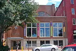 Lancaster Trust Company |
November 3, 1983 (#83004221) |
37-41 North Market Street 40°02′20″N 76°18′25″W |
Central Business District | |
| 30 | Lancaster Watch Company | 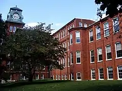 Lancaster Watch Company |
August 24, 1982 (#82003793) |
901 Columbia Avenue 40°02′21″N 76°19′29″W |
College Park | |
| 31 | B.B. Martin Tobacco Warehouse | 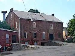 B.B. Martin Tobacco Warehouse |
September 21, 1990 (#90001394) |
422-428 North Water Street 40°02′42″N 76°18′39″W |
Stadium District | |
| 32 | Edward McGovern Tobacco Warehouse |  Edward McGovern Tobacco Warehouse |
September 21, 1990 (#90001395) |
302-304 North Plum Street 40°02′36″N 76°17′55″W |
Musser Park | |
| 33 | David H. Miller Tobacco Warehouse | 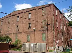 David H. Miller Tobacco Warehouse |
September 21, 1990 (#90001407) |
512 North Market Street 40°02′49″N 76°18′29″W |
Stadium District | |
| 34 | J.B. Milleysack Cigar Factory | 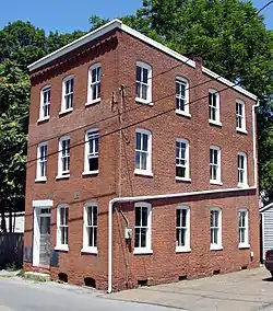 J.B. Milleysack Cigar Factory |
September 21, 1990 (#90001401) |
820 Columbia Avenue, rear 40°02′15″N 76°19′22″W |
West End | |
| 35 | William Montgomery House | 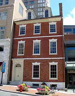 William Montgomery House |
May 18, 2000 (#00000519) |
19-21 South Queen Street 40°02′14″N 76°18′19″W |
Central Business District | |
| 36 | North Shippen-Tobacco Avenue Historic District | 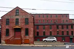 North Shippen-Tobacco Avenue Historic District |
September 21, 1990 (#90001402) |
Roughly bounded by North Shippen Street, Tobacco Avenue, and East Fulton Street 40°02′34″N 76°17′57″W |
Musser Park | |
| 37 | New Era Building | 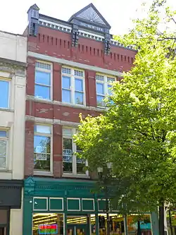 New Era Building |
July 14, 1983 (#83002256) |
39-41 North Queen Street 40°02′18″N 76°18′21″W |
Central Business District | |
| 38 | Nissly-Stauffer Tobacco Warehouses | 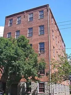 Nissly-Stauffer Tobacco Warehouses |
August 7, 1989 (#89001051) |
322-324 North Arch Street and 317-319 North Mulberry Street 40°02′35″N 76°18′39″W |
Chestnut Hill | |
| 39 | North Charlotte Street Historic District | 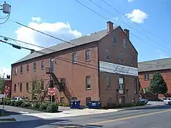 North Charlotte Street Historic District |
August 31, 1989 (#89001206) |
Roughly North Charlotte Street from Harrisburg Pike to West James Street 40°02′47″N 76°18′52″W |
Stadium District | |
| 40 | North Prince Street Historic District | 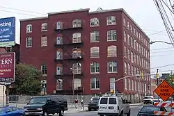 North Prince Street Historic District |
August 18, 1989 (#89001054) |
Roughly North Prince Street and West Lemon Street 40°02′39″N 76°18′31″W |
Central Business and Stadium Districts | |
| 41 | Old City Hall | 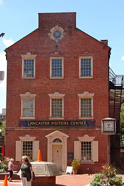 Old City Hall |
June 30, 1972 (#72001129) |
Penn Square 40°02′17″N 76°18′23″W |
Central Business District | |
| 42 | Old Main, Goethean Hall, and Diagnothian Hall | 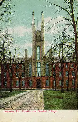 Old Main, Goethean Hall, and Diagnothian Hall |
July 30, 1975 (#75001645) |
Franklin and Marshall College campus 40°02′43″N 76°19′12″W |
College Park | |
| 43 | Reilly Brothers and Raub Building | 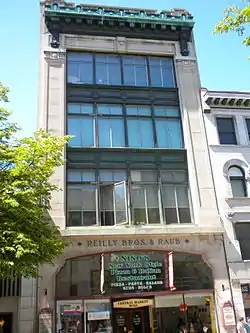 Reilly Brothers and Raub Building |
November 3, 1983 (#83004222) |
44-46 North Queen Street and 45 North Market Street 40°02′20″N 76°18′21″W |
Central Business District | |
| 44 | R.K. Schnader & Sons Tobacco Warehouse | 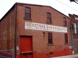 R.K. Schnader & Sons Tobacco Warehouse |
September 21, 1990 (#90001404) |
437-439 West Grant Street 40°02′16″N 76°18′54″W |
Chestnut Hill | |
| 45 | Walter Schnader Tobacco Warehouse | 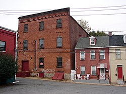 Walter Schnader Tobacco Warehouse |
September 21, 1990 (#90001391) |
417-419 West Grant Street 40°02′17″N 76°18′50″W |
Chestnut Hill | |
| 46 | L.G. Sherman Tobacco Warehouse | 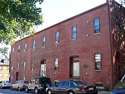 L.G. Sherman Tobacco Warehouse |
September 21, 1990 (#90001405) |
602 East Marion Street 40°02′29″N 76°17′36″W |
East Side | |
| 47 | Slater Cigar Company | 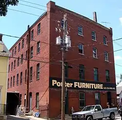 Slater Cigar Company |
September 21, 1990 (#90001403) |
625 and 626-628 Columbia Avenue 40°02′16″N 76°19′04″W |
Chestnut Hill and West End | |
| 48 | Soldiers and Sailors Monument | 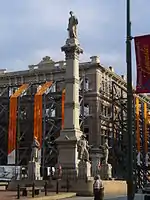 Soldiers and Sailors Monument |
April 2, 1973 (#73001635) |
Penn Square 40°02′16″N 76°18′21″W |
Central Business District | |
| 49 | Sprenger Brewery | 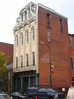 Sprenger Brewery |
November 27, 1979 (#79002257) |
125-131 East King Street 40°02′18″N 76°18′10″W |
Central Business District | |
| 50 | Steinman Hardware Store | 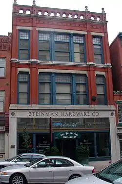 Steinman Hardware Store |
October 18, 1979 (#79002258) |
26-28 West King Street 40°02′13″N 76°18′21″W |
Central Business District | |
| 51 | Stevens High School | 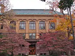 Stevens High School |
June 30, 1983 (#83002257) |
West Chestnut and Charlotte Streets 40°02′27″N 76°18′46″W |
Chestut Hill | |
| 52 | Teller Brothers-Reed Tobacco Historic District | 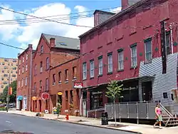 Teller Brothers-Reed Tobacco Historic District |
September 21, 1990 (#90001406) |
North Prince Street, 200 block, east side 40°02′30″N 76°18′30″W |
Central Business District | |
| 53 | U.S. Post Office | 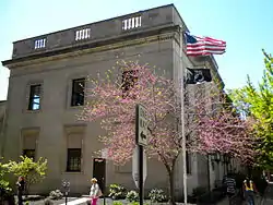 U.S. Post Office |
July 23, 1981 (#81000545) |
50 West Chestnut Street 40°02′26″N 76°18′28″W |
Central Business District | |
| 54 | Charlie Wagner's Cafe | 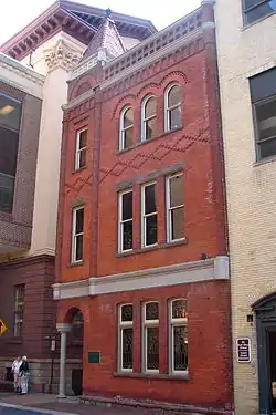 Charlie Wagner's Cafe |
December 29, 1983 (#83004223) |
40 East Grant Street 40°02′20″N 76°18′21″W |
Central Business District | |
| 55 | West Lawn | 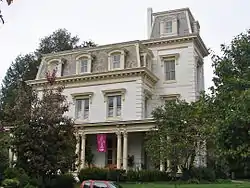 West Lawn |
May 3, 1984 (#84003453) |
407 West Chestnut Street 40°02′26″N 76°18′49″W |
Chestnut Hill | |
| 56 | Woodward Hill Cemetery | 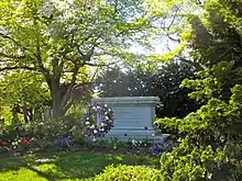 Woodward Hill Cemetery |
February 24, 2005 (#05000098) |
Bounded by Strawberry Street, South Queen Street, and Chesapeake Street 40°01′45″N 76°18′07″W |
Churchtowne | |
| 57 | Jasper Yeates House |  Jasper Yeates House |
September 23, 1982 (#82003794) |
24 South Queen Street 40°02′14″N 76°18′21″W |
Central Business District |
Former listing
| [3] | Name on the Register | Image | Date listed | Date removed | Location | City or town | Summary |
|---|---|---|---|---|---|---|---|
| 1 | Watt and Shand Department Store |  Watt and Shand Department Store |
March 12, 1999 (#99000322) | October 11, 2007 | 2-12 E. King St., 23-27 Penn Sq., 1-21 S. Queen St., 18-24 S. Christian St. |
Central Business District |
| Wikimedia Commons has media related to National Register of Historic Places in Lancaster, Pennsylvania. |
References
- The latitude and longitude information provided in this table was derived originally from the National Register Information System, which has been found to be fairly accurate for about 99% of listings. Some locations in this table may have been corrected to current GPS standards.
- "National Register of Historic Places: Weekly List Actions". National Park Service, United States Department of the Interior. Retrieved on January 29, 2021.
- Numbers represent an alphabetical ordering by significant words. Various colorings, defined here, differentiate National Historic Landmarks and historic districts from other NRHP buildings, structures, sites or objects.
- The eight-digit number below each date is the number assigned to each location in the National Register Information System database, which can be viewed by clicking the number.
| Topics |  | |
|---|---|---|
| Lists by county |
| |
| Lists by city | ||
| Other lists | ||
| ||