National Register of Historic Places listings in Delaware County, Pennsylvania
This is a list of the National Register of Historic Places listings in Delaware County, Pennsylvania.
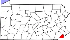
Location of Delaware County in Pennsylvania
This is intended to be a complete list of the properties and districts on the National Register of Historic Places in Delaware County, Pennsylvania, United States. The locations of National Register properties and districts for which the latitude and longitude coordinates are included below, may be seen in a map.[1]
There are 95 properties and districts listed on the National Register in the county. Seven sites are further designated as National Historic Landmarks. Another property was once listed but has been removed.
- This National Park Service list is complete through NPS recent listings posted January 29, 2021.[2]
Current listings
| [3] | Name on the Register | Image | Date listed[4] | Location | Municipality | Description |
|---|---|---|---|---|---|---|
| 1 | 1724 Chester Courthouse |  1724 Chester Courthouse |
May 27, 1971 (#71000702) |
Market Street below 5th Street 39°50′52″N 75°21′36″W |
Chester | |
| 2 | Henry Albertson Subdivision Historic District | 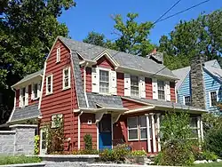 Henry Albertson Subdivision Historic District |
January 30, 1998 (#98000044) |
Roughly bounded by North Lansdowne, Clover, Wycombe, Price, and Stewart Avenues, and Balfour Cir. 39°56′34″N 75°16′21″W |
Lansdowne | |
| 3 | Allgates | 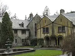 Allgates |
May 15, 1979 (#79002222) |
Coopertown Road 39°59′54″N 75°19′36″W |
Haverford Township | Wilson Eyre, architect (1910, expanded 1917). |
| 4 | Bartram's Covered Bridge | 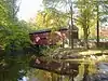 Bartram's Covered Bridge |
December 10, 1980 (#80003462) |
West of Newtown on Legislative Route 15098 39°59′23″N 75°26′15″W |
Newtown Township | Extends into Willistown Township in Chester County |
| 5 | Booth Farm | 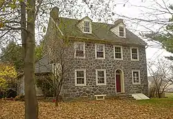 Booth Farm |
June 13, 2003 (#03000527) |
3221 Foulk Road 39°51′15″N 75°29′24″W |
Bethel Township | |
| 6 | Brandywine Battlefield | 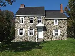 Brandywine Battlefield |
October 15, 1966 (#66000660) |
Brandywine Battlefield Park 39°53′17″N 75°35′37″W |
Chadds Ford Township | |
| 7 | Brandywine Summit Camp Meeting | 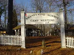 Brandywine Summit Camp Meeting |
February 24, 1995 (#95000132) |
119 Beaver Valley Road, Chadds Ford 39°51′04″N 75°32′50″W |
Concord Township | |
| 8 | Bridge in Radnor Township No. 1 |  Bridge in Radnor Township No. 1 |
June 22, 1988 (#88000791) |
Goshen Road over Darby Creek 40°00′13″N 75°22′19″W |
Radnor Township | |
| 9 | Bridge in Radnor Township No. 2 | 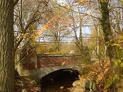 Bridge in Radnor Township No. 2 |
June 22, 1988 (#88000784) |
Bryn Mawr Avenue over Meadow Brook Creek 40°00′41″N 75°20′39″W |
Radnor Township | |
| 10 | Camp-Woods | 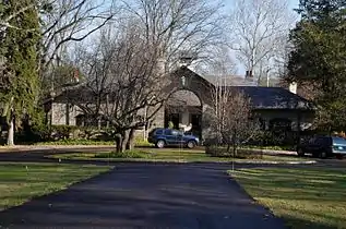 Camp-Woods |
September 1, 1983 (#83002239) |
745 Newtown Road 40°01′15″N 75°22′30″W |
Radnor Township | |
| 11 | Chad House | 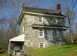 Chad House |
March 11, 1971 (#71000698) |
Pennsylvania Route 100 39°52′29″N 75°35′31″W |
Chadds Ford Township | |
| 12 | Chadds Ford Historic District | 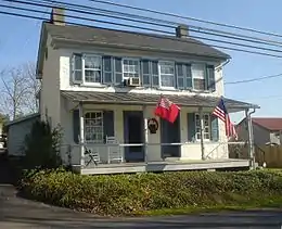 Chadds Ford Historic District |
November 23, 1971 (#71000699) |
Junction of U.S. Route 1 and Pennsylvania Route 100 39°52′17″N 75°35′31″W |
Chadds Ford Township | |
| 13 | Chamberlain-Pennell House | 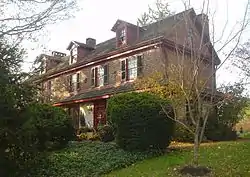 Chamberlain-Pennell House |
December 27, 1977 (#77001165) |
West of Media off U.S. Route 1 at Valley Brook Road 39°53′52″N 75°28′47″W |
Chester Heights | |
| 14 | Chanticleer | 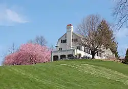 Chanticleer |
July 24, 1984 (#84003350) |
786 Church Road[5] 40°01′50″N 75°23′12″W |
Radnor Township | |
| 15 | Chester Creek Historic District |  Chester Creek Historic District |
March 24, 1972 (#72001120) |
North, east, and south of Glen Mills along the western branch of Chester Creek 39°55′23″N 75°29′27″W |
Thornbury Township | |
| 16 | Chester Heights Camp Meeting Historic District | 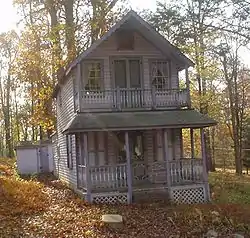 Chester Heights Camp Meeting Historic District |
May 8, 2001 (#01000460) |
320 Valley Brook Road 39°53′24″N 75°28′03″W |
Chester Heights | |
| 17 | Chester Waterside Station of the Philadelphia Electric Company |  Chester Waterside Station of the Philadelphia Electric Company |
May 24, 2007 (#07000467) |
2501 Seaport Dr. 39°49′45″N 75°23′02″W |
Chester | |
| 18 | John Cheyney Log Tenant House and Farm | 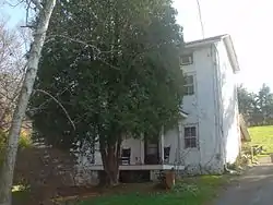 John Cheyney Log Tenant House and Farm |
November 21, 1978 (#78002390) |
Station Road 39°55′50″N 75°30′52″W |
Thornbury Township | |
| 19 | Chichester Friends Meetinghouse | 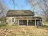 Chichester Friends Meetinghouse |
March 14, 1973 (#73001622) |
611 Meetinghouse Road 39°50′11″N 75°25′53″W |
Upper Chichester Township | |
| 20 | Collen Brook Farm | 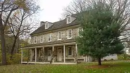 Collen Brook Farm |
December 22, 1988 (#88003048) |
Off Mansion and Marvine Roads 39°57′05″N 75°19′16″W |
Upper Darby Township | |
| 21 | Concord Friends Meetinghouse | 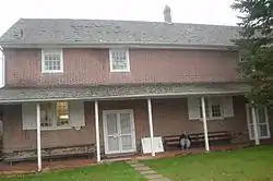 Concord Friends Meetinghouse |
June 17, 1977 (#77001164) |
Old Concord Road 39°53′07″N 75°31′13″W |
Concord Township | |
| 22 | Concordville Historic District | 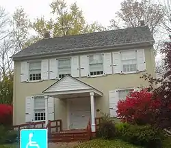 Concordville Historic District |
April 3, 1973 (#73001624) |
Concord Road and Baltimore Pike 39°53′09″N 75°31′15″W |
Concord Township | |
| 23 | Crosley-Garrett Mill Workers' Housing, Store and Mill Site |  Crosley-Garrett Mill Workers' Housing, Store and Mill Site |
February 27, 2003 (#03000074) |
Paper Mill Road and St. David's Road 40°01′09″N 75°24′16″W |
Newtown Township | |
| 24 | George K. Crozer Mansion | George K. Crozer Mansion |
August 14, 1973 (#73001625) |
6th Street 39°51′19″N 75°23′16″W |
Upland | Destroyed by fire in June 1990, and subsequently demolished. |
| 25 | John P. Crozer II Mansion |  John P. Crozer II Mansion |
July 23, 1980 (#80003486) |
900, 922, 924 and 926 Main Street 39°51′31″N 75°23′00″W |
Upland | |
| 26 | Darby Meeting |  Darby Meeting |
September 13, 1978 (#78002392) |
1017 Main Street 39°55′15″N 75°15′48″W |
Darby | |
| 27 | Delaware County National Bank |  Delaware County National Bank |
November 5, 1987 (#87001947) |
1 West Third Street 39°50′49″N 75°21′34″W |
Chester | |
| 28 | Downtown Wayne Historic District | 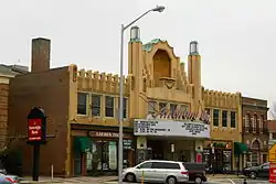 Downtown Wayne Historic District |
September 5, 2012 (#12000607) |
Roughly bounded by Louella Ct., West Ave., and S. Wayne Ave., at Wayne 40°02′41″N 75°23′07″W |
Radnor Township | |
| 29 | Eden Cemetery |  Eden Cemetery |
December 13, 2010 (#10001031) |
1434 Springfield Rd. 39°55′20″N 75°16′24″W |
Collingdale | |
| 30 | Federal School |  Federal School |
November 5, 1971 (#71000704) |
Haverford-Darby Road 39°59′48″N 75°19′34″W |
Haverford Township | |
| 31 | Forge Hill |  Forge Hill |
March 7, 1973 (#73001627) |
Off U.S. Route 1 39°54′02″N 75°27′48″W |
Chester Heights | |
| 32 | Gilpin Homestead |  Gilpin Homestead |
May 27, 1971 (#71000700) |
Harvey Road 39°53′02″N 75°33′50″W |
Chadds Ford Township | |
| 33 | Glenays |  Glenays |
December 27, 1977 (#77001163) |
926 Coopertown Road 40°00′41″N 75°19′49″W |
Radnor Township | |
| 34 | The Grange |  The Grange |
January 11, 1976 (#76001636) |
Grove Pl. 39°58′33″N 75°17′05″W |
Haverford Township | |
| 35 | Handwrought |  Handwrought |
January 18, 1978 (#78002391) |
Concord and Station Road 39°52′52″N 75°30′52″W |
Concord Township | |
| 36 | High Hill Farm |  High Hill Farm |
August 21, 1986 (#86001784) |
180 Thornton Road 39°53′48″N 75°31′30″W |
Concord Township | |
| 37 | Hood Octagonal School |  Hood Octagonal School |
February 14, 2006 (#06000045) |
3500 West Chester Pike, Newtown Square 39°59′10″N 75°23′22″W |
Newtown Township | On grounds of Dunwoody Village |
| 38 | Idlewild |  Idlewild |
May 8, 2013 (#13000255) |
110 Idlewild Circle 39°54′44″N 75°23′18″W |
Upper Providence Township | Summer cottage owned and designed by Frank Furness |
| 39 | Ivy Mills Historic District | 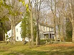 Ivy Mills Historic District |
August 21, 1972 (#72001117) |
Corner of Ivy Mills and Pole Cat Roads 39°53′10″N 75°29′14″W |
Concord Township | |
| 40 | Lansdowne Park Historic District | 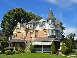 Lansdowne Park Historic District |
November 5, 1987 (#87001986) |
West Greenwood, Owen, West Baltimore, Windermere, and West Stratford Avenues 39°56′22″N 75°16′33″W |
Lansdowne | |
| 41 | Lansdowne Theatre | 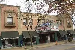 Lansdowne Theatre |
January 6, 1987 (#86003575) |
29 North Lansdowne Avenue 39°56′20″N 75°16′20″W |
Lansdowne | |
| 42 | The Lazaretto | The Lazaretto |
March 16, 1972 (#72001119) |
Wanamaker Avenue and 2nd Street 39°51′38″N 75°18′02″W |
Tinicum Township | |
| 43 | Thomas Leiper Estate | 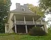 Thomas Leiper Estate |
December 29, 1970 (#70000547) |
Avondale Road 39°53′12″N 75°21′30″W |
Nether Providence Township | |
| 44 | Llanerch Public School | 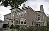 Llanerch Public School |
April 10, 2017 (#100000855) |
5 Llandillo Rd. 39°58′20″N 75°17′59″W |
Haverford Township | |
| 45 | Lower Swedish Cabin | 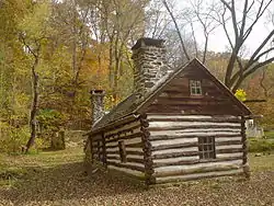 Lower Swedish Cabin |
June 9, 1980 (#80003484) |
Creek Road 39°56′05″N 75°17′43″W |
Upper Darby Township | |
| 46 | Marcus Hook Plank House | 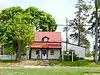 Marcus Hook Plank House |
April 10, 2017 (#100000856) |
221 Market St. 39°48′49″N 75°24′45″W |
Marcus Hook | |
| 47 | Thomas Massey House | 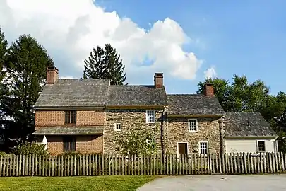 Thomas Massey House |
November 16, 1970 (#70000904) |
Lawrence and Springhouse Roads 39°57′57″N 75°21′07″W |
Marple Township | |
| 48 | Media Armory | 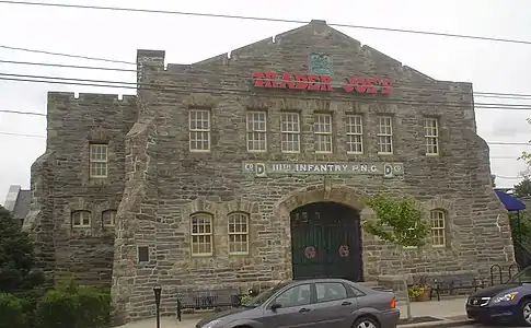 Media Armory |
December 22, 1989 (#89002077) |
12 East State Street 39°55′06″N 75°23′20″W |
Media | Will Price, architect. |
| 49 | Melrose | 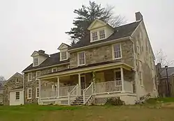 Melrose |
September 4, 1986 (#86001780) |
Hill Dr. 39°55′56″N 75°31′38″W |
Thornbury Township | |
| 50 | Merion Golf Club, East and West Courses | 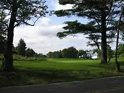 Merion Golf Club, East and West Courses |
December 21, 1989 (#89002085) |
Ardmore Avenue 39°59′36″N 75°19′35″W |
Haverford Township | |
| 51 | Morton Homestead |  Morton Homestead |
December 2, 1970 (#70000546) |
100 Lincoln Avenue 39°52′37″N 75°18′21″W |
Prospect Park | |
| 52 | Morton Morton House | 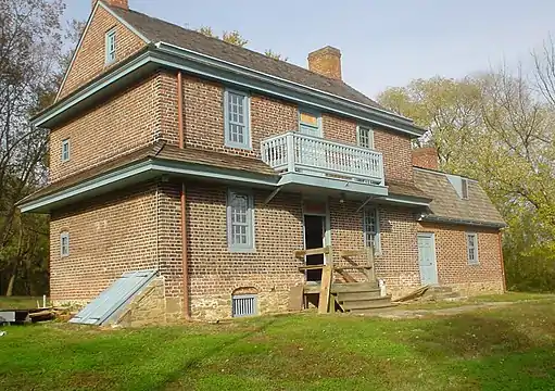 Morton Morton House |
February 4, 2000 (#00000055) |
Junction of Muckinipates and Darby Creeks 39°52′50″N 75°17′27″W |
Norwood | |
| 53 | Newlin Mill Complex |  Newlin Mill Complex |
March 9, 1983 (#83002240) |
South Cheyney Road 39°53′25″N 75°30′22″W |
Concord Township | |
| 54 | Nicholas Newlin House |  Nicholas Newlin House |
April 26, 1972 (#72001118) |
Concord Road 39°53′10″N 75°31′19″W |
Concord Township | |
| 55 | Nitre Hall |  Nitre Hall |
December 18, 1970 (#70000545) |
Karakung Dr. 39°59′01″N 75°17′09″W |
Haverford Township | |
| 56 | North Wayne Historic District |  North Wayne Historic District |
July 25, 1985 (#85001619) |
Roughly bounded by Eagle Road, Woodland Ct., Radnor Street, Poplar, and North Wayne Avenue 40°02′59″N 75°23′12″W |
Radnor Township | |
| 57 | Ogden House |  Ogden House |
November 20, 1979 (#79002223) |
530 Cedar Lane 39°54′41″N 75°21′04″W |
Swarthmore | |
| 58 | Old Main |  Old Main |
June 18, 1973 (#73001626) |
21st Street and Upland Avenue 39°51′21″N 75°22′17″W |
Upland | |
| 59 | Old Main and Chemistry Building |  Old Main and Chemistry Building |
May 22, 1978 (#78002389) |
14th Street between Melrose Avenue and Walnut Street 39°51′42″N 75°21′19″W |
Chester | |
| 60 | Old Rose Tree Tavern |  Old Rose Tree Tavern |
June 21, 1971 (#71000705) |
Northeast of the junction of Rose Tree and Providence Roads 39°56′17″N 75°23′34″W |
Upper Providence Township | Inside Rose Tree Park |
| 61 | William Painter Farm |  William Painter Farm |
July 27, 1971 (#71000701) |
2 miles (3.2 km) northeast of Chadds Ford on U.S. Route 1 39°52′42″N 75°33′10″W |
Chadds Ford Township | |
| 62 | William Penn Landing Site | 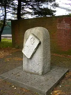 William Penn Landing Site |
March 11, 1971 (#71000703) |
Penn and Front Streets 39°50′36″N 75°21′41″W |
Chester | |
| 63 | Pennsylvania Railroad Station at Wayne | Pennsylvania Railroad Station at Wayne |
May 7, 1999 (#99000674) |
Junction of North Wayne Avenue and Station Road 40°02′44″N 75°23′16″W |
Radnor Township | |
| 64 | Pont Reading | 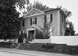 Pont Reading |
October 26, 1972 (#72001116) |
2713 Haverford Road 39°59′47″N 75°18′10″W |
Haverford Township | |
| 65 | The Printzhof |  The Printzhof |
October 15, 1966 (#66000661) |
Taylor Avenue and 2nd Street 39°51′40″N 75°18′11″W |
Tinicum Township | |
| 66 | Caleb Pusey House | 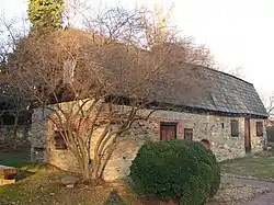 Caleb Pusey House |
March 11, 1971 (#71000706) |
15 Race Street 39°51′04″N 75°23′13″W |
Upland | |
| 67 | Pusey-Crozier Mill Historic District | 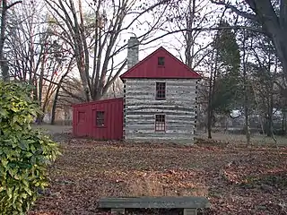 Pusey-Crozier Mill Historic District |
September 27, 1976 (#76001638) |
Race Street 39°51′05″N 75°23′12″W |
Upland | |
| 68 | Radnor Friends Meetinghouse | 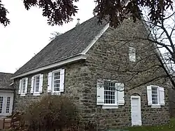 Radnor Friends Meetinghouse |
August 31, 1978 (#78002393) |
Sproul and Conestoga Roads 40°01′48″N 75°21′53″W |
Radnor Township | |
| 69 | Ridley Creek State Park | 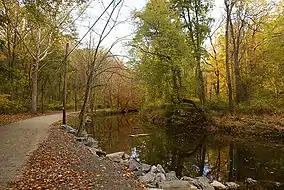 Ridley Creek State Park |
October 8, 1976 (#76001637) |
Northwest of Media between Pennsylvania Routes 3 and 352 39°57′13″N 75°26′41″W |
Edgmont, Middletown, and Upper Providence Townships | |
| 70 | Dr. Samuel D. Risley House |  Dr. Samuel D. Risley House |
April 26, 1990 (#90000697) |
430 North Monroe Street 39°55′19″N 75°23′14″W |
Media | |
| 71 | Rose Valley Historic District |  Rose Valley Historic District |
July 19, 2010 (#10000470) |
Roughly bounded by Ridley Creek, Woodward Rd., Providence and Brookhaven Rds. and Todmorden Ln. within Rose Valley Borough 39°53′46″N 75°23′06″W |
Rose Valley | |
| 72 | St. David's Church and Graveyard | _2009.jpg.webp) St. David's Church and Graveyard |
September 20, 1978 (#78002394) |
7 miles (11 km) north of Media 40°01′37″N 75°24′16″W |
Newtown Township | |
| 73 | St. Joseph's Parish Complex | 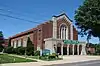 St. Joseph's Parish Complex |
May 29, 2018 (#100002522) |
500 Woodlawn Ave 39°54′48″N 75°17′00″W |
Collingdale | |
| 74 | Saturday Club | 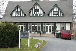 Saturday Club |
March 14, 1978 (#78002395) |
117 West Wayne Avenue 40°02′36″N 75°23′21″W |
Radnor Township | |
| 75 | Second Street Bridge |  Second Street Bridge |
June 22, 1988 (#88000752) |
Pennsylvania Route 291/Second Street over Chester Creek 39°50′41″N 75°21′39″W |
Chester | Destroyed[6] |
| 76 | Sellers Hall | 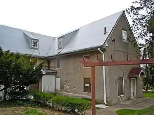 Sellers Hall |
April 18, 2018 (#100002339) |
NW corner of Hampden Rd. & Walnut St. 39°57′25″N 75°15′40″W |
Upper Darby Township | |
| 77 | Seventeen-hundred-and-four House | 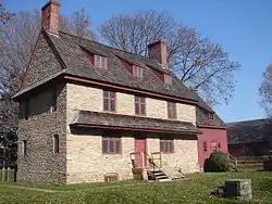 Seventeen-hundred-and-four House |
December 24, 1967 (#67000018) |
Oakland Road, near junction of U.S. Route 202 and County Road 15199 39°53′47″N 75°33′40″W |
Chadds Ford Township | |
| 78 | South Wayne Historic District |  South Wayne Historic District |
April 18, 1991 (#91000477) |
Roughly bounded by Lancaster Avenue, Conestoga Road and Iven Avenue, Radnor Township 40°02′22″N 75°22′59″W |
Radnor Township | |
| 79 | Square Tavern | 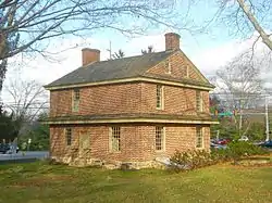 Square Tavern |
September 7, 1984 (#84003353) |
Newtown Street Road and Goshen Road 39°59′46″N 75°24′30″W |
Newtown Township | |
| 80 | Stonehaven | 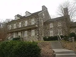 Stonehaven |
October 24, 1996 (#96001197) |
484 Lenni Road, junction with New Road 39°53′35″N 75°27′09″W |
Chester Heights | |
| 81 | Third Presbyterian Church |  Third Presbyterian Church |
November 26, 2019 (#100004702) |
420 E. 9th St. 39°51′16″N 75°21′22″W |
Chester | |
| 82 | Thompson Cottage |  Thompson Cottage |
April 13, 1977 (#77001166) |
Southeast of West Chester on Thornton Road 39°53′38″N 75°31′24″W |
Concord Township | |
| 83 | Thornton Village Historic District |  Thornton Village Historic District |
November 14, 2006 (#06000745) |
Centered on Thornton and Glen Mills Roads 39°54′36″N 75°31′54″W |
Thornbury Township | |
| 84 | Thunderbird Lodge |  Thunderbird Lodge |
August 18, 1989 (#89001053) |
45 Rose Valley Road 39°53′55″N 75°23′17″W |
Rose Valley | Will Price, architect. |
| 85 | Twaddell's Mill and House |  Twaddell's Mill and House |
March 7, 1973 (#73001623) |
Rock Hill Road south of Chadds Ford 39°50′39″N 75°34′43″W |
Chadds Ford Township | |
| 86 | Twentieth Century Club of Lansdowne |  Twentieth Century Club of Lansdowne |
July 23, 1980 (#80003485) |
84 South Lansdowne Avenue 39°56′08″N 75°16′24″W |
Lansdowne | |
| 87 | Twin Bridges Rural Historic District |  Twin Bridges Rural Historic District |
September 18, 2017 (#100001635) |
Roughly bounded by Creek and Bullock Rds., the Beverly Farm, Big Bend, and Hill Girt Farms estates, and Brandywine Creek 39°51′05″N 75°35′12″W |
Chadds Ford Township | Extends into Pennsbury Township in Chester County |
| 88 | John J. Tyler Arboretum |  John J. Tyler Arboretum |
February 27, 2003 (#03000080) |
515 Painter Road 39°56′05″N 75°25′52″W |
Middletown Township | |
| 89 | Wayne Hotel | 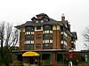 Wayne Hotel |
November 5, 1987 (#87001966) |
139 East Lancaster Avenue 40°02′38″N 75°23′12″W |
Radnor Township | |
| 90 | Benjamin West Birthplace | 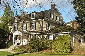 Benjamin West Birthplace |
October 15, 1966 (#66000662) |
Swarthmore College campus 39°54′18″N 75°21′06″W |
Swarthmore | |
| 91 | Westlawn | 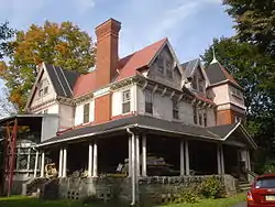 Westlawn |
November 18, 1988 (#88002188) |
123 North Providence Road 39°54′23″N 75°22′37″W |
Nether Providence Township | |
| 92 | Wolley Stille | 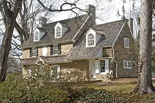 Wolley Stille |
June 27, 1980 (#80003487) |
Harvey Road 39°52′28″N 75°21′58″W |
Nether Providence Township | |
| 93 | Woodcrest |  Woodcrest |
December 30, 2008 (#08001265) |
610 King of Prussia Road, Cabrini College campus 40°03′16″N 75°22′30″W |
Radnor Township | |
| 94 | Andrew Wyeth Studio and Kuerner Farm |  Andrew Wyeth Studio and Kuerner Farm |
July 11, 2011 (#11000564) |
14 Ring Road; also 415 Ring Road and 1821 Murphy Road 39°52′09″N 75°34′32″W |
Chadds Ford Township | The Kuerner Farm was the inspiration for more than 1,000 Wyeth paintings over a 64-year period. Second set of addresses represents a boundary increase of August 25, 2014 |
| 95 | N. C. Wyeth House and Studio |  N. C. Wyeth House and Studio |
December 9, 1997 (#97001680) |
Murphy Road 39°51′59″N 75°35′09″W |
Chadds Ford Township | Home and studio of painter N.C. Wyeth and family. Managed by the Brandywine River Museum |
Former listing
| [3] | Name on the Register | Image | Date listed | Date removed | Location | City or town | Summary |
|---|---|---|---|---|---|---|---|
| 1 | Bridge in Ridley Park Borough | May 10, 1988 (#88000819) | March 1, 1993 | W. Ridley Ave. over Little Crum Creek 39°52′32″N 75°19′49″W |
Ridley Park |
See also
| Wikimedia Commons has media related to National Register of Historic Places in Delaware County, Pennsylvania. |
References
- The latitude and longitude information provided in this table was derived originally from the National Register Information System, which has been found to be fairly accurate for about 99% of listings. Some locations in this table may have been corrected to current GPS standards.
- "National Register of Historic Places: Weekly List Actions". National Park Service, United States Department of the Interior. Retrieved on January 29, 2021.
- Numbers represent an alphabetical ordering by significant words. Various colorings, defined here, differentiate National Historic Landmarks and historic districts from other NRHP buildings, structures, sites or objects.
- The eight-digit number below each date is the number assigned to each location in the National Register Information System database, which can be viewed by clicking the number.
- Location is derived from the Chanticleer website; the NRIS lists the property as "Address Restricted"
- View provided by File:MouthChesterCreek.JPG
| Topics | 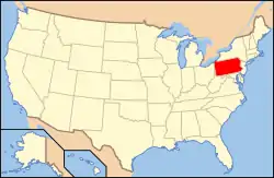 | |
|---|---|---|
| Lists by county |
| |
| Lists by city | ||
| Other lists | ||
| ||
Municipalities and communities of Delaware County, Pennsylvania, United States | ||
|---|---|---|
| City | | |
| Boroughs | ||
| Townships | ||
| CDPs | ||
| Unincorporated communities |
| |
| Ghost town | ||
| Footnotes | ‡This populated place also has portions in an adjacent county or counties | |
| ||
This article is issued from Wikipedia. The text is licensed under Creative Commons - Attribution - Sharealike. Additional terms may apply for the media files.