La Ferté-Beauharnais
La Ferté-Beauharnais is a commune in the Loir-et-Cher department of central France.
La Ferté-Beauharnais | |
|---|---|
.jpg.webp) | |
.svg.png.webp) Coat of arms | |
Location of La Ferté-Beauharnais 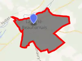
| |
 La Ferté-Beauharnais  La Ferté-Beauharnais | |
| Coordinates: 47°32′33″N 1°51′03″E | |
| Country | France |
| Region | Centre-Val de Loire |
| Department | Loir-et-Cher |
| Arrondissement | Romorantin-Lanthenay |
| Canton | Chambord |
| Intercommunality | Sologne des étangs |
| Government | |
| • Mayor (2014–2020) | Jean-Pierre Guémon |
| Area 1 | 2.42 km2 (0.93 sq mi) |
| Population (2017-01-01)[1] | 525 |
| • Density | 220/km2 (560/sq mi) |
| Time zone | UTC+01:00 (CET) |
| • Summer (DST) | UTC+02:00 (CEST) |
| INSEE/Postal code | 41083 /41210 |
| Elevation | 95–109 m (312–358 ft) (avg. 98 m or 322 ft) |
| 1 French Land Register data, which excludes lakes, ponds, glaciers > 1 km2 (0.386 sq mi or 247 acres) and river estuaries. | |
Population
| Year | Pop. | ±% |
|---|---|---|
| 1793 | 268 | — |
| 1806 | 216 | −19.4% |
| 1821 | 300 | +38.9% |
| 1831 | 360 | +20.0% |
| 1841 | 416 | +15.6% |
| 1851 | 466 | +12.0% |
| 1861 | 531 | +13.9% |
| 1872 | 601 | +13.2% |
| 1881 | 623 | +3.7% |
| 1891 | 664 | +6.6% |
| 1901 | 602 | −9.3% |
| 1911 | 640 | +6.3% |
| 1921 | 550 | −14.1% |
| 1931 | 510 | −7.3% |
| 1946 | 510 | +0.0% |
| 1954 | 466 | −8.6% |
| 1962 | 468 | +0.4% |
| 1968 | 454 | −3.0% |
| 1975 | 392 | −13.7% |
| 1982 | 400 | +2.0% |
| 1990 | 442 | +10.5% |
| 1999 | 463 | +4.8% |
| 2008 | 519 | +12.1% |
| 2013 | 522 | +0.6% |
References
- "Populations légales 2017". INSEE. Retrieved 6 January 2020.
| Wikimedia Commons has media related to La Ferté-Beauharnais. |
| Authority control |
|---|
This article is issued from Wikipedia. The text is licensed under Creative Commons - Attribution - Sharealike. Additional terms may apply for the media files.