Saint-Gourgon
Saint-Gourgon is a commune in the Loir-et-Cher department of central France.
Saint-Gourgon | |
|---|---|
Commune | |
.svg.png.webp) Coat of arms | |
Location of Saint-Gourgon 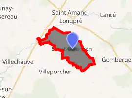
| |
 Saint-Gourgon  Saint-Gourgon | |
| Coordinates: 47°39′42″N 1°01′05″E | |
| Country | France |
| Region | Centre-Val de Loire |
| Department | Loir-et-Cher |
| Arrondissement | Vendôme |
| Canton | Montoire-sur-le-Loir |
| Intercommunality | Beauce et Gâtine |
| Government | |
| • Mayor (2014–2020) | Joël Salmon |
| Area 1 | 10.15 km2 (3.92 sq mi) |
| Population (2017-01-01)[1] | 113 |
| • Density | 11/km2 (29/sq mi) |
| Time zone | UTC+01:00 (CET) |
| • Summer (DST) | UTC+02:00 (CEST) |
| INSEE/Postal code | 41213 /41310 |
| Elevation | 112–129 m (367–423 ft) (avg. 130 m or 430 ft) |
| 1 French Land Register data, which excludes lakes, ponds, glaciers > 1 km2 (0.386 sq mi or 247 acres) and river estuaries. | |
Population
| Year | Pop. | ±% |
|---|---|---|
| 1793 | 300 | — |
| 1806 | 320 | +6.7% |
| 1821 | 274 | −14.4% |
| 1831 | 289 | +5.5% |
| 1841 | 302 | +4.5% |
| 1851 | 279 | −7.6% |
| 1861 | 273 | −2.2% |
| 1872 | 238 | −12.8% |
| 1881 | 259 | +8.8% |
| 1891 | 250 | −3.5% |
| 1901 | 254 | +1.6% |
| 1911 | 246 | −3.1% |
| 1921 | 219 | −11.0% |
| 1931 | 226 | +3.2% |
| 1946 | 197 | −12.8% |
| 1954 | 192 | −2.5% |
| 1962 | 197 | +2.6% |
| 1968 | 176 | −10.7% |
| 1975 | 158 | −10.2% |
| 1982 | 145 | −8.2% |
| 1990 | 120 | −17.2% |
| 1999 | 116 | −3.3% |
| 2005 | 118 | +1.7% |
| 2015 | 115 | −2.5% |
References
- "Populations légales 2017". INSEE. Retrieved 6 January 2020.
| Wikimedia Commons has media related to Saint-Gourgon. |
| Authority control |
|---|
This article is issued from Wikipedia. The text is licensed under Creative Commons - Attribution - Sharealike. Additional terms may apply for the media files.