Le Temple, Loir-et-Cher
Le Temple is a commune of the Loir-et-Cher department in central France.
Le Temple | |
|---|---|
Commune | |
_(23661643912).jpg.webp) | |
.svg.png.webp) Coat of arms | |
Location of Le Temple 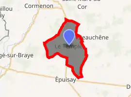
| |
 Le Temple  Le Temple | |
| Coordinates: 47°55′59″N 0°56′08″E | |
| Country | France |
| Region | Centre-Val de Loire |
| Department | Loir-et-Cher |
| Arrondissement | Vendôme |
| Canton | Le Perche |
| Intercommunality | Collines du Perche |
| Government | |
| • Mayor (2014–2020) | Denys Bouhours |
| Area 1 | 13.32 km2 (5.14 sq mi) |
| Population (2017-01-01)[1] | 187 |
| • Density | 14/km2 (36/sq mi) |
| Time zone | UTC+01:00 (CET) |
| • Summer (DST) | UTC+02:00 (CEST) |
| INSEE/Postal code | 41254 /41170 |
| Elevation | 144–208 m (472–682 ft) (avg. 163 m or 535 ft) |
| 1 French Land Register data, which excludes lakes, ponds, glaciers > 1 km2 (0.386 sq mi or 247 acres) and river estuaries. | |
Population
| Year | Pop. | ±% |
|---|---|---|
| 1793 | 290 | — |
| 1806 | 355 | +22.4% |
| 1821 | 366 | +3.1% |
| 1831 | 428 | +16.9% |
| 1841 | 383 | −10.5% |
| 1851 | 381 | −0.5% |
| 1861 | 380 | −0.3% |
| 1872 | 374 | −1.6% |
| 1881 | 375 | +0.3% |
| 1891 | 384 | +2.4% |
| 1901 | 333 | −13.3% |
| 1911 | 330 | −0.9% |
| 1921 | 302 | −8.5% |
| 1931 | 293 | −3.0% |
| 1946 | 289 | −1.4% |
| 1954 | 260 | −10.0% |
| 1962 | 266 | +2.3% |
| 1968 | 224 | −15.8% |
| 1975 | 180 | −19.6% |
| 1982 | 156 | −13.3% |
| 1990 | 150 | −3.8% |
| 1999 | 179 | +19.3% |
| 2006 | 176 | −1.7% |
| 2015 | 184 | +4.5% |
References
- "Populations légales 2017". INSEE. Retrieved 6 January 2020.
| Wikimedia Commons has media related to Le Temple (Loir-et-Cher). |
| Authority control |
|---|
This article is issued from Wikipedia. The text is licensed under Creative Commons - Attribution - Sharealike. Additional terms may apply for the media files.