Sainte-Anne, Loir-et-Cher
Sainte-Anne is a commune in the Loir-et-Cher department of central France.
Sainte-Anne | |
|---|---|
Commune | |
.svg.png.webp) Coat of arms | |
Location of Sainte-Anne 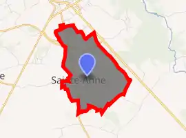
| |
 Sainte-Anne  Sainte-Anne | |
| Coordinates: 47°45′29″N 1°04′58″E | |
| Country | France |
| Region | Centre-Val de Loire |
| Department | Loir-et-Cher |
| Arrondissement | Vendôme |
| Canton | Vendôme |
| Intercommunality | Vendômois Rural |
| Government | |
| • Mayor (2014–2020) | Pascal Bardin |
| Area 1 | 5.13 km2 (1.98 sq mi) |
| Population (2017-01-01)[1] | 459 |
| • Density | 89/km2 (230/sq mi) |
| Time zone | UTC+01:00 (CET) |
| • Summer (DST) | UTC+02:00 (CEST) |
| INSEE/Postal code | 41200 /41100 |
| Elevation | 103–139 m (338–456 ft) (avg. 137 m or 449 ft) |
| 1 French Land Register data, which excludes lakes, ponds, glaciers > 1 km2 (0.386 sq mi or 247 acres) and river estuaries. | |
Population
| Year | Pop. | ±% |
|---|---|---|
| 1793 | 120 | — |
| 1806 | 137 | +14.2% |
| 1821 | 124 | −9.5% |
| 1831 | 123 | −0.8% |
| 1841 | 141 | +14.6% |
| 1851 | 132 | −6.4% |
| 1861 | 146 | +10.6% |
| 1872 | 135 | −7.5% |
| 1881 | 173 | +28.1% |
| 1891 | 196 | +13.3% |
| 1901 | 147 | −25.0% |
| 1911 | 140 | −4.8% |
| 1921 | 132 | −5.7% |
| 1931 | 123 | −6.8% |
| 1946 | 116 | −5.7% |
| 1954 | 121 | +4.3% |
| 1962 | 101 | −16.5% |
| 1968 | 109 | +7.9% |
| 1975 | 121 | +11.0% |
| 1982 | 242 | +100.0% |
| 1990 | 254 | +5.0% |
| 1999 | 273 | +7.5% |
| 2005 | 348 | +27.5% |
| 2015 | 424 | +21.8% |
References
- "Populations légales 2017". INSEE. Retrieved 6 January 2020.
| Wikimedia Commons has media related to Sainte-Anne (Loir-et-Cher). |
| Authority control |
|---|
This article is issued from Wikipedia. The text is licensed under Creative Commons - Attribution - Sharealike. Additional terms may apply for the media files.