Saint-Firmin-des-Prés
Saint-Firmin-des-Prés is a commune in the Loir-et-Cher department of central France.
Saint-Firmin-des-Prés | |
|---|---|
Commune | |
.svg.png.webp) Coat of arms | |
Location of Saint-Firmin-des-Prés 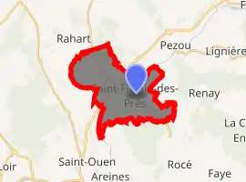
| |
 Saint-Firmin-des-Prés  Saint-Firmin-des-Prés | |
| Coordinates: 47°50′35″N 1°06′52″E | |
| Country | France |
| Region | Centre-Val de Loire |
| Department | Loir-et-Cher |
| Arrondissement | Vendôme |
| Canton | Le Perche |
| Intercommunality | Pays de Vendôme |
| Government | |
| • Mayor (2014–2020) | Benoit Rousselet |
| Area 1 | 13.89 km2 (5.36 sq mi) |
| Population (2017-01-01)[1] | 824 |
| • Density | 59/km2 (150/sq mi) |
| Time zone | UTC+01:00 (CET) |
| • Summer (DST) | UTC+02:00 (CEST) |
| INSEE/Postal code | 41209 /41100 |
| Elevation | 79–140 m (259–459 ft) (avg. 90 m or 300 ft) |
| 1 French Land Register data, which excludes lakes, ponds, glaciers > 1 km2 (0.386 sq mi or 247 acres) and river estuaries. | |
Population
| Year | Pop. | ±% |
|---|---|---|
| 1793 | 459 | — |
| 1806 | 354 | −22.9% |
| 1821 | 488 | +37.9% |
| 1831 | 517 | +5.9% |
| 1841 | 524 | +1.4% |
| 1851 | 547 | +4.4% |
| 1861 | 526 | −3.8% |
| 1872 | 603 | +14.6% |
| 1881 | 537 | −10.9% |
| 1891 | 568 | +5.8% |
| 1901 | 534 | −6.0% |
| 1911 | 498 | −6.7% |
| 1921 | 474 | −4.8% |
| 1931 | 418 | −11.8% |
| 1946 | 393 | −6.0% |
| 1954 | 368 | −6.4% |
| 1962 | 349 | −5.2% |
| 1968 | 403 | +15.5% |
| 1975 | 425 | +5.5% |
| 1982 | 649 | +52.7% |
| 1990 | 689 | +6.2% |
| 1999 | 777 | +12.8% |
| 2006 | 791 | +1.8% |
| 2015 | 843 | +6.6% |
References
- "Populations légales 2017". INSEE. Retrieved 6 January 2020.
| Wikimedia Commons has media related to Saint-Firmin-des-Prés. |
| Authority control |
|---|
This article is issued from Wikipedia. The text is licensed under Creative Commons - Attribution - Sharealike. Additional terms may apply for the media files.