Saint-Hilaire-la-Gravelle
Saint-Hilaire-la-Gravelle is a commune in the Loir-et-Cher department of central France.
Saint-Hilaire-la-Gravelle | |
|---|---|
Commune | |
 The Loir | |
.svg.png.webp) Coat of arms | |
Location of Saint-Hilaire-la-Gravelle 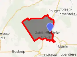
| |
 Saint-Hilaire-la-Gravelle  Saint-Hilaire-la-Gravelle | |
| Coordinates: 47°55′31″N 1°12′27″E | |
| Country | France |
| Region | Centre-Val de Loire |
| Department | Loir-et-Cher |
| Arrondissement | Vendôme |
| Canton | Le Perche |
| Intercommunality | Haut Vendômois |
| Government | |
| • Mayor (2014–2020) | Dominique Maroye-Patignier |
| Area 1 | 17.57 km2 (6.78 sq mi) |
| Population (2017-01-01)[1] | 717 |
| • Density | 41/km2 (110/sq mi) |
| Time zone | UTC+01:00 (CET) |
| • Summer (DST) | UTC+02:00 (CEST) |
| INSEE/Postal code | 41214 /41160 |
| Elevation | 87–172 m (285–564 ft) (avg. 92 m or 302 ft) |
| 1 French Land Register data, which excludes lakes, ponds, glaciers > 1 km2 (0.386 sq mi or 247 acres) and river estuaries. | |
Population
| Year | Pop. | ±% |
|---|---|---|
| 1793 | 611 | — |
| 1806 | 676 | +10.6% |
| 1821 | 699 | +3.4% |
| 1831 | 781 | +11.7% |
| 1841 | 755 | −3.3% |
| 1851 | 822 | +8.9% |
| 1861 | 858 | +4.4% |
| 1872 | 755 | −12.0% |
| 1881 | 743 | −1.6% |
| 1891 | 702 | −5.5% |
| 1901 | 738 | +5.1% |
| 1911 | 660 | −10.6% |
| 1921 | 607 | −8.0% |
| 1931 | 576 | −5.1% |
| 1946 | 450 | −21.9% |
| 1954 | 540 | +20.0% |
| 1962 | 537 | −0.6% |
| 1968 | 558 | +3.9% |
| 1975 | 556 | −0.4% |
| 1982 | 663 | +19.2% |
| 1990 | 648 | −2.3% |
| 1999 | 687 | +6.0% |
| 2005 | 697 | +1.5% |
| 2015 | 716 | +2.7% |
References
- "Populations légales 2017". INSEE. Retrieved 6 January 2020.
| Wikimedia Commons has media related to Saint-Hilaire-la-Gravelle. |
| Authority control |
|---|
This article is issued from Wikipedia. The text is licensed under Creative Commons - Attribution - Sharealike. Additional terms may apply for the media files.