National Register of Historic Places listings in DeKalb County, Indiana
This is a list of the National Register of Historic Places listings in DeKalb County, Indiana.
This is intended to be a complete list of the properties and districts on National Register of Historic Places in DeKalb County, Indiana, United States. Latitude and longitude coordinates are provided for many National Register properties and districts; these locations may be seen together in a map.[1]
There are 29 properties and districts listed on the National Register in the county, including 1 National Historic Landmark.
Properties and districts located in incorporated areas display the name of the municipality, while properties and districts in unincorporated areas display the name of their civil township. Properties and districts split between multiple jurisdictions display the names of all jurisdictions.
- This National Park Service list is complete through NPS recent listings posted January 29, 2021.[2]
Current listings
| [3] | Name on the Register[4] | Image | Date listed[5] | Location | City or town | Description |
|---|---|---|---|---|---|---|
| 1 | Auburn Community Mausoleum | 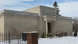 Auburn Community Mausoleum |
March 24, 2014 (#14000069) |
1431 Center St. 41°21′24″N 85°02′58″W |
Auburn | |
| 2 | Auburn Cord Duesenberg Automobile Facility |  Auburn Cord Duesenberg Automobile Facility |
September 21, 1978 (#78000029) |
1600 S. Wayne St. 41°21′21″N 85°03′26″W |
Auburn | |
| 3 | Samuel Bevier House | 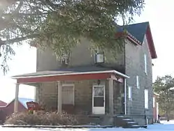 Samuel Bevier House |
May 6, 1983 (#83000014) |
County Roads 11 and 52, south of Garrett 41°20′13″N 85°08′15″W |
Keyser Township | |
| 4 | Joseph Bowman Farmhouse | 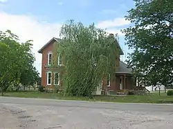 Joseph Bowman Farmhouse |
May 6, 1983 (#83000013) |
County Roads 19 and 40, northeast of Garrett 41°22′52″N 85°05′55″W |
Keyser Township | |
| 5 | Breechbill-Davidson House | 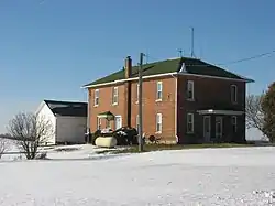 Breechbill-Davidson House |
May 6, 1983 (#83000012) |
State Road 8 and County Road 7, northwest of Garrett 41°22′02″N 85°09′21″W |
Keyser Township | |
| 6 | Brethren in Christ Church | 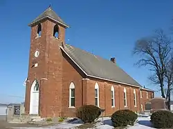 Brethren in Christ Church |
May 6, 1983 (#83000011) |
County Road 7, northwest of Garrett 41°22′11″N 85°09′18″W |
Keyser Township | |
| 7 | Butler Community Mausoleum |  Butler Community Mausoleum |
March 25, 2014 (#14000070) |
County Road 28 E., east of Butler 41°25′49″N 84°50′59″W |
Stafford Township | |
| 8 | Orin Clark House | 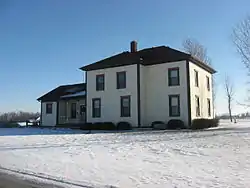 Orin Clark House |
May 6, 1983 (#83000010) |
County Roads 3 and 48, west of Garrett 41°21′03″N 85°10′34″W |
Keyser Township | |
| 9 | William Cornell Homestead | 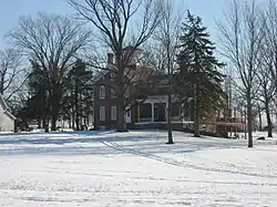 William Cornell Homestead |
August 14, 1973 (#73000015) |
Southwest of Auburn off State Road 427 41°16′44″N 85°05′28″W |
Butler Township | |
| 10 | DeKalb County Home and Barn |  DeKalb County Home and Barn |
May 6, 1983 (#83000015) |
County Road 40, northeast of Garrett 41°22′54″N 85°04′59″W |
Keyser Township | |
| 11 | Downtown Auburn Historic District |  Downtown Auburn Historic District |
September 10, 1986 (#86002858) |
Roughly bounded by E. and W. 4th, N. and S. Cedar, E. 12th, and N. and S. Jackson Sts. 41°22′00″N 85°03′18″W |
Auburn | |
| 12 | Downtown Butler Historic District | 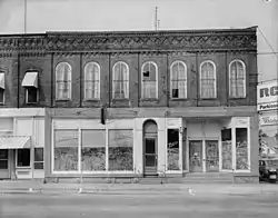 Downtown Butler Historic District |
December 7, 2001 (#01001347) |
Roughly the 100 and 200 blocks of S. Broadway 41°25′45″N 84°52′18″W |
Butler | |
| 13 | Eckhart Public Library and Park |  Eckhart Public Library and Park |
November 20, 1981 (#81000009) |
603 S. Jackson St. 41°21′50″N 85°03′27″W |
Auburn | |
| 14 | William Fountain House | 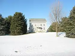 William Fountain House |
May 6, 1983 (#83000021) |
State Road 8, northwest of Garrett 41°21′58″N 85°10′38″W |
Keyser Township | |
| 15 | Garrett Community Mausoleum | 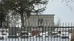 Garrett Community Mausoleum |
March 25, 2014 (#14000071) |
S. Hamsher St. 41°20′43″N 85°08′38″W |
Garrett | |
| 16 | Garrett Historic District | 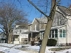 Garrett Historic District |
May 6, 1983 (#83000121) |
Roughly bounded by Railroad, Britton, Warfield, and Hamsher Sts., and 3rd Ave. 41°20′43″N 85°08′06″W |
Garrett | |
| 17 | Gump House | 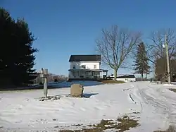 Gump House |
May 6, 1983 (#83000020) |
State Road 8, northwest of Garrett 41°21′58″N 85°11′23″W |
Keyser Township | |
| 18 | J.H. Haag House | 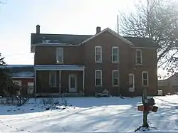 J.H. Haag House |
May 6, 1983 (#83000019) |
County Road 54 41°19′46″N 85°08′08″W |
Garrett | |
| 19 | Edward Kelham House | 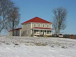 Edward Kelham House |
May 6, 1983 (#83000018) |
County Road 48, west of Garrett 41°21′07″N 85°11′20″W |
Keyser Township | |
| 20 | Keyser Township School 8 | 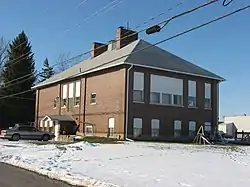 Keyser Township School 8 |
May 6, 1983 (#83000017) |
E. Quincy St. 41°21′06″N 85°07′03″W |
Garrett | |
| 21 | Charles Lehmback Farmstead | 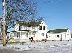 Charles Lehmback Farmstead |
May 6, 1983 (#83000016) |
County Road 15, east of Garrett 41°20′37″N 85°07′01″W |
Keyser Township | |
| 22 | Mountz House | 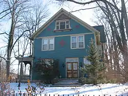 Mountz House |
September 11, 1979 (#79000013) |
507 E. Houston St. 41°20′53″N 85°07′49″W |
Garrett | |
| 23 | Henry Peters House | 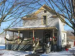 Henry Peters House |
May 6, 1983 (#83000022) |
201 N. 6th St. 41°21′06″N 85°07′11″W |
Garrett | |
| 24 | Rakestraw House | 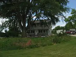 Rakestraw House |
May 6, 1983 (#83000024) |
County Road 19, northeast of Garrett 41°22′11″N 85°05′54″W |
Keyser Township | |
| 25 | Henry Shull Farmhouse Inn | 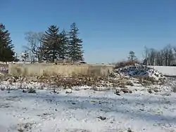 Henry Shull Farmhouse Inn |
May 6, 1983 (#83000023) |
County Road 11-A, southeast of Garrett 41°19′36″N 85°05′23″W |
Keyser Township | |
| 26 | Spencerville Covered Bridge |  Spencerville Covered Bridge |
April 2, 1981 (#81000010) |
County Road 68 at Spencerville 41°16′53″N 84°54′53″W |
Spencer Township | |
| 27 | Waterloo Community Mausoleum | 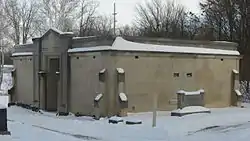 Waterloo Community Mausoleum |
March 25, 2014 (#14000072) |
N. Center St. 41°26′14″N 85°01′23″W |
Waterloo | |
| 28 | John Wilderson House | 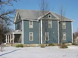 John Wilderson House |
May 6, 1983 (#83000025) |
1349 S. Cowen St. 41°20′01″N 85°08′12″W |
Garrett | |
| 29 | Maria and Franklin Wiltrout Polygonal Barn | 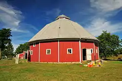 Maria and Franklin Wiltrout Polygonal Barn |
April 2, 1993 (#93000183) |
0209 County Road 16, northwest of Corunna 41°28′04″N 85°11′02″W |
Fairfield Township |
See also
| Wikimedia Commons has media related to National Register of Historic Places in DeKalb County, Indiana. |
References
- The latitude and longitude information provided in this table was derived originally from the National Register Information System, which has been found to be fairly accurate for about 99% of listings. Some locations in this table may have been corrected to current GPS standards.
- "National Register of Historic Places: Weekly List Actions". National Park Service, United States Department of the Interior. Retrieved on January 29, 2021.
- Numbers represent an alphabetical ordering by significant words. Various colorings, defined here, differentiate National Historic Landmarks and historic districts from other NRHP buildings, structures, sites or objects.
- "National Register Information System". National Register of Historic Places. National Park Service. March 13, 2009.
- The eight-digit number below each date is the number assigned to each location in the National Register Information System database, which can be viewed by clicking the number.
| Topics | |
|---|---|
| Lists by state |
|
| Lists by insular areas | |
| Lists by associated state | |
| Other areas | |
| Related | |
| |
Municipalities and communities of DeKalb County, Indiana, United States | ||
|---|---|---|
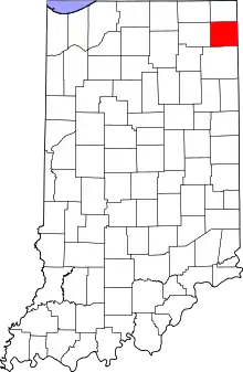
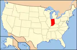
| Cities | Map of Indiana highlighting DeKalb County | |
| Towns | ||
| Townships | ||
| Unincorporated communities | ||
| Footnotes | ‡This populated place also has portions in an adjacent county or counties | |
| ||