National Register of Historic Places listings in Wabash County, Indiana
This is a list of the National Register of Historic Places listings in Wabash County, Indiana.
This is intended to be a complete list of the properties and districts on the National Register of Historic Places in Wabash County, Indiana, United States. Latitude and longitude coordinates are provided for many National Register properties and districts; these locations may be seen together in a map.[1]
There are 31 properties and districts listed on the National Register in the county. Another property was once listed but has been removed.
Properties and districts located in incorporated areas display the name of the municipality, while properties and districts in unincorporated areas display the name of their civil township. Properties and districts split between multiple jurisdictions display the names of all jurisdictions.
- This National Park Service list is complete through NPS recent listings posted February 5, 2021.[2]
Current listings
| [3] | Name on the Register[4] | Image | Date listed[5] | Location | City or town | Description |
|---|---|---|---|---|---|---|
| 1 | 4th Roann Covered Bridge |  4th Roann Covered Bridge |
August 6, 1981 (#81000022) |
North of Roann on N. County Road 700W 40°54′56″N 85°55′27″W |
Paw Paw Township and Roann | |
| 2 | James M. Amoss Building | 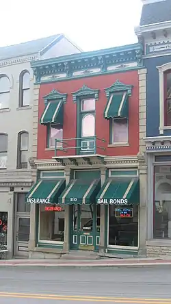 James M. Amoss Building |
August 30, 1984 (#84001742) |
110 S. Wabash St. 40°47′52″N 85°49′16″W |
Wabash | |
| 3 | Downtown Wabash Historic District | 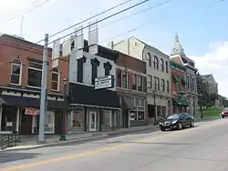 Downtown Wabash Historic District |
July 18, 1986 (#86001678) |
Roughly bounded by Hill, Wabash, Canal, and Miami Sts. 40°47′50″N 85°49′17″W |
Wabash | |
| 4 | East Wabash Historic District | 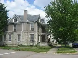 East Wabash Historic District |
June 23, 2011 (#11000390) |
Roughly bounded by Walnut, E. Market, N. Wabash, and S. East Sts. 40°47′56″N 85°49′04″W |
Wabash | |
| 5 | F. & A.M. Tuscan Lodge No. 143 | December 1, 2020 (#100005869) |
828 Washington St. 40°50′11″N 85°43′41″W |
Lagro | ||
| 6 | First Christian Church | 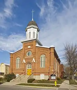 First Christian Church |
June 23, 1983 (#83000161) |
110 W. Hill St. 40°47′56″N 85°49′22″W |
Wabash | |
| 7 | Halderman-Van Buskirk Farmstead | 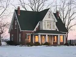 Halderman-Van Buskirk Farmstead |
March 20, 2013 (#13000092) |
5653 N700W, south of Roann 40°54′22″N 85°55′26″W |
Paw Paw Township | |
| 8 | Hominy Ridge Shelter House |  Hominy Ridge Shelter House |
September 23, 1994 (#94001122) |
On the south bank of the Salamonie River, north of Hominy Ridge Lake and southeast of Lagro, in the Salamonie River State Forest 40°48′34″N 85°40′59″W |
Lagro Township | |
| 9 | Honeywell Memorial Community Center | 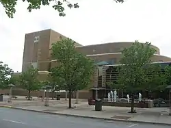 Honeywell Memorial Community Center |
July 15, 1983 (#83000042) |
275 W. Market St. 40°47′45″N 85°49′30″W |
Wabash | |
| 10 | Honeywell Studio | 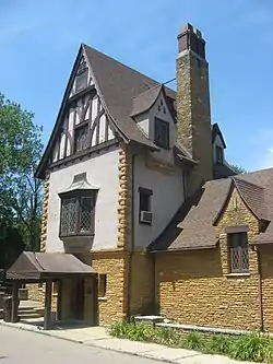 Honeywell Studio |
June 17, 2005 (#05000609) |
378 N. State Road 15 40°49′48″N 85°51′26″W |
Wabash | |
| 11 | Hopewell Methodist Episcopal Church and Cemetery |  Hopewell Methodist Episcopal Church and Cemetery |
September 14, 2015 (#15000600) |
5031 E300N 40°52′13″N 85°41′57″W |
Lagro Township | |
| 12 | I.O.R.M. Hall, Tonkawa No. 126 | December 1, 2020 (#100005871) |
828 Washington St. 40°50′11″N 85°43′40″W |
Lagro | ||
| 13 | LaFontaine Historic District | 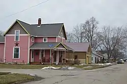 LaFontaine Historic District |
September 30, 2014 (#14000809) |
Roughly Kendall and Branson between Walnut and Gruell Sts. 40°40′27″N 85°43′21″W |
La Fontaine | |
| 14 | Lentz House (Hotel Sheller) | 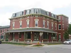 Lentz House (Hotel Sheller) |
November 14, 1982 (#82000050) |
Walnut and 2nd Sts. 41°00′01″N 85°46′08″W |
North Manchester | |
| 15 | Thomas J. Lewis House | 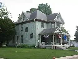 Thomas J. Lewis House |
June 21, 2006 (#06000521) |
105 S. Arnold St. 40°54′41″N 85°55′18″W |
Roann | |
| 16 | Manchester College Historic District | 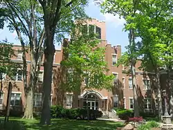 Manchester College Historic District |
December 27, 1990 (#90001929) |
604 College Ave. 41°00′38″N 85°45′45″W |
North Manchester | |
| 17 | Thomas R. Marshall School | 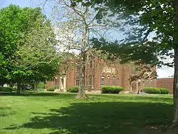 Thomas R. Marshall School |
March 22, 2004 (#04000206) |
603 Bond St. 41°00′19″N 85°45′45″W |
North Manchester | |
| 18 | McNamee-Ford House | 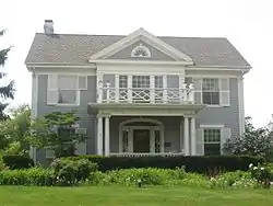 McNamee-Ford House |
March 3, 1995 (#95000199) |
536 N. Wabash St. 40°48′20″N 85°49′16″W |
Wabash | |
| 19 | Noftzger-Adams House | 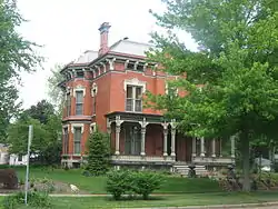 Noftzger-Adams House |
November 14, 1979 (#79000024) |
102 E. 3rd St. 41°00′06″N 85°46′11″W |
North Manchester | |
| 20 | North Manchester Covered Bridge |  North Manchester Covered Bridge |
September 30, 1982 (#82000051) |
S. Mill St. at the Eel River 40°59′45″N 85°45′55″W |
North Manchester | |
| 21 | North Manchester Historic District | 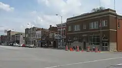 North Manchester Historic District |
June 27, 2002 (#02000687) |
Roughly bounded by Maple, 3rd, and Mill Sts., and the northern bank of the Eel River 40°59′58″N 85°46′15″W |
North Manchester | |
| 22 | North Manchester Public Library |  North Manchester Public Library |
March 14, 1996 (#96000290) |
204 W. Main St. 40°59′57″N 85°46′20″W |
North Manchester | |
| 23 | North Wabash Historic District | 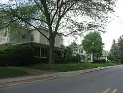 North Wabash Historic District |
September 3, 1999 (#99001077) |
Roughly bounded by W. Maple, N. Carroll, Ferry, Miami, Pawling, N. Wabash, and Union Sts. 40°48′13″N 85°49′18″W |
Wabash | |
| 24 | Peabody Memorial Tower | 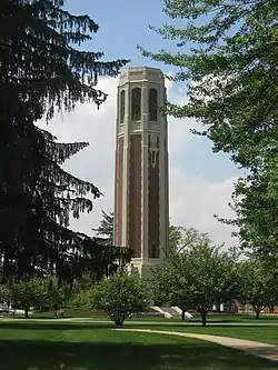 Peabody Memorial Tower |
June 24, 2010 (#10000377) |
400 W. 7th St. 41°00′22″N 85°46′33″W |
North Manchester | |
| 25 | Roann Historic District | 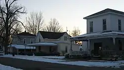 Roann Historic District |
March 20, 2013 (#13000093) |
Roughly bounded by State Road 16 and West, Ohio, and Beamer Sts. 40°54′40″N 85°55′30″W |
Paw Paw Township and Roann | |
| 26 | Roann-Paw Paw Township Public Library |  Roann-Paw Paw Township Public Library |
December 20, 2002 (#02001561) |
240 S. Chippewa Rd. 40°54′36″N 85°55′29″W |
Roann | |
| 27 | St. Patrick's Roman Catholic Church |  St. Patrick's Roman Catholic Church |
March 12, 1999 (#99000306) |
W. Main St. 40°50′11″N 85°43′48″W |
Lagro | |
| 28 | Stockdale Mill | 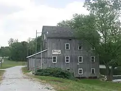 Stockdale Mill |
March 24, 2004 (#04000204) |
N. County Road 800W at Stockdale 40°54′52″N 85°56′36″W |
Paw Paw Township | |
| 29 | Teague Barn Wabash Importing Company Farm Stable | 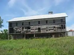 Teague Barn Wabash Importing Company Farm Stable |
June 27, 2002 (#02000691) |
4568 W. Mill Creek Pike, southwest of Wabash 40°46′31″N 85°52′44″W |
Noble Township | |
| 30 | West Wabash Historic District |  West Wabash Historic District |
April 21, 1988 (#88000447) |
Bounded roughly by the Norfolk Southern railroad line and Union, Wabash, Miami, Main, and Holliday Sts. 40°47′54″N 85°49′28″W |
Wabash | |
| 31 | Solomon Wilson Building | 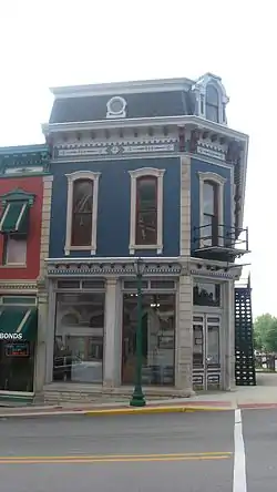 Solomon Wilson Building |
August 30, 1984 (#84001743) |
102 S. Wabash St. 40°47′52″N 85°49′15″W |
Wabash |
Former listing
| [3] | Name on the Register | Image | Date listed | Date removed | Location | City or town | Summary |
|---|---|---|---|---|---|---|---|
| 1 | North Manchester Planing and Band Saw Mill | March 5, 1982 (#82000052) | June 12, 1995 | 705 Main (mill); 706-708 W. Grant and 202 N. High St. (houses) 40°59′55″N 85°46′40″W |
North Manchester | Also known as J.A. Browne Co. Mill. |
See also
| Wikimedia Commons has media related to National Register of Historic Places in Wabash County, Indiana. |
References
- The latitude and longitude information provided in this table was derived originally from the National Register Information System, which has been found to be fairly accurate for about 99% of listings. Some locations in this table may have been corrected to current GPS standards.
- "National Register of Historic Places: Weekly List Actions". National Park Service, United States Department of the Interior. Retrieved on February 5, 2021.
- Numbers represent an alphabetical ordering by significant words. Various colorings, defined here, differentiate National Historic Landmarks and historic districts from other NRHP buildings, structures, sites or objects.
- "National Register Information System". National Register of Historic Places. National Park Service. March 13, 2009.
- The eight-digit number below each date is the number assigned to each location in the National Register Information System database, which can be viewed by clicking the number.
| Topics | |
|---|---|
| Lists by state |
|
| Lists by insular areas | |
| Lists by associated state | |
| Other areas | |
| Related | |
| |
Municipalities and communities of Wabash County, Indiana, United States | ||
|---|---|---|
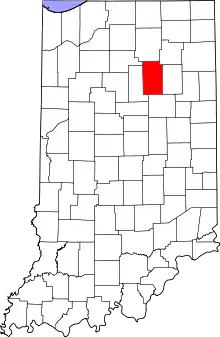
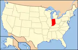
| City | Map of Indiana highlighting Wabash County | |
| Towns | ||
| Townships | ||
| CDPs | ||
| Other unincorporated communities | ||
| Footnotes | ‡This populated place also has portions in an adjacent county or counties | |
| ||