National Register of Historic Places listings in Arkansas County, Arkansas
This is a list of the National Register of Historic Places listings in Arkansas County, Arkansas.
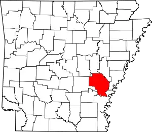
Location of Arkansas County in Arkansas
This is intended to be a complete list of the properties and districts on the National Register of Historic Places in Arkansas County, Arkansas, United States. The locations of National Register properties and districts for which the latitude and longitude coordinates are included below, may be seen in a map.[1]
There are 25 properties and districts listed on the National Register in the county, including 2 National Historic Landmarks.
- This National Park Service list is complete through NPS recent listings posted January 29, 2021.[2]
Current listings
| [3] | Name on the Register[4] | Image | Date listed[5] | Location | City or town | Description |
|---|---|---|---|---|---|---|
| 1 | A.M. Bohnert Rice Plantation Pump #2 Engine |  A.M. Bohnert Rice Plantation Pump #2 Engine |
September 23, 2010 (#10000783) |
Southeast corner of U.S. Route 165 and Post Bayou Lane 34°02′35″N 91°22′24″W |
Gillett vicinity | |
| 2 | Arkansas County Courthouse-Northern District | 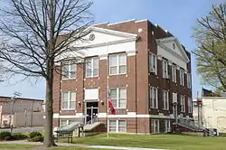 Arkansas County Courthouse-Northern District |
November 20, 1992 (#92001621) |
Southwestern corner of the junction of E. 3rd and S. College Sts. 34°29′59″N 91°33′06″W |
Stuttgart | |
| 3 | Arkansas County Courthouse-Southern District | 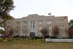 Arkansas County Courthouse-Southern District |
November 20, 1992 (#92001620) |
Courthouse Sq. 34°17′42″N 91°20′06″W |
De Witt | |
| 4 | Arkansas Post National Memorial |  Arkansas Post National Memorial |
October 15, 1966 (#66000198) |
8 miles (13 km) southeast of Gillett on Highways 1 and 169 34°01′15″N 91°20′54″W |
Gillett | |
| 5 | L.A. Black Rice Milling Association Inc. Office | 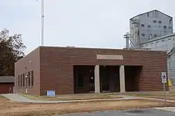 L.A. Black Rice Milling Association Inc. Office |
January 29, 2013 (#12001229) |
508 S. Monroe St. 34°17′26″N 91°20′27″W |
DeWitt | |
| 6 | Crocketts Bluff Hunting Lodge |  Crocketts Bluff Hunting Lodge |
August 1, 2008 (#08000723) |
End of a dirt road north of the point at which Highway 153 turns south 34°26′51″N 91°13′15″W |
Crocketts Bluff | |
| 7 | DeWitt Commercial Historic District |  DeWitt Commercial Historic District |
April 27, 2010 (#10000213) |
Roughly bounded by N. Washington, 2nd St., S. Adams and Gibson Ave. 34°17′41″N 91°20′06″W |
De Witt | |
| 8 | DeWitt Post Office |  DeWitt Post Office |
August 14, 1998 (#98000915) |
221 W. Cross St. 34°17′42″N 91°20′14″W |
De Witt | |
| 9 | First United Methodist Church | 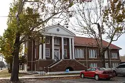 First United Methodist Church |
September 4, 1992 (#92001158) |
Junction of Jefferson and Cross Sts. 34°17′42″N 91°20′16″W |
De Witt | |
| 10 | Halliburton House |  Halliburton House |
November 5, 1974 (#74000464) |
300 W. Halliburton St. 34°17′55″N 91°20′15″W |
De Witt | |
| 11 | Immanuel High School-AR0280 |  Immanuel High School-AR0280 |
January 24, 2007 (#06001282) |
68 Immanuel Rd. 34°24′06″N 91°19′19″W |
Almyra | |
| 12 | Maxwell Street Bridge |  Maxwell Street Bridge |
April 8, 2011 (#10001148) |
Maxwell St., east of Jefferson St. 34°17′51″N 91°20′15″W |
De Witt | |
| 13 | Menard-Hodges Mounds (3AR4) |  Menard-Hodges Mounds (3AR4) |
October 31, 1985 (#85003542) |
Southern corner of the irregular Section 2303, Township 8 South, Range 2 West[6] 33°58′57″N 91°15′45″W |
Nady | Now owned by the National Park Service and administered as part of the Arkansas Post National Memorial. |
| 14 | North Jackson Street Bridge | 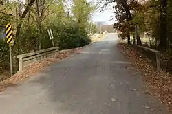 North Jackson Street Bridge |
April 8, 2011 (#10001151) |
North Jackson St., over Holt Branch 34°17′51″N 91°20′29″W |
De Witt | |
| 15 | North Washington Street Bridge |  North Washington Street Bridge |
January 22, 2014 (#13001102) |
N. Washington St. over Holt Branch 34°18′02″N 91°20′00″W |
De Witt | |
| 16 | Old Arkansas 11, Kauffman Road Segment | 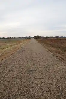 Old Arkansas 11, Kauffman Road Segment |
September 20, 2006 (#06000834) |
Kauffman Rd. 34°22′59″N 91°32′26″W |
Stuttgart | |
| 17 | Old Gillett Jail |  Old Gillett Jail |
May 22, 2007 (#07000440) |
207 Main St. 34°07′09″N 91°22′45″W |
Gillett | |
| 18 | Riceland Hotel | .jpg.webp) Riceland Hotel |
May 21, 1986 (#86001105) |
3rd and Main Sts. 34°30′00″N 91°33′10″W |
Stuttgart | |
| 19 | Roland Site | May 2, 1975 (#75000372) |
Address Restricted |
Tichnor | ||
| 20 | St. Charles Battle Monument |  St. Charles Battle Monument |
May 3, 1996 (#96000505) |
Junction of Arkansas St. and Broadway 34°22′26″N 91°08′08″W |
St. Charles | |
| 21 | St. Charles Battle Site |  St. Charles Battle Site |
December 2, 1974 (#74000465) |
Junction of Highway 1 and the White River 34°22′41″N 91°07′34″W |
St. Charles | Site of the Civil War Battle of Saint Charles. |
| 22 | Standard Ice Company Building | .jpg.webp) Standard Ice Company Building |
July 2, 1979 (#79003433) |
517 S. Main St. 34°29′52″N 91°33′08″W |
Stuttgart | |
| 23 | Stuttgart Commercial Historic District |  Stuttgart Commercial Historic District |
June 4, 2007 (#07000502) |
Roughly bounded by 1st St., College St., 6th St., and Maple St. 34°29′52″N 91°33′08″W |
Stuttgart | |
| 24 | Tichnor Rice Dryer and Storage Building | 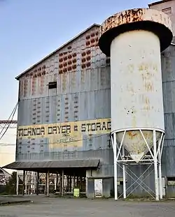 Tichnor Rice Dryer and Storage Building |
September 22, 2006 (#06000911) |
1030 Highway 44 34°08′10″N 91°15′56″W |
Tichnor | |
| 25 | US Post Office-Stuttgart | 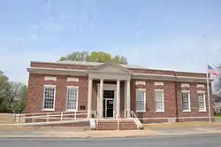 US Post Office-Stuttgart |
January 14, 2004 (#03001380) |
302 S. Maple 34°29′59″N 91°33′14″W |
Stuttgart |
See also
| Wikimedia Commons has media related to National Register of Historic Places in Arkansas County, Arkansas. |
References
- The latitude and longitude information provided in this table was derived originally from the National Register Information System, which has been found to be fairly accurate for about 99% of listings. Some locations in this table may have been corrected to current GPS standards.
- "National Register of Historic Places: Weekly List Actions". National Park Service, United States Department of the Interior. Retrieved on January 29, 2021.
- Numbers represent an alphabetical ordering by significant words. Various colorings, defined here, differentiate National Historic Landmarks and historic districts from other NRHP buildings, structures, sites or objects.
- "National Register Information System". National Register of Historic Places. National Park Service. March 13, 2009.
- The eight-digit number below each date is the number assigned to each location in the National Register Information System database, which can be viewed by clicking the number.
- Phillips, Philip, et al. Archaeological Survey in the Lower Mississippi Alluvial Valley 1940-1947. Reprint ed. Tuscaloosa: U of Alabama P, 2003, 54.
| Topics | |
|---|---|
| Lists by state |
|
| Lists by insular areas | |
| Lists by associated state | |
| Other areas | |
| Related | |
| |
Municipalities and communities of Arkansas County, Arkansas, United States | ||
|---|---|---|
| Cities | Map of Arkansas highlighting Arkansas County | |
| Towns | ||
| Unincorporated communities | ||
| Footnotes | ‡This populated place also has portions in an adjacent county or counties | |
| ||
This article is issued from Wikipedia. The text is licensed under Creative Commons - Attribution - Sharealike. Additional terms may apply for the media files.