National Register of Historic Places listings in Carroll County, Arkansas
This is a list of the National Register of Historic Places listings in Carroll County, Arkansas.
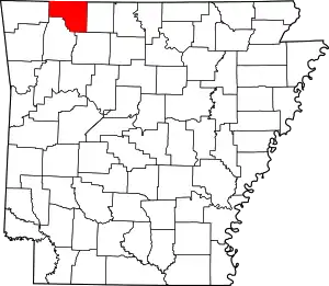
Location of Carroll County in Arkansas
This is intended to be a complete list of the properties and districts on the National Register of Historic Places in Carroll County, Arkansas, United States. The locations of National Register properties and districts for which the latitude and longitude coordinates are included below, may be seen in a map.[1]
There are 29 properties and districts listed on the National Register in the county. Another property was once listed but has been removed.
- This National Park Service list is complete through NPS recent listings posted February 5, 2021.[2]
Current listings
| [3] | Name on the Register[4] | Image | Date listed[5] | Location | City or town | Description |
|---|---|---|---|---|---|---|
| 1 | Beaver Bridge | 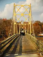 Beaver Bridge |
April 9, 1990 (#90000730) |
Highway 187, over the White River 36°28′15″N 93°46′06″W |
Beaver | |
| 2 | Berryville Agriculture Building | 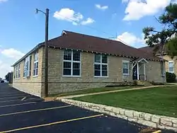 Berryville Agriculture Building |
September 10, 1992 (#92001214) |
South of Freeman Ave., east of Linda St., north of W. College Ave., and west of Ferguson St. 36°22′07″N 93°34′33″W |
Berryville | |
| 3 | Berryville Commercial Historic District |  Berryville Commercial Historic District |
March 24, 2016 (#16000402) |
Public Square 36°21′52″N 93°34′03″W |
Berryville | |
| 4 | Berryville Gymnasium |  Berryville Gymnasium |
September 10, 1992 (#92001215) |
South of Freeman Ave., east of Linda St., north of W. College Ave., and west of Ferguson St. 36°22′08″N 93°34′33″W |
Berryville | |
| 5 | Berryville Post Office |  Berryville Post Office |
August 14, 1998 (#98000922) |
101 E. Madison Ave. 36°21′52″N 93°33′56″W |
Berryville | |
| 6 | Blue Spring Shelter |  Blue Spring Shelter |
December 20, 2002 (#02001596) |
Blue Spring Heritage Center, CR 210 36°24′10″N 93°44′11″W |
Eureka Springs | Native American prehistoric site |
| 7 | Carroll County Courthouse, Eastern District | 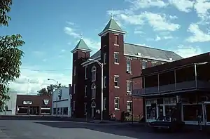 Carroll County Courthouse, Eastern District |
August 27, 1976 (#76000392) |
Public Sq. 36°21′51″N 93°34′04″W |
Berryville | |
| 8 | Carroll County Poor Farm Cemetery | May 24, 2006 (#06000412) |
Address Restricted |
Pleasant Valley | ||
| 9 | Concord School House |  Concord School House |
March 9, 2009 (#08001334) |
805 County Road 309 36°23′13″N 93°40′57″W |
Eureka Springs | |
| 10 | W.D. Crawford House |  W.D. Crawford House |
November 20, 1992 (#92001613) |
East of County Road 27, about 1 mile north of its junction with County Road 98 36°23′00″N 93°29′48″W |
Cisco | |
| 11 | Crescent Hotel | 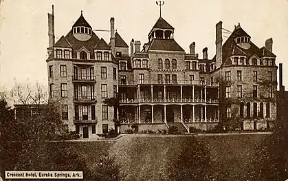 Crescent Hotel |
January 26, 2016 (#15000991) |
75 Prospect Ave. 36°24′30″N 93°44′15″W |
Eureka Springs | |
| 12 | Dog Branch School | 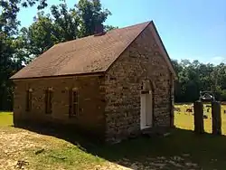 Dog Branch School |
September 8, 1992 (#92001177) |
South of U.S. Highway 412, approximately 3 miles east of Osage 36°12′12″N 93°21′28″W |
Osage | |
| 13 | Eureka Springs Cemetery | June 8, 2018 (#100002535) |
NW of jct. of Cty. Rd. 205 & US 62 E 36°23′52″N 93°42′17″W |
Eureka Springs | ||
| 14 | Eureka Springs Historic District |  Eureka Springs Historic District |
December 18, 1970 (#70000118) |
Most of Eureka Springs and its environs; also S. Main 36°24′06″N 93°44′18″W |
Eureka Springs | South Main represents a boundary increase of January 29, 1979 |
| 15 | Green Forest Water Tower |  Green Forest Water Tower |
May 22, 2007 (#07000470) |
Southeast of the junction of S. Springfield St. and E. 2nd St. 36°20′11″N 93°26′08″W |
Green Forest | |
| 16 | Lake Leatherwood Park Historic District |  Lake Leatherwood Park Historic District |
November 24, 1998 (#98001346) |
Between U.S. Highway 62 and Highway 23 at Leatherwood Lake 36°26′07″N 93°45′37″W |
Eureka Springs | |
| 17 | Lake Leatherwood Recreational Facilities |  Lake Leatherwood Recreational Facilities |
August 12, 1992 (#90001942) |
End of County Road 61 36°26′04″N 93°45′34″W |
Eureka Springs | |
| 18 | Mo-Ark Baptist Academy |  Mo-Ark Baptist Academy |
September 27, 1996 (#96001030) |
South of the western terminus of Park St. 36°29′52″N 93°23′57″W |
Blue Eye | |
| 19 | Mulladay Hollow Bridge |  Mulladay Hollow Bridge |
April 6, 1990 (#90000531) |
County Road 61, over Mulladay Hollow Creek 36°26′06″N 93°45′56″W |
Eureka Springs | |
| 20 | Old U.S. 62, Busch Segment | 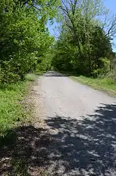 Old U.S. 62, Busch Segment |
September 25, 2008 (#08000942) |
County Roads 107, 109, and 173 36°26′55″N 93°49′47″W |
Busch | |
| 21 | Quigley's Castle |  Quigley's Castle |
May 30, 2003 (#03000467) |
274 Quigley's Castle Rd. 36°20′46″N 93°45′21″W |
Eureka Springs | |
| 22 | Sanitarium Lake Bridges Historic District |  Sanitarium Lake Bridges Historic District |
January 19, 2010 (#09001238) |
County Road 317, approximately 0.5 miles south of Greenwood Hollow Rd. 36°22′30″N 93°44′02″W |
Eureka Springs | |
| 23 | Shady Grove Delmar Church and School |  Shady Grove Delmar Church and School |
January 27, 2015 (#14001197) |
Cty. Rd. 933, 1.4 mi. W. of Delmar 36°10′07″N 93°21′44″W |
Delmar vicinity | |
| 24 | Stamps Store | 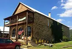 Stamps Store |
September 5, 1990 (#90001380) |
AR 103 south of U.S. Highway 412 36°10′58″N 93°24′16″W |
Osage | |
| 25 | Tall Pines Motor Inn |  Tall Pines Motor Inn |
January 15, 1999 (#98001603) |
U.S. Highway 62 36°24′18″N 93°45′08″W |
Eureka Springs | |
| 26 | Thorncrown Chapel |  Thorncrown Chapel |
April 28, 2000 (#97000452) |
U.S. Highway 62, 0.5 miles west of Eureka Springs 36°25′01″N 93°46′13″W |
Eureka Springs | |
| 27 | U.S. 62 White River Bridge |  U.S. 62 White River Bridge |
January 24, 2008 (#07001421) |
U.S. Highway 62, approximately ¼ mile south of County Road 212 36°27′04″N 93°49′24″W |
Eureka Springs | |
| 28 | Winona Church and School |  Winona Church and School |
June 5, 1991 (#91000688) |
Rockhouse Rd. 36°19′58″N 93°40′54″W |
Winona Springs | |
| 29 | Yell Masonic Lodge Hall | 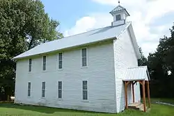 Yell Masonic Lodge Hall |
November 1, 1984 (#84000178) |
CR 912, off U.S. Route 412 36°15′49″N 93°19′19″W |
Carrollton | Two-story wood-frame meeting house built in 1876. |
Former listing
| Landmark name | Image | Dates | Location | City or Town | Summary | |
|---|---|---|---|---|---|---|
| 1 | James C. Chaney House | September 20, 2006 (delisted) | Osage |
See also
| Wikimedia Commons has media related to National Register of Historic Places in Carroll County, Arkansas. |
References
- The latitude and longitude information provided in this table was derived originally from the National Register Information System, which has been found to be fairly accurate for about 99% of listings. Some locations in this table may have been corrected to current GPS standards.
- "National Register of Historic Places: Weekly List Actions". National Park Service, United States Department of the Interior. Retrieved on February 5, 2021.
- Numbers represent an alphabetical ordering by significant words. Various colorings, defined here, differentiate National Historic Landmarks and historic districts from other NRHP buildings, structures, sites or objects.
- "National Register Information System". National Register of Historic Places. National Park Service. March 13, 2009.
- The eight-digit number below each date is the number assigned to each location in the National Register Information System database, which can be viewed by clicking the number.
| Topics | |
|---|---|
| Lists by state |
|
| Lists by insular areas | |
| Lists by associated state | |
| Other areas | |
| Related | |
| |
Municipalities and communities of Carroll County, Arkansas, United States | ||
|---|---|---|
| Cities | Map of Arkansas highlighting Carroll County | |
| Towns | ||
| Townships | ||
| Unincorporated communities | ||
| Ghost towns |
| |
| Footnotes | ‡This populated place also has portions in an adjacent county or counties | |
| ||
This article is issued from Wikipedia. The text is licensed under Creative Commons - Attribution - Sharealike. Additional terms may apply for the media files.