National Register of Historic Places listings in Sebastian County, Arkansas
This is a list of the National Register of Historic Places listings in Sebastian County, Arkansas.

Location of Sebastian County in Arkansas
This is intended to be a complete list of the properties and districts on the National Register of Historic Places in Sebastian County, Arkansas, United States. The locations of National Register properties and districts for which the latitude and longitude coordinates are included below, may be seen in a map.[1]
There are 59 properties and districts listed on the National Register in the county, one of which, the Fort Smith National Historic Site, is also a National Historic Landmark District. Another 7 properties were once listed but have been removed.
- This National Park Service list is complete through NPS recent listings posted February 5, 2021.[2]
Current listings
| [3] | Name on the Register[4] | Image | Date listed[5] | Location | City or town | Description |
|---|---|---|---|---|---|---|
| 1 | Harold Adams Office Building | 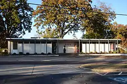 Harold Adams Office Building |
September 30, 2014 (#14000796) |
2101 S. H St. 35°22′31″N 94°24′38″W |
Fort Smith | |
| 2 | Atkinson-Williams Warehouse | 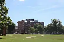 Atkinson-Williams Warehouse |
December 13, 1979 (#79000458) |
320 Rogers Ave. 35°23′15″N 94°25′42″W |
Fort Smith | |
| 3 | William Ayers House | 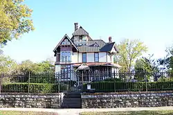 William Ayers House |
July 8, 1999 (#99000792) |
820 N. 12th St. 35°23′56″N 94°24′47″W |
Fort Smith | |
| 4 | Birney Safety Streetcar No. 224 | .jpg.webp) Birney Safety Streetcar No. 224 |
May 19, 1994 (#94000465) |
100 S. 4th St. 35°23′09″N 94°25′47″W |
Fort Smith | |
| 5 | Bonneville House | 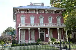 Bonneville House |
September 22, 1971 (#71000128) |
318 N. 7th St. 35°23′21″N 94°25′14″W |
Fort Smith | |
| 6 | C.R. Breckinridge House | 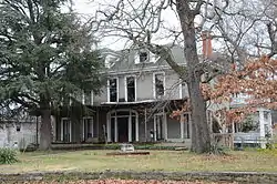 C.R. Breckinridge House |
August 7, 1979 (#79000460) |
504 N. 16th St. 35°23′09″N 94°24′47″W |
Fort Smith | |
| 7 | Camp Chaffee Tank Destroyer Battalion Historic District | 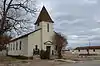 Camp Chaffee Tank Destroyer Battalion Historic District |
September 23, 2011 (#11000693) |
Roughly bounded by Terry St., Ward Ave., Ellis St. & Darby Ave.; Roughly bounded by Ward Ave., RR spur, Taylor Ave. & Terry St. 35°23′09″N 94°24′47″W |
Fort Smith | World War II Home Front Efforts in Arkansas, MPS; second set of addresses represents a boundary increase April 6, 2014 |
| 8 | Oscar Chambers House | 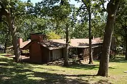 Oscar Chambers House |
June 7, 2016 (#16000320) |
3200 S. Dallas St. 35°21′11″N 94°23′57″W |
Fort Smith | |
| 9 | Christ the King Church | 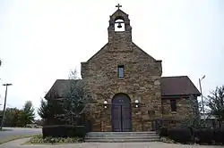 Christ the King Church |
December 22, 1982 (#82000936) |
Greenwood Ave. at S. South St. 35°21′53″N 94°24′15″W |
Fort Smith | |
| 10 | W.H.H. Clayton House | 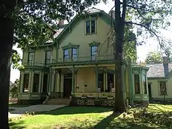 W.H.H. Clayton House |
September 4, 1970 (#70000130) |
514 N. 6th St. 35°23′30″N 94°25′15″W |
Fort Smith | |
| 11 | Commercial Hotel | 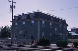 Commercial Hotel |
May 7, 1973 (#73000391) |
123 N. 1st St. 35°23′24″N 94°25′44″W |
Fort Smith | |
| 12 | Coop Creek Bridge | 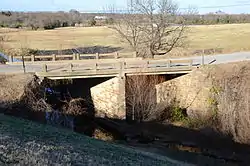 Coop Creek Bridge |
May 5, 1995 (#95000566) |
County Road 236 over Coop Creek 35°03′27″N 94°14′10″W |
Mansfield | |
| 13 | Dr. Neil Crow Sr. House | September 18, 2018 (#100002956) |
19 Berry Hill Rd. 35°21′28″N 94°23′06″W |
Fort Smith | ||
| 14 | Dodson Avenue Methodist Episcopal Church | 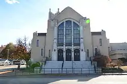 Dodson Avenue Methodist Episcopal Church |
March 2, 2006 (#06000082) |
1922 Dodson Ave. 35°22′19″N 94°24′45″W |
Fort Smith | |
| 15 | Echols Memorial Christian Church |  Echols Memorial Christian Church |
February 21, 2006 (#06000070) |
2801 Alabama 35°23′03″N 94°24′06″W |
Fort Smith | |
| 16 | Elmwood Cemetery | 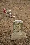 Elmwood Cemetery |
January 26, 2018 (#100002004) |
SW of intersection of Zero & S 24th Sts. 35°19′39″N 94°24′44″W |
Fort Smith | |
| 17 | Ferguson-Calderara House | December 11, 1979 (#79000461) |
214 N. 14th St. 35°23′01″N 94°25′00″W |
Fort Smith | Note: The house is listed under the wrong address. The actual address is 211 N. 14th. | |
| 18 | First Evangelical Lutheran Church |  First Evangelical Lutheran Church |
January 24, 2017 (#100000558) |
1115 N. D St. 35°23′13″N 94°25′00″W |
Fort Smith | |
| 19 | Fishback Neighborhood Historic District | 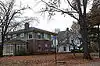 Fishback Neighborhood Historic District |
September 23, 2010 (#10000780) |
Roughly bounded by Rogers, Greenwood, and Dodson Aves. and 31st St.; also roughly bounded by Rogers & Dodson Aves., S. 24th, S. 26th & J Sts. 35°22′25″N 94°24′05″W |
Fort Smith | Second set of addresses represents a boundary increase February 3, 2015 |
| 20 | Fitzgerald Historic District | 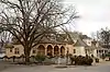 Fitzgerald Historic District |
January 26, 2018 (#100002005) |
Roughly bounded by Rogers & Dodson Aves., S I, S 22nd & S 25th Sts. 35°22′32″N 94°24′28″W |
Fort Smith | |
| 21 | Fort Smith Masonic Temple | 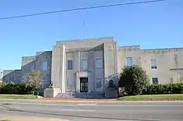 Fort Smith Masonic Temple |
November 20, 1992 (#92001624) |
200 N. 11th St. 35°23′09″N 94°25′06″W |
Fort Smith | |
| 22 | Fort Smith National Cemetery | 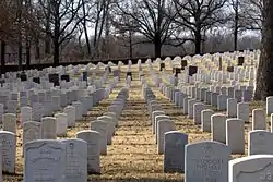 Fort Smith National Cemetery |
May 20, 1999 (#99000578) |
522 Garland Ave. and S. 6th St. 35°22′59″N 94°25′43″W |
Fort Smith | |
| 23 | Fort Smith National Historic Site | 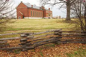 Fort Smith National Historic Site |
October 15, 1966 (#66000202) |
Southern side of Garland Avenue[6] 35°23′17″N 94°25′52″W |
Fort Smith | |
| 24 | Fort Smith US Post Office and Courthouse | 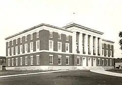 Fort Smith US Post Office and Courthouse |
December 13, 1999 (#99001406) |
30 S. 6th St. 35°23′10″N 94°25′36″W |
Fort Smith | |
| 25 | Fort Smith's Belle Grove Historic District | 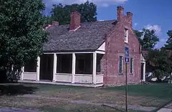 Fort Smith's Belle Grove Historic District |
July 16, 1973 (#73000392) |
Bounded by N. 4th, N. 9th, N. B, and N. H Sts.[7] 35°23′27″N 94°25′15″W |
Fort Smith | |
| 26 | Ft. Smith Confederate Monument | 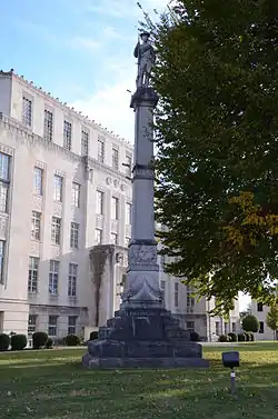 Ft. Smith Confederate Monument |
April 26, 1996 (#96000460) |
Courthouse Lawn, near the junction of 6th St. and Rogers Ave. 35°23′14″N 94°25′40″W |
Fort Smith | |
| 27 | Greenwood Gymnasium | 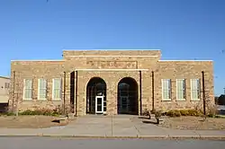 Greenwood Gymnasium |
June 15, 2011 (#11000357) |
300 E. Gary St. 35°13′08″N 94°15′40″W |
Greenwood | New Deal Recovery Efforts in Arkansas MPS |
| 28 | Greenwood Presbyterian Church | 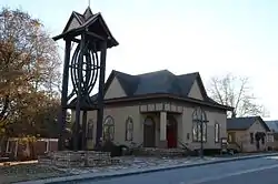 Greenwood Presbyterian Church |
October 1, 2008 (#08000955) |
103 W. Denver St. 35°12′57″N 94°15′28″W |
Greenwood | |
| 29 | Hackett Creek Bridge | 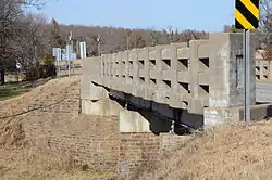 Hackett Creek Bridge |
May 5, 1995 (#95000568) |
Highway 45 over Hackett Creek 35°11′35″N 94°24′51″W |
Hackett | |
| 30 | Robert Atlas Harper House | 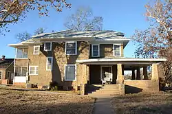 Robert Atlas Harper House |
June 2, 2000 (#00000612) |
201 N. Main St. 35°12′58″N 94°15′22″W |
Greenwood | |
| 31 | Hartford Commercial Historic District | 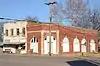 Hartford Commercial Historic District |
July 15, 2009 (#09000514) |
Buildings on the eastern side of Broadway St. from 12 N. Broadway to 106 S. Broadway 35°01′21″N 94°22′53″W |
Hartford | |
| 32 | Hartford Water Tower |  Hartford Water Tower |
January 24, 2008 (#07001434) |
Pine and 1st. Sts. 35°01′30″N 94°22′37″W |
Hartford | |
| 33 | Jones Memorial Methodist Church | 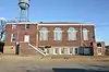 Jones Memorial Methodist Church |
January 21, 2011 (#10001157) |
400 E. Main St. 35°01′22″N 94°22′38″W |
Hartford | |
| 34 | Joseph Knoble Brewery | 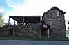 Joseph Knoble Brewery |
March 24, 1972 (#72000209) |
N. 3rd and E Sts. 35°23′33″N 94°25′22″W |
Fort Smith | |
| 35 | Maness Schoolhouse | 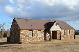 Maness Schoolhouse |
May 29, 2003 (#03000466) |
8801 Wells Lake Rd. 35°17′50″N 94°20′05″W |
Barling | |
| 36 | Maumelle Ordnance Works Locomotive #1 | 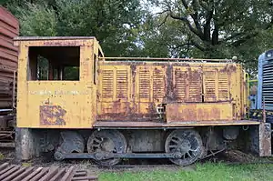 Maumelle Ordnance Works Locomotive #1 |
September 20, 2006 (#06000835) |
100 S. 4th St. 35°23′11″N 94°25′52″W |
Fort Smith | |
| 37 | May-Lecta-Sweet Historic District | 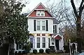 May-Lecta-Sweet Historic District |
July 2, 2008 (#08000597) |
Roughly bounded by May Ave., Rogers Ave., Sweet Ave., and Kinkead Ave. 35°22′43″N 94°24′03″W |
Fort Smith | |
| 38 | Milltown Bridge | 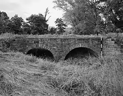 Milltown Bridge |
April 6, 1990 (#90000527) |
County Road 77, 1.5 miles west of Milltown 35°09′30″N 94°10′26″W |
Milltown | |
| 39 | William J. Murphy House | 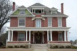 William J. Murphy House |
August 7, 1979 (#79000462) |
923 N. 13th St. 35°23′21″N 94°24′44″W |
Fort Smith | |
| 40 | New Theatre | 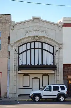 New Theatre |
November 18, 1999 (#99001351) |
9 N. 10th St. 35°23′07″N 94°25′18″W |
Fort Smith | |
| 41 | Oak Cemetery | 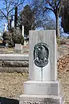 Oak Cemetery |
June 2, 1995 (#95000665) |
Southeast of the junction of Greenwood and Dodson Aves. 35°22′09″N 94°24′05″W |
Fort Smith | |
| 42 | Old Arkansas 22, Barling Segment |  Old Arkansas 22, Barling Segment |
May 22, 2007 (#07000439) |
Mayo Rd. 35°20′30″N 94°18′56″W |
Barling | |
| 43 | Old Huntington Jail | 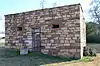 Old Huntington Jail |
September 24, 2008 (#08000944) |
223 E. Broadway St. 35°04′56″N 94°15′43″W |
Huntington | |
| 44 | Old Sebastian County Jail | 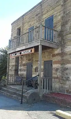 Old Sebastian County Jail |
December 1, 1994 (#94001413) |
Highway 10, east of the County Courthouse 35°12′43″N 94°15′16″W |
Greenwood | |
| 45 | Old US 71-Jenny Lind Segment | 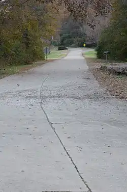 Old US 71-Jenny Lind Segment |
September 23, 2009 (#09000738) |
Doraul Acres Ln. and part of Mt. Nebo Rd. west of U.S. Route 71 35°13′51″N 94°19′04″W |
Jenny Lind | |
| 46 | Horace Franklin Rogers House | 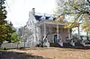 Horace Franklin Rogers House |
May 2, 1979 (#79000463) |
2900 Rogers Ave. 35°22′32″N 94°24′00″W |
Fort Smith | |
| 47 | St. Louis San Francisco (Frisco) Railway Steam Locomotive #4003 | 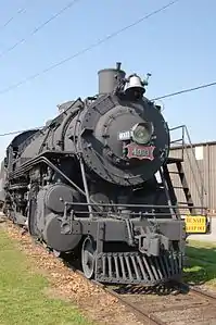 St. Louis San Francisco (Frisco) Railway Steam Locomotive #4003 |
July 12, 2004 (#04000500) |
100 S. 4th St. 35°23′07″N 94°25′47″W |
Fort Smith | |
| 48 | Saint Scholastica Convent | 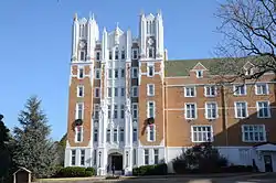 Saint Scholastica Convent |
March 2, 2006 (#06000084) |
1301 S. Albert Pike 35°22′17″N 94°23′03″W |
Fort Smith | |
| 49 | Sebastian County Courthouse-Ft. Smith City Hall | 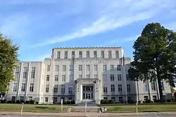 Sebastian County Courthouse-Ft. Smith City Hall |
June 8, 1993 (#93000484) |
100 S. 6th St. 35°23′08″N 94°25′34″W |
Fort Smith | |
| 50 | Sebastian County Road 4G Bridge | 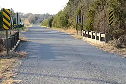 Sebastian County Road 4G Bridge |
May 5, 1995 (#95000569) |
County Road 4G over a tributary of Sugar Loaf Creek 34°59′25″N 94°25′07″W |
West Hartford | |
| 51 | Tillman Shaw House | 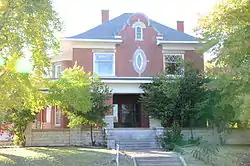 Tillman Shaw House |
May 16, 1988 (#88000561) |
500 S. 19th St. 35°22′44″N 94°24′47″W |
Fort Smith | |
| 52 | South Side Baptist Church |  South Side Baptist Church |
March 2, 2006 (#06000083) |
2400 Dodson Ave. 35°22′19″N 94°24′24″W |
Fort Smith | |
| 53 | James Sparks House | 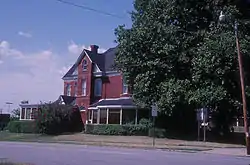 James Sparks House |
September 14, 1972 (#72000210) |
201 N. 14th St. 35°23′08″N 94°24′55″W |
Fort Smith | |
| 54 | Spirit of the American Doughboy Monument-Fort Smith | 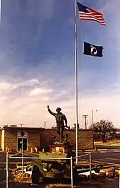 Spirit of the American Doughboy Monument-Fort Smith |
May 23, 1997 (#97000454) |
4901 Midland Ave. 35°25′31″N 94°22′32″W |
Fort Smith | |
| 55 | State Highway 96 Bridge | 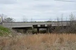 State Highway 96 Bridge |
May 5, 1995 (#95000564) |
Highway 96 over a tributary of Vache Grasse Creek 35°13′08″N 94°13′16″W |
Greenwood | |
| 56 | United Hebrew Congregation Tilles Memorial Temple | January 11, 2021 (#100006035) |
126 North 47th St. 35°22′32″N 94°22′47″W |
Fort Smith | ||
| 57 | United States Air Force Locomotive #1246 | 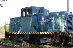 United States Air Force Locomotive #1246 |
September 20, 2006 (#06000840) |
100 S. 4th St. 35°23′09″N 94°25′52″W |
Fort Smith | |
| 58 | Robert Wanslow House |  Robert Wanslow House |
January 26, 2018 (#100002007) |
2815 S Q St. 35°21′57″N 94°24′07″W |
Fort Smith | |
| 59 | West Garrison Avenue Historic District |  West Garrison Avenue Historic District |
April 26, 1979 (#79000464) |
100-525 Garrison Ave.; also roughly bounded by 13th St., N. B, 1st St., and Parker Ave. 35°23′18″N 94°25′37″W |
Fort Smith | Second set of boundaries represents a boundary increase of June 6, 2001 |
Former listings
| [3] | Name on the Register | Image | Date listed | Date removed | Location | City or town | Summary |
|---|---|---|---|---|---|---|---|
| 1 | Karl Edward Bracht House | May 2, 1979 (#79000459) | October 18, 2002 | 315 N. 13th St. 35°23′05″N 94°24′59″W |
Fort Smith | Demolished in or before 2009 | |
| 2 | Josiah Foster Building | January 20, 1978 (#78000631) | September 14, 2002 | 222 Garrison Avenue |
Fort Smith | Demolished by 1996 tornado. | |
| 3 | Jenny Lind Bridge | Jenny Lind Bridge |
April 6, 1990 (#90000530) | September 24, 2004 | Howard Hill School Road |
Jerry Lind vicinity | |
| 4 | Angus McLeod House | December 8, 1978 (#78000632) | January 26, 2018 | 912 N. 13th St. 35°23′20″N 94°24′45″W |
Fort Smith | House burned on July 7, 2010 and subsequently demolished in 2011 | |
| 5 | Old US 71-Devil's Backbone Segment | May 26, 2004 (#04000488) | January 22, 2009 | S. Coker St. from just SW of Stewart Court to current US 71 |
Greenwood | ||
| 6 | Sebastian County Road 5G Bridge | May 5, 1995 (#95000567) | October 7, 2009 | County Road 5G over a tributary of West Creek 35°00′57″N 94°23′37″W |
Hartford | ||
| 7 | Vache Grasse Creek Bridge | Vache Grasse Creek Bridge |
May 5, 1995 (#95000563) | January 14, 2002 | Co. Rd. 77A over Vache Grasse Creek |
Milltown vicinity |
See also
| Wikimedia Commons has media related to National Register of Historic Places in Sebastian County, Arkansas. |
References
- The latitude and longitude information provided in this table was derived originally from the National Register Information System, which has been found to be fairly accurate for about 99% of listings. Some locations in this table may have been corrected to current GPS standards.
- "National Register of Historic Places: Weekly List Actions". National Park Service, United States Department of the Interior. Retrieved on February 5, 2021.
- Numbers represent an alphabetical ordering by significant words. Various colorings, defined here, differentiate National Historic Landmarks and historic districts from other NRHP buildings, structures, sites or objects.
- "National Register Information System". National Register of Historic Places. National Park Service. March 13, 2009.
- The eight-digit number below each date is the number assigned to each location in the National Register Information System database, which can be viewed by clicking the number.
- Location derived from this National Park Service map; the NRIS lists the site as "Address unknown at this time"
- Location derived from this Arkansas Historic Preservation document; the NRIS lists the site as "Address unknown at this time"
| Topics | |
|---|---|
| Lists by state |
|
| Lists by insular areas | |
| Lists by associated state | |
| Other areas | |
| Related | |
| |
Municipalities and communities of Sebastian County, Arkansas, United States | ||
|---|---|---|
| Cities | Map of Arkansas highlighting Sebastian County | |
| Towns | ||
| Unincorporated communities | ||
| Footnotes | ‡This populated place also has portions in an adjacent county or counties | |
| ||
This article is issued from Wikipedia. The text is licensed under Creative Commons - Attribution - Sharealike. Additional terms may apply for the media files.