National Register of Historic Places listings in Scott County, Arkansas
This is a list of the National Register of Historic Places listings in Scott County, Arkansas.
Location of Scott County in Arkansas
This is intended to be a complete list of the properties and districts on the National Register of Historic Places in Scott County, Arkansas, United States. The locations of National Register properties and districts for which the latitude and longitude coordinates are included below, may be seen in a map.[1]
There are 14 properties and districts listed on the National Register in the county.
- This National Park Service list is complete through NPS recent listings posted January 29, 2021.[2]
Current listings
| [3] | Name on the Register[4] | Image | Date listed[5] | Location | City or town | Description |
|---|---|---|---|---|---|---|
| 1 | Bates School | 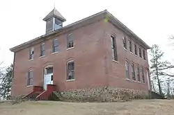 Bates School |
February 21, 2006 (#06000081) |
1074 Bates School Rd. 34°54′24″N 94°22′53″W |
Bates | |
| 2 | Cold Spring | 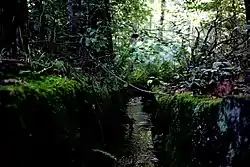 Cold Spring |
October 21, 1993 (#93001082) |
County Road 93 northeast of Waldron in the Ouachita National Forest 34°57′39″N 93°53′31″W |
Waldron | |
| 3 | Dooley Dipping Vat | June 7, 2006 (#06000466) |
Off Dooley Rd. east of Forest Service Road 925 34°46′00″N 94°01′10″W |
Boles | ||
| 4 | C.E. Forrester House | 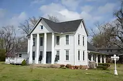 C.E. Forrester House |
September 3, 1998 (#98001127) |
140 Danville Rd. 34°53′55″N 94°05′02″W |
Waldron | |
| 5 | Mount Pleasant Methodist Church | 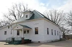 Mount Pleasant Methodist Church |
June 5, 1986 (#86001207) |
Highway 248 34°55′22″N 94°01′26″W |
Waldron | |
| 6 | Parks School | 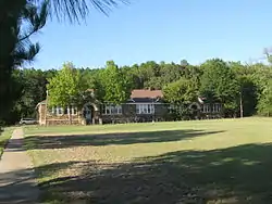 Parks School |
June 6, 2002 (#02000602) |
Highway 28 34°48′11″N 93°57′34″W |
Parks | |
| 7 | Poteau Work Center | 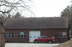 Poteau Work Center |
October 20, 1993 (#93001094) |
Poteau Work Center access road off Highway 80 34°53′40″N 94°04′06″W |
Waldron | |
| 8 | Poteau Work Center Residence No. 2 | 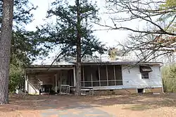 Poteau Work Center Residence No. 2 |
October 20, 1993 (#93001095) |
Poteau Work Center access road off Highway 80 34°53′41″N 94°04′09″W |
Waldron | |
| 9 | Powder Magazine | October 20, 1993 (#93001096) |
County Road 96 north of Blue Ball, Ouachita National Forest 35°00′08″N 93°43′07″W |
Blue Ball | ||
| 10 | Scott City County Jail, (Old) | .JPG.webp) Scott City County Jail, (Old) |
May 16, 2002 (#02000486) |
125 W. 2nd St. 34°53′56″N 94°05′29″W |
Waldron | |
| 11 | Scott County Courthouse | 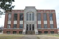 Scott County Courthouse |
November 13, 1989 (#89001971) |
Courthouse Square[6] 34°53′57″N 94°05′30″W |
Waldron | |
| 12 | Square Rock Dipping Vat | June 7, 2006 (#06000464) |
Northwest of the junction of Forest Service Roads 296 and 565A 34°57′32″N 93°59′42″W |
Waldron | ||
| 13 | Waldron Commercial Historic District | 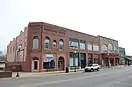 Waldron Commercial Historic District |
September 25, 2008 (#08000943) |
S. Main St. between 1st and 5th Sts. and Washington St. between 2nd and 3rd Sts. 34°53′57″N 94°05′28″W |
Waldron | |
| 14 | Waldron School Historic District | September 27, 2019 (#100004437) |
403 and 429 W. 5th St. 34°53′51″N 94°05′45″W |
Waldron |
Former listings
| [3] | Name on the Register | Image | Date listed | Date removed | Location | City or town | Summary |
|---|---|---|---|---|---|---|---|
| 1 | John T. Forrester House | (#80000786) | October 18, 2002 | 115 Danville Street |
Waldron |
See also
| Wikimedia Commons has media related to National Register of Historic Places in Scott County, Arkansas. |
References
- The latitude and longitude information provided in this table was derived originally from the National Register Information System, which has been found to be fairly accurate for about 99% of listings. Some locations in this table may have been corrected to current GPS standards.
- "National Register of Historic Places: Weekly List Actions". National Park Service, United States Department of the Interior. Retrieved on January 29, 2021.
- Numbers represent an alphabetical ordering by significant words. Various colorings, defined here, differentiate National Historic Landmarks and historic districts from other NRHP buildings, structures, sites or objects.
- "National Register Information System". National Register of Historic Places. National Park Service. March 13, 2009.
- The eight-digit number below each date is the number assigned to each location in the National Register Information System database, which can be viewed by clicking the number.
- Location derived from the Arkansas Historic Preservation Program's profile of the courthouse; the NRIS lists the site as "Address Unknown"
| Topics | |
|---|---|
| Lists by state |
|
| Lists by insular areas | |
| Lists by associated state | |
| Other areas | |
| Related | |
| |
Municipalities and communities of Scott County, Arkansas, United States | ||
|---|---|---|
| Cities | Map of Arkansas highlighting Scott County | |
| Unincorporated communities | ||
| Ghost towns | ||
| Footnotes | ‡This populated place also has portions in an adjacent county or counties | |
| ||
This article is issued from Wikipedia. The text is licensed under Creative Commons - Attribution - Sharealike. Additional terms may apply for the media files.