National Register of Historic Places listings in Prairie County, Arkansas
This is a list of the National Register of Historic Places listings in Prairie County, Arkansas.
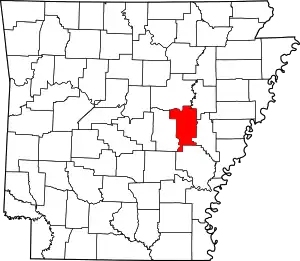
Location of Prairie County in Arkansas
This is intended to be a complete list of the properties on the National Register of Historic Places in Prairie County, Arkansas, United States.
There are 14 properties listed on the National Register in the county. Another three properties were once listed but have been removed.
- This National Park Service list is complete through NPS recent listings posted February 5, 2021.[1]
Current listings
| [2] | Name on the Register[3] | Image | Date listed[4] | Location | City or town | Description |
|---|---|---|---|---|---|---|
| 1 | American Legion Hut-Des Arc |  American Legion Hut-Des Arc |
June 9, 1995 (#95000692) |
206 Erwin St. 34°58′34″N 91°29′41″W |
Des Arc | |
| 2 | Bethel House |  Bethel House |
December 22, 1982 (#82000872) |
Erwin and 2nd Sts. 34°58′32″N 91°29′40″W |
Des Arc | |
| 3 | Bedford Brown Bethell House | 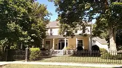 Bedford Brown Bethell House |
December 4, 1978 (#78000619) |
2nd and Curran Sts. 34°58′30″N 91°29′39″W |
Des Arc | |
| 4 | Castleberry Hotel |  Castleberry Hotel |
September 19, 2007 (#07000960) |
61 Main St. 34°47′15″N 91°27′31″W |
De Valls Bluff | 1925 Craftsman style hotel |
| 5 | De Valls Bluff Waterworks |  De Valls Bluff Waterworks |
September 20, 2007 (#07000969) |
Junction of Hazel and Rumbaugh Sts. 34°46′58″N 91°27′47″W |
De Valls Bluff | 1936 Public Works Administration waterworks |
| 6 | First Presbyterian Church | 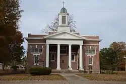 First Presbyterian Church |
June 14, 1990 (#90000897) |
Junction of Main and 5th Sts. 34°58′38″N 91°29′52″W |
Des Arc | |
| 7 | Frith-Plunkett House |  Frith-Plunkett House |
June 10, 1982 (#82002127) |
8th and Main Sts. 34°58′37″N 91°30′12″W |
Des Arc | |
| 8 | Kocourek and Son Hardware |  Kocourek and Son Hardware |
May 26, 2015 (#15000257) |
110 E. North Front St. 34°46′52″N 91°34′49″W |
Hazen | |
| 9 | Oak Grove Cemetery | 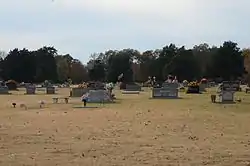 Oak Grove Cemetery |
May 22, 2001 (#01000507) |
7th St. 34°58′47″N 91°30′07″W |
Des Arc | |
| 10 | Prairie County Courthouse | 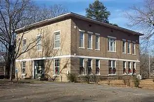 Prairie County Courthouse |
April 20, 1995 (#95000457) |
Junction of Magnolia and Prairie Sts. 34°46′59″N 91°27′44″W |
De Valls Bluff | 1939 courthouse built by Works Progress Administration using salvaged materials from 1910 structure |
| 11 | Prairie County Courthouse | 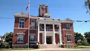 Prairie County Courthouse |
April 18, 1977 (#77000266) |
Main St. 34°58′39″N 91°29′39″W |
Des Arc | |
| 12 | Rock Island Depot |  Rock Island Depot |
December 22, 1987 (#87002285) |
U.S. Route 70 34°46′50″N 91°34′45″W |
Hazen | |
| 13 | St. Elizabeth's Catholic Church |  St. Elizabeth's Catholic Church |
September 23, 2009 (#09000744) |
Northeastern corner of the junction of Sycamore and Mason Sts. 34°46′54″N 91°27′34″W |
De Valls Bluff | |
| 14 | Wingmead | May 23, 2011 (#11000302) |
West side of AR 33, ½ mile south of Eason Rd. 34°39′33″N 91°27′23″W |
Roe |
Former listings
| [2] | Name on the Register | Image | Date listed | Date removed | Location | City or town | Summary |
|---|---|---|---|---|---|---|---|
| 1 | Barrett-Rogers Building | July 23, 1998 (#98000881) | October 7, 2009 | 100 N. Hazen Ave. 34°46′53″N 91°34′48″W |
Hazen | ||
| 2 | DeValls Bluff First Baptist Church | November 20, 1992 (#92001616) | September 17, 1999 | Jct. of Prairie and Mason Sts. |
De Valls Bluff | ||
| 3 | White River Bridge at DeValls Bluff | White River Bridge at DeValls Bluff |
April 9, 1990 (#90000514) | June 1, 2005 | U.S. Route 70 over the White River |
De Valls Bluff |
See also
| Wikimedia Commons has media related to National Register of Historic Places in Prairie County, Arkansas. |
References
- "National Register of Historic Places: Weekly List Actions". National Park Service, United States Department of the Interior. Retrieved on February 5, 2021.
- Numbers represent an alphabetical ordering by significant words. Various colorings, defined here, differentiate National Historic Landmarks and historic districts from other NRHP buildings, structures, sites or objects.
- "National Register Information System". National Register of Historic Places. National Park Service. March 13, 2009.
- The eight-digit number below each date is the number assigned to each location in the National Register Information System database, which can be viewed by clicking the number.
| Topics | |
|---|---|
| Lists by state |
|
| Lists by insular areas | |
| Lists by associated state | |
| Other areas | |
| Related | |
| |
Municipalities and communities of Prairie County, Arkansas, United States | ||
|---|---|---|
| Cities | Map of Arkansas highlighting Prairie County | |
| Towns | ||
| Unincorporated communities |
| |
| Ghost town |
| |
| Footnotes | ‡This populated place also has portions in an adjacent county of counties | |
| ||
This article is issued from Wikipedia. The text is licensed under Creative Commons - Attribution - Sharealike. Additional terms may apply for the media files.