National Register of Historic Places listings in Marion County, Arkansas
This is a list of the National Register of Historic Places listings in Marion County, Arkansas.
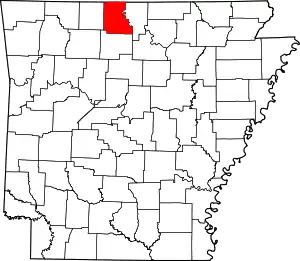
Location of Marion County in Arkansas
This is intended to be a complete list of the properties and districts on the National Register of Historic Places in Marion County, Arkansas, United States. The locations of National Register properties and districts for which the latitude and longitude coordinates are included below, may be seen in a map.[1]
There are 22 properties and districts listed on the National Register in the county, and one former listing.
- This National Park Service list is complete through NPS recent listings posted February 5, 2021.[2]
Current listings
| [3] | Name on the Register[4] | Image | Date listed[5] | Location | City or town | Description |
|---|---|---|---|---|---|---|
| 1 | Aggie Hall | 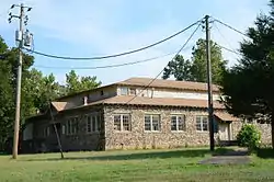 Aggie Hall |
September 4, 1992 (#92001115) |
County Road 9 36°08′30″N 92°46′51″W |
Bruno | |
| 2 | Aggie Workshop |  Aggie Workshop |
September 4, 1992 (#92001113) |
Highway 235S 36°08′32″N 92°46′51″W |
Bruno | |
| 3 | J.C. Berry's Dry Goods Store | 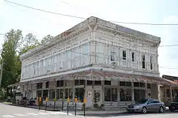 J.C. Berry's Dry Goods Store |
May 30, 2003 (#03000468) |
331 Old South Main St. 36°13′29″N 92°40′53″W |
Yellville | |
| 4 | Buffalo River State Park | 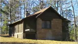 Buffalo River State Park |
October 20, 1988 (#78003461) |
Buffalo National River 36°04′41″N 92°34′06″W |
Yellville | |
| 5 | Carter-Jones House | 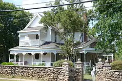 Carter-Jones House |
July 21, 1987 (#87000979) |
30 Carter St. 36°13′37″N 92°41′00″W |
Yellville | |
| 6 | Cold Springs School | 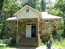 Cold Springs School |
October 29, 1992 (#92001494) |
Cold Spring Hollow, just east of the Buffalo National River 36°04′53″N 92°28′01″W |
Big Flat | |
| 7 | Cotter Tunnel | September 19, 2007 (#07000961) |
Under U.S. Route 62 east of County Road 724 36°16′41″N 92°32′53″W |
Cotter | ||
| 8 | Cowdrey House | 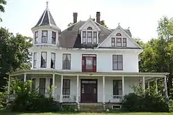 Cowdrey House |
July 20, 1978 (#78000609) |
1 Valley St. 36°13′27″N 92°40′48″W |
Yellville | |
| 9 | Crooked Creek Bridge | 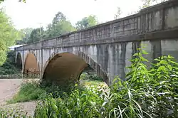 Crooked Creek Bridge |
January 21, 2010 (#09001253) |
U.S. Route 62S over Crooked Creek 36°14′53″N 92°50′38″W |
Pyatt | |
| 10 | Eros School Building | 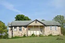 Eros School Building |
September 4, 1992 (#92001110) |
County Road 9 36°10′58″N 92°51′00″W |
Eros | |
| 11 | Estes-Williams American Legion Hut #61 | February 16, 2001 (#01000111) |
U.S. Highways 62/412 36°13′34″N 92°40′49″W |
Yellville | ||
| 12 | Fairview School Building | 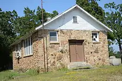 Fairview School Building |
September 4, 1992 (#92001116) |
County Road 203 36°20′02″N 92°36′20″W |
Fairview | |
| 13 | Hirst-Mathew Hall | 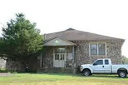 Hirst-Mathew Hall |
September 4, 1992 (#92001114) |
Highway 235S 36°08′31″N 92°46′53″W |
Bruno | |
| 14 | William Jasper Johnson House | September 12, 2018 (#100002949) |
N of jct. of Lakeshore Rd. & Honeysuckle Ave. 36°23′05″N 92°34′40″W |
Bull Shoals | ||
| 15 | Layton Building | 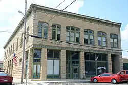 Layton Building |
April 26, 1978 (#78000610) |
1110 Mill St. 36°13′32″N 92°40′57″W |
Yellville | |
| 16 | Marion County Courthouse | 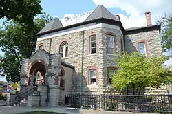 Marion County Courthouse |
May 19, 1994 (#94000471) |
Courthouse Square 36°13′33″N 92°40′55″W |
Yellville | |
| 17 | Pea Ridge School Building | 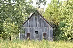 Pea Ridge School Building |
June 8, 1993 (#93000486) |
East of County Road 6, approximately 4 miles south of Bruno 36°05′41″N 92°45′24″W |
Bruno | |
| 18 | Pyatt School Building | 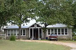 Pyatt School Building |
September 4, 1992 (#92001111) |
County Road 12 36°14′38″N 92°50′42″W |
Pyatt | |
| 19 | Pyatt Tunnel | September 19, 2007 (#07000953) |
Underneath MC 4008 approximately 1 mile south of U.S. Route 62 36°14′31″N 92°49′17″W |
Pyatt | ||
| 20 | Rush Historic District |  Rush Historic District |
February 27, 1987 (#87000105) |
Rush Rd. 36°07′37″N 92°33′10″W |
Yellville | |
| 21 | Sunburst Shelter | May 4, 1982 (#82002123) |
Address Restricted |
Summit | ||
| 22 | US 62 Bridge over Crooked Creek | June 9, 2000 (#00000632) |
U.S. Route 62 36°14′45″N 92°50′04″W |
Pyatt |
Former listing
| [3] | Name on the Register | Image | Date listed | Date removed | Location | City or town | Summary |
|---|---|---|---|---|---|---|---|
| 1 | Bruno School Building | September 4, 1992 (#92001112) | January 24, 2017 | County Road 9 36°08′32″N 92°46′49″W |
Bruno |
See also
| Wikimedia Commons has media related to National Register of Historic Places in Marion County, Arkansas. |
References
- The latitude and longitude information provided in this table was derived originally from the National Register Information System, which has been found to be fairly accurate for about 99% of listings. Some locations in this table may have been corrected to current GPS standards.
- "National Register of Historic Places: Weekly List Actions". National Park Service, United States Department of the Interior. Retrieved on February 5, 2021.
- Numbers represent an alphabetical ordering by significant words. Various colorings, defined here, differentiate National Historic Landmarks and historic districts from other NRHP buildings, structures, sites or objects.
- "National Register Information System". National Register of Historic Places. National Park Service. March 13, 2009.
- The eight-digit number below each date is the number assigned to each location in the National Register Information System database, which can be viewed by clicking the number.
| Topics | |
|---|---|
| Lists by state |
|
| Lists by insular areas | |
| Lists by associated state | |
| Other areas | |
| Related | |
| |
Municipalities and communities of Marion County, Arkansas, United States | ||
|---|---|---|
| Cities | Map of Arkansas highlighting Marion County | |
| Town | ||
| Unincorporated communities | ||
| ||
This article is issued from Wikipedia. The text is licensed under Creative Commons - Attribution - Sharealike. Additional terms may apply for the media files.