National Register of Historic Places listings in Phillips County, Arkansas
This is a list of the National Register of Historic Places listings in Phillips County, Arkansas.
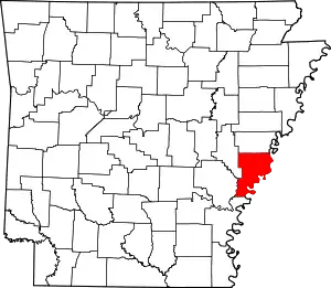
Location of Phillips County in Arkansas
This is intended to be a complete list of the properties and districts on the National Register of Historic Places in Phillips County, Arkansas, United States. The locations of National Register properties and districts for which the latitude and longitude coordinates are included below, may be seen in a map.[1]
There are 52 properties and districts listed on the National Register in the county, including 2 National Historic Landmarks. Another 3 properties that were once listed have since been removed.
- This National Park Service list is complete through NPS recent listings posted January 29, 2021.[2]
Current listings
| [3] | Name on the Register[4] | Image | Date listed[5] | Location | City or town | Description |
|---|---|---|---|---|---|---|
| 1 | Allin House | 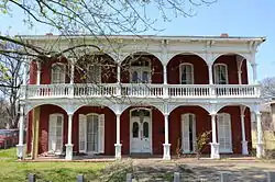 Allin House |
June 4, 1973 (#73000383) |
515 Columbia St. 34°31′38″N 90°35′30″W |
Helena-West Helena | |
| 2 | Almer Store | 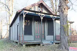 Almer Store |
October 18, 1974 (#74000488) |
824 Columbia St. 34°31′42″N 90°35′20″W |
Helena-West Helena | |
| 3 | Altman House | 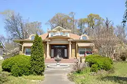 Altman House |
January 21, 1988 (#87002497) |
1202 Perry St. 34°31′47″N 90°35′50″W |
Helena-West Helena | |
| 4 | Battery A Site, Battle of Helena |  Battery A Site, Battle of Helena |
August 18, 1992 (#92001012) |
Northwest of the junction of Adams and Columbia Sts. 34°32′15″N 90°35′33″W |
Helena-West Helena | |
| 5 | Battery B Site, Battle of Helena |  Battery B Site, Battle of Helena |
August 18, 1992 (#92001011) |
Northeast of the junction of Liberty St. and Summit Rd. 34°32′02″N 90°35′51″W |
Helena-West Helena | |
| 6 | Battery C Site |  Battery C Site |
December 1, 1978 (#78000615) |
Clark and York Sts. 34°31′29″N 90°35′39″W |
Helena-West Helena | |
| 7 | Battery D |  Battery D |
September 17, 1974 (#74000489) |
Military Rd. 34°31′05″N 90°35′22″W |
Helena-West Helena | |
| 8 | Beech Street Historic District | 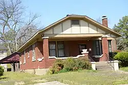 Beech Street Historic District |
January 30, 1987 (#86003314) |
Roughly bounded by McDonough, Columbia, Beech, Elm, Perry, and College 34°31′38″N 90°35′48″W |
Helena-West Helena | |
| 9 | Centennial Baptist Church | 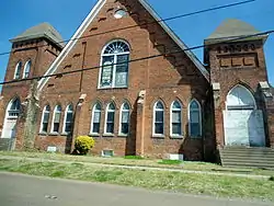 Centennial Baptist Church |
March 26, 1987 (#87000518) |
York and Columbia Sts. 34°31′32″N 90°35′27″W |
Helena-West Helena | |
| 10 | Cherry Street Historic District |  Cherry Street Historic District |
August 17, 1987 (#86003546) |
Along Cherry St. between Porter and Elm Sts.; also Cherry St. between Porter and Perry Sts. and from Elm to the south side of Missouri St. 34°31′36″N 90°35′04″W |
Helena-West Helena | Second set of addresses represents a boundary increase of May 27, 2010 |
| 11 | Chicago Mill Company Office Building | October 31, 1996 (#96001133) |
129 N. Washington St. 34°32′39″N 90°39′22″W |
Helena-West Helena | No longer standing. | |
| 12 | Coolidge House | 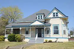 Coolidge House |
September 8, 1983 (#83001161) |
820 Perry St. 34°31′46″N 90°35′36″W |
Helena-West Helena | |
| 13 | Denison House | 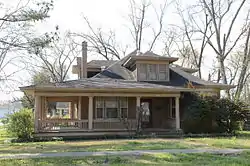 Denison House |
October 31, 1996 (#96001132) |
427 Garland Ave. 34°32′44″N 90°38′25″W |
Helena-West Helena | |
| 14 | Estevan Hall | 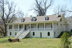 Estevan Hall |
October 22, 1974 (#74000491) |
653 S. Biscoe St. 34°30′48″N 90°35′37″W |
Helena-West Helena | |
| 15 | Faust House | 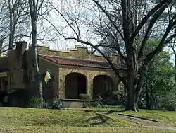 Faust House |
October 31, 1996 (#96001130) |
114 Richmond Hill 34°32′36″N 90°38′02″W |
Helena-West Helena | |
| 16 | Federal Building-United States Post Office and Court House | 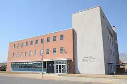 Federal Building-United States Post Office and Court House |
May 5, 2015 (#15000204) |
617 Walnut St. 34°31′43″N 90°35′15″W |
Helena | Now called the Jacob Trieber Federal Building, United States Post Office, and United States Court House. |
| 17 | First Baptist Church | 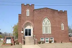 First Baptist Church |
May 13, 1991 (#91000587) |
Junction of Pine and Carruth Sts. 34°33′26″N 90°54′44″W |
Marvell | |
| 18 | Henry and Cornelia Ford Farm | 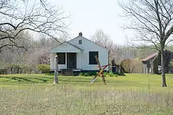 Henry and Cornelia Ford Farm |
March 2, 2006 (#06000085) |
1335 County Road 249 34°37′12″N 90°42′28″W |
Lexa | |
| 19 | Gemmill-Faust House | 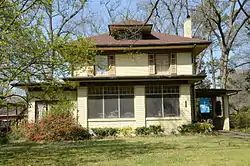 Gemmill-Faust House |
October 31, 1996 (#96001134) |
321 St. Andrew's Terrace 34°32′20″N 90°38′01″W |
Helena-West Helena | |
| 20 | William H. Grey Gravesite | September 27, 2019 (#100004441) |
108 Wire St. 34°32′29″N 90°35′45″W |
Helena-West Helena | ||
| 21 | Helena Confederate Cemetery | 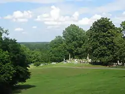 Helena Confederate Cemetery |
May 3, 1996 (#96000501) |
Southwestern corner of Maple Hill Cemetery, approximately 0.5 miles north of the junction of Poplar and Adams Sts. 34°32′30″N 90°35′34″W |
Helena-West Helena | |
| 22 | Helena Depot | 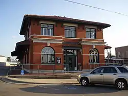 Helena Depot |
November 5, 1987 (#87000877) |
Natchez and Missouri Sts. 34°31′19″N 90°35′09″W |
Helena-West Helena | |
| 23 | Helena Library and Museum | 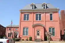 Helena Library and Museum |
December 6, 1975 (#75000400) |
623 Peach St. 34°31′42″N 90°35′19″W |
Helena-West Helena | |
| 24 | Helena National Guard Armory | 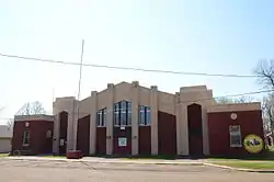 Helena National Guard Armory |
January 24, 2007 (#06001266) |
511 Miller St. 34°31′53″N 90°35′19″W |
Helena-West Helena | |
| 25 | Sidney H. Horner House | 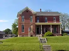 Sidney H. Horner House |
December 4, 1975 (#75000401) |
626 Porter St. 34°31′41″N 90°35′26″W |
Helena-West Helena | |
| 26 | Keesee House | 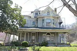 Keesee House |
September 8, 1983 (#83001162) |
723 Arkansas St. 34°31′18″N 90°35′31″W |
Helena-West Helena | |
| 27 | Richard L. Kitchens Post No. 41 | 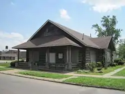 Richard L. Kitchens Post No. 41 |
September 30, 1976 (#76000444) |
409 Porter St. 34°31′40″N 90°35′16″W |
Helena-West Helena | |
| 28 | Lakeview Resettlement Project Historic District | January 28, 2019 (#100003357) |
Near the jct. of AR 85 & AR 44 34°25′00″N 90°47′11″W |
Lake View | ||
| 29 | Little Cypress Creek Bridge | 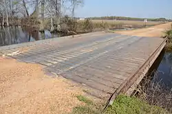 Little Cypress Creek Bridge |
May 18, 1995 (#95000611) |
County Road 66G over Little Cypress Creek 34°33′27″N 91°01′24″W |
Postelle | |
| 30 | Louisiana Purchase Survey Marker |  Louisiana Purchase Survey Marker |
February 23, 1972 (#72000206) |
Southeast of Blackton at the corner of Monroe and Phillips counties 34°38′48″N 91°03′05″W |
Blackton | Extends into Lee and Monroe counties |
| 31 | Maple Hill Cemetery | 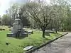 Maple Hill Cemetery |
April 6, 2000 (#00000318) |
N. Holly St. 34°32′35″N 90°35′28″W |
Helena-West Helena | |
| 32 | Mayo House | 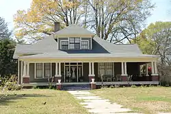 Mayo House |
December 19, 1997 (#97001513) |
302 Elm St. 34°33′28″N 90°54′44″W |
Marvell | |
| 33 | Moore-Hornor House | 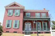 Moore-Hornor House |
June 4, 1973 (#73000384) |
323 Beech St. 34°31′31″N 90°36′08″W |
Helena-West Helena | |
| 34 | Myers House | 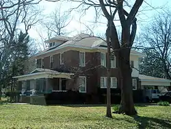 Myers House |
October 31, 1996 (#96001136) |
221 St. Andrew's Terrace 34°32′27″N 90°38′00″W |
Helena-West Helena | |
| 35 | Nelson House | 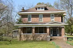 Nelson House |
October 31, 1996 (#96001135) |
303 St. Andrew's Terrace 34°32′22″N 90°38′00″W |
Helena-West Helena | |
| 36 | Perry Street Historic District | 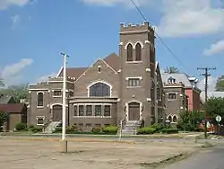 Perry Street Historic District |
November 26, 1986 (#86002954) |
Perry St. between Pecan and Franklin and Pecan St. from Porter to Perry 34°31′43″N 90°35′21″W |
Helena-West Helena | |
| 37 | Phillips County Courthouse | 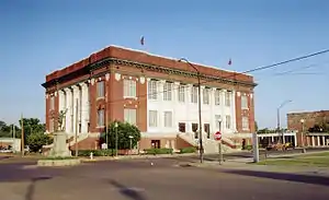 Phillips County Courthouse |
July 15, 1977 (#77000265) |
622 Cherry St. 34°31′42″N 90°35′06″W |
Helena-West Helena | |
| 38 | Phillips County Penal Farm Historic District | 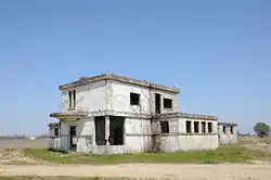 Phillips County Penal Farm Historic District |
January 24, 2007 (#06001268) |
County Road 353 south of U.S. Route 49 34°33′06″N 90°48′11″W |
Poplar Grove | |
| 39 | Jerome Bonaparte Pillow House | 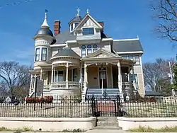 Jerome Bonaparte Pillow House |
May 7, 1973 (#73000385) |
718 Perry St. 34°31′44″N 90°35′31″W |
Helena-West Helena | |
| 40 | E.S. Ready House | 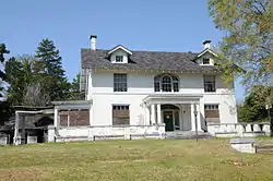 E.S. Ready House |
January 1, 1976 (#76000445) |
929 Beech St. 34°31′55″N 90°35′33″W |
Helena-West Helena | |
| 41 | Richardson-Turner House | 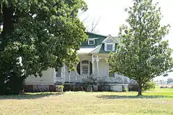 Richardson-Turner House |
May 29, 1998 (#98000583) |
1469 Highway 1, N. 34°35′09″N 90°47′17″W |
Lexa | |
| 42 | St. Mary's Catholic Church | 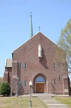 St. Mary's Catholic Church |
January 24, 2007 (#06001278) |
123 Columbia 34°31′28″N 90°35′31″W |
Helena-West Helena | |
| 43 | William A. Short House |  William A. Short House |
April 18, 1985 (#85000833) |
317 Biscoe St. 34°31′05″N 90°35′31″W |
Helena-West Helena | |
| 44 | Spirit of the American Doughboy Monument-Helena | 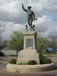 Spirit of the American Doughboy Monument-Helena |
May 23, 1997 (#97000455) |
Junction of Cherry and Perry Sts. 34°31′42″N 90°35′06″W |
Helena-West Helena | |
| 45 | William Nicholas Straub House | 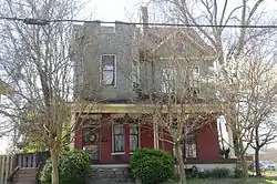 William Nicholas Straub House |
April 18, 1985 (#85000834) |
531 Perry St. 34°31′37″N 90°35′31″W |
Helena-West Helena | |
| 46 | James C. Tappan House | 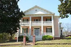 James C. Tappan House |
June 4, 1973 (#73002270) |
717 Poplar St. 34°31′46″N 90°35′38″W |
Helena-West Helena | |
| 47 | Maj. James Alexander Tappan House | 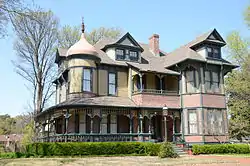 Maj. James Alexander Tappan House |
September 9, 1974 (#74000493) |
727 Columbia St. 34°31′59″N 90°35′28″W |
Helena-West Helena | |
| 48 | Temple Beth El Cemetery | May 28, 2019 (#100003984) |
NW of intersection of Mable St. & Holly St./Sterling Rd. 34°32′46″N 90°35′21″W |
Helena | ||
| 49 | Turner Historic District |  Turner Historic District |
March 2, 2006 (#06000073) |
Corners of Highway 318 and County Road 606 34°29′31″N 90°57′24″W |
Cypert | |
| 50 | Warrens Bridge | 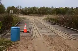 Warrens Bridge |
May 18, 1995 (#95000612) |
County Road 14I over Lambrook Levee Ditch 34°20′09″N 91°00′42″W |
Lambrook | |
| 51 | West House | 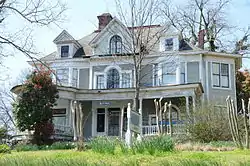 West House |
September 8, 1983 (#83001163) |
229 Beech St. 34°31′39″N 90°35′33″W |
Helena-West Helena | |
| 52 | White House | 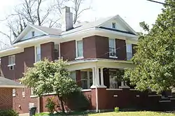 White House |
December 22, 1982 (#82000871) |
1015 Perry St. 34°31′57″N 90°35′56″W |
Helena-West Helena |
Former listings
| [3] | Name on the Register | Image | Date listed | Date removed | Location | City or town | Summary |
|---|---|---|---|---|---|---|---|
| 1 | Barlow-Coolidge House | August 19, 1975 (#75000402) | September 17, 1999 | 917 Ohio St. |
Helena-West Helena | ||
| 2 | New Light Missionary Baptist Church | December 7, 1995 (#95001410) | January 26, 2018 | 522 Arkansas St. 34°31′18″N 90°35′25″W |
Helena-West Helena | Demolished. | |
| 3 | Short-Deisch House | October 18, 1974 (#74000490) | December 28, 2002 | 409 Biscoe Street |
Helena-West Helena |
See also
| Wikimedia Commons has media related to National Register of Historic Places in Phillips County, Arkansas. |
References
- The latitude and longitude information provided in this table was derived originally from the National Register Information System, which has been found to be fairly accurate for about 99% of listings. Some locations in this table may have been corrected to current GPS standards.
- "National Register of Historic Places: Weekly List Actions". National Park Service, United States Department of the Interior. Retrieved on January 29, 2021.
- Numbers represent an alphabetical ordering by significant words. Various colorings, defined here, differentiate National Historic Landmarks and historic districts from other NRHP buildings, structures, sites or objects.
- "National Register Information System". National Register of Historic Places. National Park Service. March 13, 2009.
- The eight-digit number below each date is the number assigned to each location in the National Register Information System database, which can be viewed by clicking the number.
| Topics | |
|---|---|
| Lists by state |
|
| Lists by insular areas | |
| Lists by associated state | |
| Other areas | |
| Related | |
| |
Municipalities and communities of Phillips County, Arkansas, United States | ||
|---|---|---|
| Cities | Map of Arkansas highlighting Phillips County | |
| Town | ||
| Townships |
| |
| Unincorporated communities | ||
| ||
This article is issued from Wikipedia. The text is licensed under Creative Commons - Attribution - Sharealike. Additional terms may apply for the media files.