National Register of Historic Places listings in Buchanan County, Missouri
This is a list of the National Register of Historic Places listings in Buchanan County, Missouri.
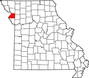
Location of Buchanan County in Missouri
This is intended to be a complete list of the properties and districts on the National Register of Historic Places in Buchanan County, Missouri, United States. Latitude and longitude coordinates are provided for many National Register properties and districts; these locations may be seen together in a map.[1]
There are 62 properties and districts listed on the National Register in the county, including 1 National Historic Landmark.
- This National Park Service list is complete through NPS recent listings posted January 29, 2021.[2]
Current listings
| [3] | Name on the Register | Image | Date listed[4] | Location | City or town | Description |
|---|---|---|---|---|---|---|
| 1 | The Benton Club of St. Joseph |  The Benton Club of St. Joseph |
October 2, 2017 (#100001687) |
402 N. 7th St. 39°46′09″N 94°51′07″W |
St. Joseph | |
| 2 | Buchanan County Courthouse | 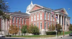 Buchanan County Courthouse |
August 21, 1972 (#72001563) |
Courthouse Sq. 39°46′05″N 94°51′20″W |
St. Joseph | Originally listed as both courthouse and jail, but jail removed in a 1978 boundary decrease |
| 3 | Buchanan County Infirmary | 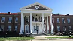 Buchanan County Infirmary |
January 29, 2009 (#08001386) |
3500 N. Village Dr. 39°49′02″N 94°48′41″W |
St. Joseph | |
| 4 | Charles A. and Annie Buddy House | 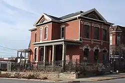 Charles A. and Annie Buddy House |
May 14, 2004 (#04000427) |
424 S. 9th St. 39°45′49″N 94°50′58″W |
St. Joseph | |
| 5 | Burnside-Sandusky Gothic House | 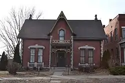 Burnside-Sandusky Gothic House |
January 19, 2005 (#04001518) |
720 S. 10th St. 39°45′39″N 94°50′53″W |
St. Joseph | |
| 6 | Cathedral Hill Historic District | 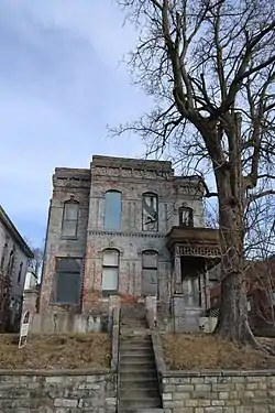 Cathedral Hill Historic District |
June 15, 2000 (#00000691) |
North 9th St., Powell St. and North 13th St. 39°46′22″N 94°50′48″W |
St. Joseph | |
| 7 | Central-North Commercial Historic District | 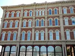 Central-North Commercial Historic District |
March 8, 1991 (#91000125) |
Roughly bounded by N. 4th, Main, Francis and Robidoux Sts. 39°46′04″N 94°51′20″W |
St. Joseph | |
| 8 | Central Police Station | 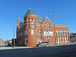 Central Police Station |
November 6, 2009 (#09000887) |
701 Messanie St. 39°45′45″N 94°51′07″W |
St. Joseph | |
| 9 | Century Apartments | 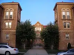 Century Apartments |
July 5, 2001 (#01000712) |
627 N. 25th St. 39°46′16″N 94°49′47″W |
St. Joseph | |
| 10 | Christian Sachau Saloon | 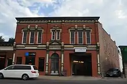 Christian Sachau Saloon |
October 25, 1985 (#85003358) |
1615 Frederick Ave. 39°46′21″N 94°50′26″W |
St. Joseph | |
| 11 | City Hose Company No. 9 | 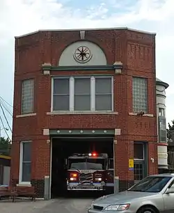 City Hose Company No. 9 |
October 25, 1985 (#85003357) |
2217 Frederick Ave. 39°46′32″N 94°50′00″W |
St. Joseph | |
| 12 | Corby-Forsee Building | 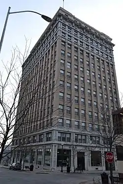 Corby-Forsee Building |
March 27, 1980 (#80002317) |
5th and Felix Sts. 39°45′59″N 94°51′15″W |
St. Joseph | |
| 13 | Dewey Avenue-West Rosine Historic District | 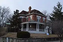 Dewey Avenue-West Rosine Historic District |
August 1, 2002 (#02000816) |
Roughly bound by Prospect Ave., Auguste St., Dewey Avenue and West Rosine St. 39°46′42″N 94°51′39″W |
St. Joseph | |
| 14 | Edmond Jacques Eckel House | January 31, 1980 (#80002318) |
515 N. 4th St. 39°46′10″N 94°51′18″W |
St. Joseph | Demolished | |
| 15 | Everett School | 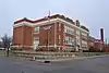 Everett School |
September 15, 2005 (#05001023) |
826 S 14th St. 39°45′34″N 94°50′37″W |
St. Joseph | |
| 16 | Enoch Madison Fenton House | April 12, 1982 (#82003126) |
Southeast of Rushville 39°35′41″N 94°58′30″W |
Rushville | Demolished.[5] | |
| 17 | Dr. Jacob Geiger House-Maud Wyeth Painter House | 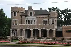 Dr. Jacob Geiger House-Maud Wyeth Painter House |
March 12, 1986 (#86000826) |
2501 Frederick Ave. 39°46′37″N 94°49′48″W |
St. Joseph | |
| 18 | German-American Bank Building | 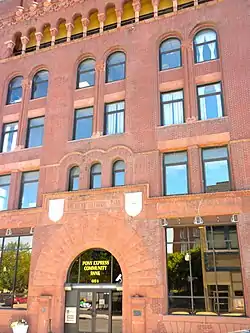 German-American Bank Building |
November 24, 1978 (#78001638) |
624 Felix St. 39°45′59″N 94°51′07″W |
St. Joseph | |
| 19 | Hall School | 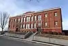 Hall School |
January 31, 2017 (#100000607) |
2509 Duncan St. 39°45′06″N 94°49′47″W |
St. Joseph | |
| 20 | Hall Street Historic District | 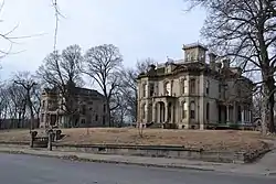 Hall Street Historic District |
July 17, 1979 (#79001352) |
Roughly bounded by Isadore, Corby, 6th and 9th Sts. 39°46′20″N 94°51′04″W |
St. Joseph | |
| 21 | Harris Addition Historic District | 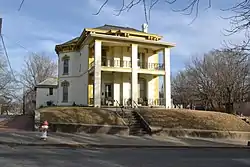 Harris Addition Historic District |
January 13, 2003 (#01000723) |
Roughly bounded by 16th St, Dalton St., 22nd St. and Edmond St. 39°46′04″N 94°50′17″W |
St. Joseph | |
| 22 | Alois Herbert Double House | 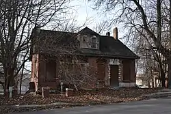 Alois Herbert Double House |
May 29, 2007 (#06000992) |
620 S. 10th St. 39°45′50″N 94°50′54″W |
St. Joseph | |
| 23 | Jesse James House | 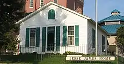 Jesse James House |
September 4, 1980 (#80002319) |
12th St. and Mitchell Ave. 39°45′20″N 94°50′43″W |
St. Joseph | |
| 24 | Kelley and Browne Flats | 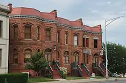 Kelley and Browne Flats |
August 3, 1989 (#89000991) |
1208-1216 Frederick Ave. 39°46′12″N 94°50′41″W |
St. Joseph | |
| 25 | Kemper Addition Historic District | 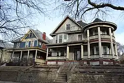 Kemper Addition Historic District |
September 20, 2002 (#01000721) |
Portions of Clay, Union, Kemper and Bon Ton Sts. 39°46′19″N 94°50′11″W |
St. Joseph | |
| 26 | King's Hill Archeological Site | April 16, 1969 (#69000091) |
Western end of King Hill Dr.[6] 39°43′08″N 94°51′33″W |
St. Joseph | ||
| 27 | Krug Park Place Historic District | 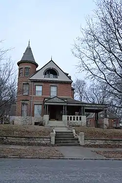 Krug Park Place Historic District |
August 1, 2002 (#02000817) |
Roughly bounded by St. Joseph Ave., Myrtle St., Clark St., and Magnolia Ave. 39°47′30″N 94°50′47″W |
St. Joseph | |
| 28 | Lawler Motor Company Building | 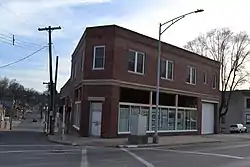 Lawler Motor Company Building |
January 8, 2009 (#08001285) |
1224 Frederick Ave. 39°46′12″N 94°50′42″W |
St. Joseph | |
| 29 | Livestock Exchange Building | 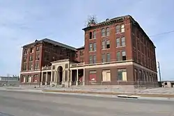 Livestock Exchange Building |
April 20, 2004 (#04000342) |
601 Illinois Ave. 39°43′14″N 94°52′10″W |
St. Joseph | |
| 30 | John Sublett Jr. and Caroline Ashton Logan House | 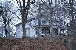 John Sublett Jr. and Caroline Ashton Logan House |
May 7, 2007 (#06000991) |
1906 N. 22nd St. 39°47′10″N 94°50′05″W |
St. Joseph | |
| 31 | Maple Grove | 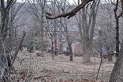 Maple Grove |
October 16, 1974 (#74001070) |
2100 N. 11th St. 39°47′05″N 94°50′46″W |
St. Joseph | |
| 32 | McIntyre-Burri House | 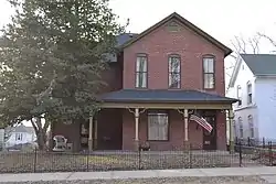 McIntyre-Burri House |
December 23, 2005 (#05001435) |
808 N. 24th St. 39°46′35″N 94°49′54″W |
St. Joseph | |
| 33 | Isaac Miller House | 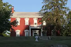 Isaac Miller House |
September 17, 1980 (#80002320) |
3003 Ashland Ave. 39°47′46″N 94°49′04″W |
St. Joseph | |
| 34 | Miller-Porter-Lacy House | 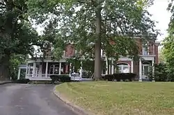 Miller-Porter-Lacy House |
September 9, 1982 (#82003127) |
2912 Frederick Blvd. 39°46′34″N 94°49′14″W |
St. Joseph | |
| 35 | Missouri Theater and Missouri Theater Building | 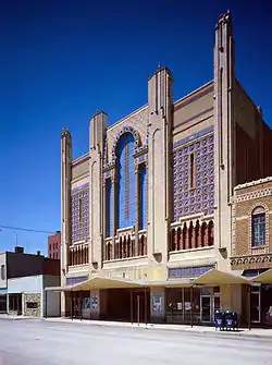 Missouri Theater and Missouri Theater Building |
October 11, 1979 (#79001353) |
112-128 S. 8th St. and 713-721 Edmond St. 39°45′58″N 94°51′02″W |
St. Joseph | |
| 36 | Missouri Valley Trust Company Historic District | 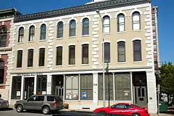 Missouri Valley Trust Company Historic District |
March 4, 1975 (#75001063) |
Felix and 4th Sts. 39°46′00″N 94°51′21″W |
St. Joseph | |
| 37 | Mount Mora Cemetery | 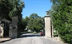 Mount Mora Cemetery |
July 19, 2006 (#06000626) |
824 Mount Mora Rd. 39°46′39″N 94°50′31″W |
St. Joseph | |
| 38 | Museum Hill Historic District | 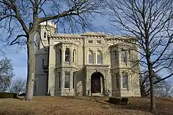 Museum Hill Historic District |
March 8, 1991 (#91000112) |
Roughly bounded by 9th, Francis, 12th, Jules, 15th and Messanie Sts.; also 321 and 323 N. 15th and 1510 Faraon St. 39°45′56″N 94°50′43″W |
St. Joseph | Second set of addresses represents a boundary increase of August 5, 2009 |
| 39 | Neely Elementary School |  Neely Elementary School |
June 23, 2014 (#14000328) |
1909 S. 12th St. 39°44′57″N 94°50′43″W |
St. Joseph | |
| 40 | Nelson-Pettis Farmsteads Historic District | 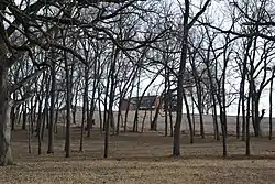 Nelson-Pettis Farmsteads Historic District |
May 11, 1995 (#95000587) |
4401 Ajax Rd., 3412 Pettis Rd. 39°43′23″N 94°48′37″W |
St. Joseph | |
| 41 | Patee Town Historic District | August 1, 2002 (#02000818) |
Roughly bounded by Penn St., S. 11th St., Lafayette St. and S. 15th St. 39°45′33″N 94°50′36″W |
St. Joseph | ||
| 42 | John Patee House |  John Patee House |
October 15, 1966 (#66000414) |
12th and Penn Sts. 39°45′21″N 94°50′42″W |
St. Joseph | |
| 43 | Pleasant Ridge School | May 2, 1985 (#85000941) |
R.F.D. #4 (MO State Rte 371) 39°40′57″N 94°49′50″W |
St. Joseph | Destroyed | |
| 44 | Pony Express Stables | 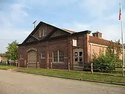 Pony Express Stables |
April 3, 1970 (#70000322) |
914 Penn St. 39°45′22″N 94°50′57″W |
St. Joseph | Stables at the eastern terminus of the Pony Express |
| 45 | John D. Richardson Dry Goods Company | 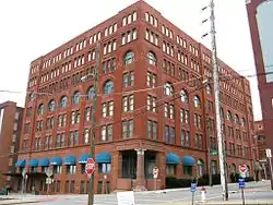 John D. Richardson Dry Goods Company |
April 12, 1982 (#82003128) |
300 N. 3rd St. 39°46′07″N 94°51′25″W |
St. Joseph | |
| 46 | Robidoux Hill Historic District | 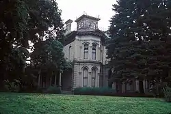 Robidoux Hill Historic District |
August 3, 1989 (#89000992) |
Roughly bounded by Franklin St., Robidoux St., Fourth St., Louis St., and Fifth St. 39°46′19″N 94°51′17″W |
St. Joseph | |
| 47 | Robidoux Row | 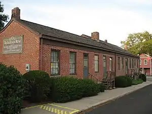 Robidoux Row |
March 7, 1973 (#73001037) |
219-225 E. Poulin St. 39°46′29″N 94°51′27″W |
St. Joseph | |
| 48 | Robidoux School | 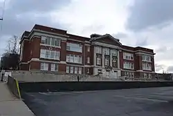 Robidoux School |
August 11, 1983 (#83000973) |
201 S. 10th St. 39°45′24″N 94°50′51″W |
St. Joseph | |
| 49 | Ryan Block | 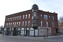 Ryan Block |
January 29, 2013 (#12001242) |
1137-1141 Frederick Ave. 39°46′12″N 94°50′43″W |
St. Joseph | |
| 50 | St. Joseph City Hall | 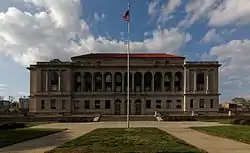 St. Joseph City Hall |
October 25, 1985 (#85003356) |
Frederick Ave. at Eleventh St. 39°46′07″N 94°50′47″W |
St. Joseph | |
| 51 | St. Joseph Park and Parkway System | 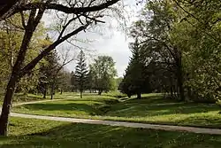 St. Joseph Park and Parkway System |
January 20, 1995 (#94001566) |
Roughly, along Northwest, Northeast, Corby Grove, Southwest and A Pkwys. and Noyes Blvd. from Krug Park to Hyde Park 39°45′04″N 94°50′25″W |
St. Joseph | |
| 52 | St. Joseph Public Library | 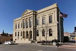 St. Joseph Public Library |
September 20, 1982 (#82003129) |
10th and Felix Sts. 39°46′00″N 94°50′53″W |
St. Joseph | |
| 53 | St. Joseph Public Library-Carnegie Branch |  St. Joseph Public Library-Carnegie Branch |
May 20, 1999 (#99000595) |
316 Massachusetts St. 39°42′58″N 94°51′58″W |
St. Joseph | |
| 54 | St. Joseph's Commerce and Banking Historic District |  St. Joseph's Commerce and Banking Historic District |
July 5, 2001 (#01000709) |
Roughly bounded by 3rd, 91t, Francis, and Edmonds St. 39°45′59″N 94°51′09″W |
St. Joseph | |
| 55 | South Fourth Street Commercial Historic District | 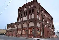 South Fourth Street Commercial Historic District |
March 8, 1991 (#91000124) |
Roughly bounded by S. 3rd, S. 5th, Charles and Messanie Sts. 39°45′50″N 94°51′22″W |
St. Joseph | |
| 56 | Sugar Lake State Park Open Shelter | 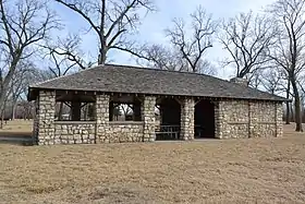 Sugar Lake State Park Open Shelter |
February 28, 1985 (#85000522) |
Off MO 138 39°32′21″N 95°03′35″W |
Rushville | A shelter at Sugar Lake, now Lewis and Clark State Park |
| 57 | Thompson-Brown-Sandusky House | 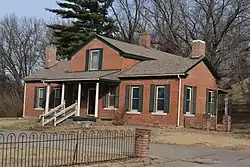 Thompson-Brown-Sandusky House |
February 10, 1983 (#83004297) |
207 E. Cliff St. 39°42′33″N 94°51′36″W |
St. Joseph | |
| 58 | Virginia Flats | 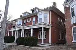 Virginia Flats |
May 21, 1992 (#92000586) |
516-518 and 520-528 N. 10th St. 39°46′14″N 94°50′54″W |
St. Joseph | |
| 59 | Vosteen-Hauck House | September 23, 1982 (#82003130) |
913 N. 2nd St. 39°46′24″N 94°51′28″W |
St. Joseph | Demolished | |
| 60 | Western Tablet and Stationery Company, Building No. 2 | 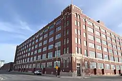 Western Tablet and Stationery Company, Building No. 2 |
August 16, 2007 (#07000814) |
1300 S 12th St. 39°45′24″N 94°50′45″W |
St. Joseph | |
| 61 | Wholesale Row | 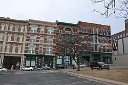 Wholesale Row |
September 19, 1977 (#77000800) |
Bounded by Jules, 3rd, 4th, and Francis Sts. 39°46′04″N 94°51′23″W |
St. Joseph | Noyes-Norman Bldg on 3rd St demolished, remaining 4 bldgs. along 3rd still extant |
| 62 | Wyeth Flats | 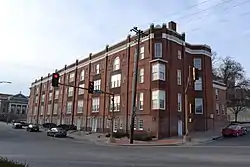 Wyeth Flats |
October 25, 1985 (#85003355) |
1015-1031 Faraon St. 39°46′09″N 94°50′48″W |
St. Joseph |
Former listing
| [3] | Name on the Register | Image | Date listed | Date removed | Location | City or town | Summary |
|---|---|---|---|---|---|---|---|
| 1 | Market Square Historic District | March 17, 1972 (#72001562) | January 1, 1999 | Roughly bounded by Edmond, Felix and N. 3rd Sts., and Market Pl. |
St. Joseph | All buildings demolished by 1973.[7] |
See also
References
| Wikimedia Commons has media related to National Register of Historic Places in Buchanan County, Missouri. |
- The latitude and longitude information provided in this table was derived originally from the National Register Information System, which has been found to be fairly accurate for about 99% of listings. Some locations in this table may have been corrected to current GPS standards.
- "National Register of Historic Places: Weekly List Actions". National Park Service, United States Department of the Interior. Retrieved on January 29, 2021.
- Numbers represent an alphabetical ordering by significant words. Various colorings, defined here, differentiate National Historic Landmarks and historic districts from other NRHP buildings, structures, sites or objects.
- The eight-digit number below each date is the number assigned to each location in the National Register Information System database, which can be viewed by clicking the number.
- "Archived copy". Archived from the original on 2011-05-21. Retrieved 2011-09-05.CS1 maint: archived copy as title (link)
- Blake, Leonard W. and Hugh C. Cutler. "Plant Remains from the King Hill Site (23BN1) and Comparisons with Those from the Utz Site (23SA2)". Missouri Archaeologist 43 Whole Volume (1982): 86-110: 86.
| Topics | |
|---|---|
| Lists by state |
|
| Lists by insular areas | |
| Lists by associated state | |
| Other areas | |
| Related | |
| |
Municipalities and communities of Buchanan County, Missouri, United States | ||
|---|---|---|
| Cities | Map of Missouri highlighting Buchanan County | |
| Villages | ||
| Townships | ||
| Unincorporated communities | ||
| Footnotes | ‡This populated place also has portions in an adjacent county or counties | |
| ||
This article is issued from Wikipedia. The text is licensed under Creative Commons - Attribution - Sharealike. Additional terms may apply for the media files.