National Register of Historic Places listings in Franklin County, Missouri
This is a list of the National Register of Historic Places listings in Franklin County, Missouri.
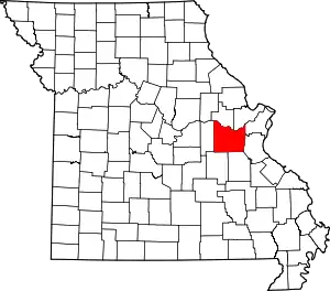
Location of Franklin County in Missouri
This is intended to be a complete list of the properties and districts on the National Register of Historic Places in Franklin County, Missouri, United States. Latitude and longitude coordinates are provided for many National Register properties and districts; these locations may be seen together in a map.[1]
There are 61 properties and districts listed on the National Register in the county. Another property was once listed but has been removed.
- This National Park Service list is complete through NPS recent listings posted January 29, 2021.[2]
Current listings
| [3] | Name on the Register | Image | Date listed[4] | Location | City or town | Description |
|---|---|---|---|---|---|---|
| 1 | John Abkemeyer House |  John Abkemeyer House |
September 28, 2000 (#00001088) |
607 Jefferson 38°33′17″N 91°00′48″W |
Washington | |
| 2 | AME Church of New Haven |  AME Church of New Haven |
August 18, 1992 (#92001002) |
225 Selma St. 38°36′48″N 91°12′52″W |
New Haven | |
| 3 | Henry Bartelmann House |  Henry Bartelmann House |
September 14, 2000 (#00001089) |
110 W. 6th St. 38°33′21″N 91°00′54″W |
Washington | |
| 4 | Bartsch-Jasper House | 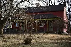 Bartsch-Jasper House |
September 22, 2000 (#00001149) |
138 Old Pottery Rd. 38°32′49″N 91°02′00″W |
Washington | |
| 5 | Henry F. Beinke House | 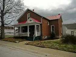 Henry F. Beinke House |
September 14, 2000 (#00001090) |
610 Jefferson St. 38°33′19″N 91°00′50″W |
Washington | |
| 6 | Henry Beins House | 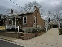 Henry Beins House |
September 14, 2000 (#00001091) |
620 Locust St. 38°33′13″N 91°00′39″W |
Washington | |
| 7 | Bethel Church | 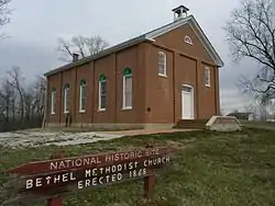 Bethel Church |
February 3, 1993 (#92001867) |
MO T 2 miles W of Labadie 38°31′07″N 90°52′44″W |
Labadie | |
| 8 | Brehe Farmstead Historic District | 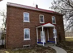 Brehe Farmstead Historic District |
September 14, 2000 (#00001092) |
6180 Bluff Rd. 38°33′45″N 91°03′08″W |
Washington | |
| 9 | H. P. Broeker House | September 22, 2000 (#00001147) |
523 Hooker St. 38°33′17″N 91°00′39″W |
Washington | ||
| 10 | John H. Broeker House | 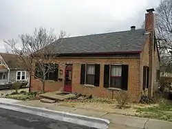 John H. Broeker House |
September 14, 2000 (#00001093) |
605 Locust St. 38°33′15″N 91°00′40″W |
Washington | |
| 11 | Henry J. Buhr House | 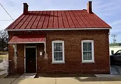 Henry J. Buhr House |
September 14, 2000 (#00001087) |
309 Lafayette St. 38°33′30″N 91°00′47″W |
Washington | |
| 12 | John B. Busch Brewery Historic District | 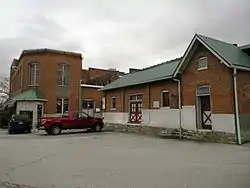 John B. Busch Brewery Historic District |
September 14, 2000 (#00001094) |
108-130A Busch Ave. and 813 Jefferson St. 38°33′11″N 91°00′55″W |
Washington | |
| 13 | Caldwell Farm | October 20, 1980 (#80002351) |
S of Washington on Bieker Rd. 38°30′32″N 90°59′01″W |
Washington | ||
| 14 | Henry Degen House | 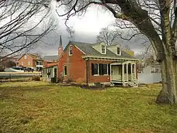 Henry Degen House |
September 14, 2000 (#00001095) |
112 W. 4th St. 38°33′28″N 91°00′49″W |
Washington | |
| 15 | Downtown Washington Historic District | 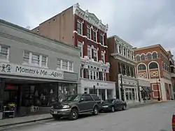 Downtown Washington Historic District |
October 5, 1989 (#89001465) |
Roughly W. Front St. from Stafford St. to Market St. and Elm St. from W. Front St. to Fourth St. 38°33′34″N 91°00′47″W |
Washington | |
| 16 | Henry Charles Eitzen Building | 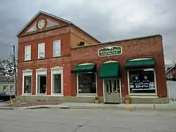 Henry Charles Eitzen Building |
September 14, 2000 (#00001096) |
200 Jefferson St. 38°33′29″N 91°00′38″W |
Washington | |
| 17 | Henry and Elizabeth Ernst House | 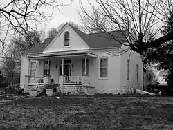 Henry and Elizabeth Ernst House |
September 14, 2000 (#00001097) |
901 Stafford St. 38°33′02″N 91°01′10″W |
Washington | |
| 18 | Fore Shoe Company Building | 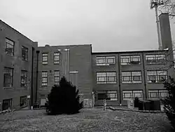 Fore Shoe Company Building |
December 23, 2005 (#05001432) |
601 E 6th St. 38°33′15″N 91°00′17″W |
Washington | |
| 19 | Gustav Grauer Farm | September 6, 1984 (#84002142) |
N of Pacific 38°33′56″N 90°44′22″W |
Pacific | ||
| 20 | Charles H. Helm House | 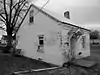 Charles H. Helm House |
September 28, 2000 (#00001099) |
520 E. 5th St. 38°33′12″N 91°00′27″W |
Washington | |
| 21 | John and Wilhelmina Helm House | September 14, 2000 (#00001100) |
536 E. 5th St. 38°33′11″N 91°00′24″W |
Washington | ||
| 22 | International Shoe Company Building | 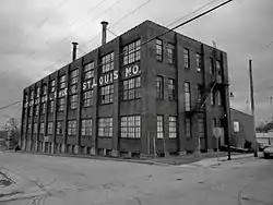 International Shoe Company Building |
April 7, 1994 (#94000287) |
160 N. Main St. 38°20′55″N 90°58′49″W |
St. Clair | |
| 23 | Stephen M. Jones Building | 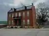 Stephen M. Jones Building |
September 14, 2000 (#00001101) |
108-110 Jefferson St. 38°33′32″N 91°00′37″W |
Washington | |
| 24 | Christian and Anna Keller Farmstead | August 6, 2009 (#08000867) |
936 Kohl Country Ln. 38°25′46″N 91°19′15″W |
Gerald | ||
| 25 | Louis Kohmueller House | 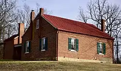 Louis Kohmueller House |
September 14, 2000 (#00001102) |
1380 S. Lake Shore Dr. 38°33′37″N 91°01′57″W |
Washington | |
| 26 | Albert Krog House | 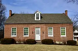 Albert Krog House |
September 14, 2000 (#00001103) |
1395 W. Main St. 38°34′10″N 91°01′47″W |
Washington | |
| 27 | Casper Kruse House | 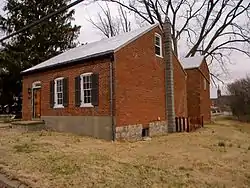 Casper Kruse House |
September 14, 2000 (#00001104) |
202 Stafford St. 38°33′44″N 91°01′08″W |
Washington | |
| 28 | Locust Street Historic District |  Locust Street Historic District |
September 14, 2000 (#00001105) |
Roughly bounded by E. Front, E. 5th, Jefferson, and Hooker Sts. 38°33′25″N 91°00′32″W |
Washington | |
| 29 | Dr. H. A. May House | 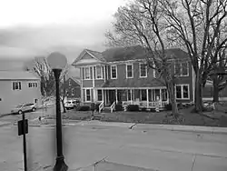 Dr. H. A. May House |
September 14, 2000 (#00001106) |
402 Jefferson St. 38°33′24″N 91°00′44″W |
Washington | |
| 30 | Frank Mense House | 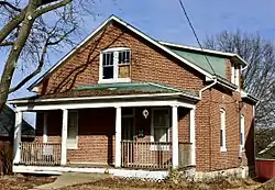 Frank Mense House |
September 14, 2000 (#00001107) |
304 High St. 38°33′37″N 91°01′29″W |
Washington | |
| 31 | Meramec State Park Beach Area Historic District | December 6, 1991 (#91001772) |
MO 185 at the Meramec R. 38°12′24″N 91°05′43″W |
Sullivan | ||
| 32 | Meramec State Park Lookout House/Observation Tower | February 28, 1985 (#85000530) |
E of Sullivan off MO 185 38°12′45″N 91°05′27″W |
Sullivan | ||
| 33 | Meramec State Park Pump House | February 28, 1985 (#85000531) |
E of Sullivan off MO 185 38°12′58″N 91°05′31″W |
Sullivan | ||
| 34 | Meramec State Park Shelter House | February 26, 1985 (#85000532) |
E of Sullivan off MO 185 38°12′51″N 91°05′21″W |
Sullivan | ||
| 35 | John Meyer House | 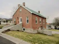 John Meyer House |
September 14, 2000 (#00001108) |
800 E. 6th St. 38°33′06″N 91°00′13″W |
Washington | |
| 36 | Paul Monje House |  Paul Monje House |
September 14, 2000 (#00001109) |
1003 W. 5th St. 38°33′24″N 91°01′31″W |
Washington | |
| 37 | Moselle Iron Furnace Stack | May 21, 1969 (#69000100) |
1 mile SE of Moselle 38°22′48″N 90°52′51″W |
Moselle | ||
| 38 | New Haven Commercial Historic District |  New Haven Commercial Historic District |
May 5, 1999 (#99000531) |
111-139 Front St. 38°36′50″N 91°12′52″W |
New Haven | |
| 39 | New Haven Residential Historic District | 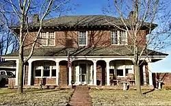 New Haven Residential Historic District |
June 3, 1999 (#99000661) |
Roughly along Wall St. and Maupin Ave., and bounded by Washington and Bates Sts. 38°36′47″N 91°12′57″W |
New Haven | |
| 40 | James North House | April 5, 1984 (#84002534) |
MO T 38°26′16″N 90°51′24″W |
Labadie | ||
| 41 | Mark O'Hara House | 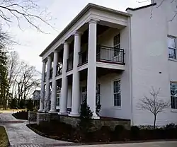 Mark O'Hara House |
September 14, 2000 (#00001110) |
1 South Point Pl. 38°32′37″N 90°58′35″W |
Washington | |
| 42 | Old Gerald School | June 27, 2014 (#14000375) |
111 W. 3rd St. 38°24′07″N 91°19′57″W |
Gerald | ||
| 43 | Panhorst Feed Store | 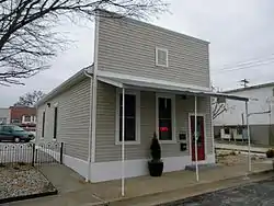 Panhorst Feed Store |
July 5, 1990 (#90001023) |
465 St. Clair St. 38°20′49″N 90°58′56″W |
St. Clair | |
| 44 | Wilhelm Pelster House-Barn | December 5, 1978 (#78001645) |
S of New Haven 38°29′36″N 91°16′20″W |
New Haven | ||
| 45 | Louis H. Peters House | September 14, 2000 (#00001111) |
408 E. 6th St. 38°33′12″N 91°00′35″W |
Washington | ||
| 46 | Joseph Raaf House | 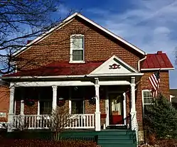 Joseph Raaf House |
September 14, 2000 (#00001112) |
602 Jefferson St. 38°33′37″N 91°01′29″W |
Washington | |
| 47 | St. Albans Farms Stone Barn | 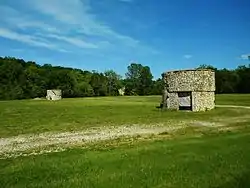 St. Albans Farms Stone Barn |
January 26, 2006 (#05001550) |
3476 St. Albans Rd. 38°35′00″N 90°45′27″W |
St. Albans | |
| 48 | St. Albans General Store | 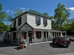 St. Albans General Store |
April 11, 2003 (#03000204) |
3516 St. Albans Rd. 38°34′48″N 90°46′19″W |
St. Albans | |
| 49 | Fred Schnier Building | 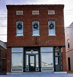 Fred Schnier Building |
September 14, 2000 (#00001113) |
10-12 W. 2nd St. 38°33′31″N 91°00′41″W |
Washington | |
| 50 | Franz Schwarzer House | 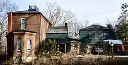 Franz Schwarzer House |
July 17, 1978 (#78001646) |
2 Walnut St. 38°33′31″N 91°00′28″W |
Washington | |
| 51 | John F. Schwegmann House | 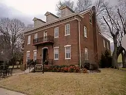 John F. Schwegmann House |
March 22, 1984 (#84002538) |
438 W. Front St. 38°33′45″N 91°00′54″W |
Washington | |
| 52 | Spaunhorst and Mayn Building | 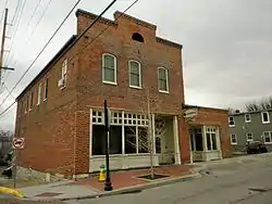 Spaunhorst and Mayn Building |
February 16, 2007 (#07000041) |
300-305 Jefferson St. 38°33′31″N 91°00′40″W |
Washington | |
| 53 | Stafford-Olive Historic District | 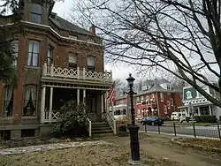 Stafford-Olive Historic District |
September 14, 2000 (#00001114) |
Roughly bounded by Stafford, Olive, W. 5th, and W. 2nd Sts. 38°33′36″N 91°01′05″W |
Washington | |
| 54 | George Tamm Building | 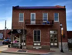 George Tamm Building |
September 14, 2000 (#00001115) |
121 Jefferson St. 38°33′32″N 91°00′39″W |
Washington | |
| 55 | Tavern Cave | June 15, 1970 (#70000331) |
Address Restricted |
St. Albans | ||
| 56 | Henry C. Thias House | 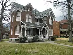 Henry C. Thias House |
September 20, 1984 (#84002539) |
304 Elm St. 38°33′32″N 91°00′51″W |
Washington | |
| 57 | Tibbe Historic District | 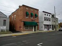 Tibbe Historic District |
March 22, 1990 (#90000501) |
Bounded by Front, Market, Main, Lafayette, Second, Oak, Fifth, Cedar, Main, and Olive 38°33′32″N 91°00′57″W |
Washington | |
| 58 | Jonathan L. Tuepker House | 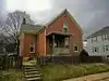 Jonathan L. Tuepker House |
September 14, 2000 (#00001116) |
519 Stafford St. 38°33′24″N 91°01′11″W |
Washington | |
| 59 | Christopher and Johanna Twelker Farm | November 2, 2016 (#16000748) |
4749 MO 185 38°29′59″N 91°10′34″W |
New Haven vicinity | ||
| 60 | William T. Vitt House | 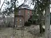 William T. Vitt House |
September 14, 2000 (#00001117) |
2 River Pilot Dr. 38°33′11″N 90°59′49″W |
Washington | |
| 61 | Louis Wehrmann Building |  Louis Wehrmann Building |
September 14, 2000 (#00001118) |
212 Jefferson St. 38°33′28″N 91°00′40″W |
Washington |
Former listing
| [3] | Name on the Register | Image | Date listed | Date removed | Location | City or town | Summary |
|---|---|---|---|---|---|---|---|
| 1 | John Glaser Pottery Factory | September 14, 2000 (#00001098) | August 26, 2005 | 812 W. Front St. |
Washington |
See also
References
| Wikimedia Commons has media related to National Register of Historic Places in Franklin County, Missouri. |
- The latitude and longitude information provided in this table was derived originally from the National Register Information System, which has been found to be fairly accurate for about 99% of listings. Some locations in this table may have been corrected to current GPS standards.
- "National Register of Historic Places: Weekly List Actions". National Park Service, United States Department of the Interior. Retrieved on January 29, 2021.
- Numbers represent an alphabetical ordering by significant words. Various colorings, defined here, differentiate National Historic Landmarks and historic districts from other NRHP buildings, structures, sites or objects.
- The eight-digit number below each date is the number assigned to each location in the National Register Information System database, which can be viewed by clicking the number.
| Topics | |
|---|---|
| Lists by state |
|
| Lists by insular areas | |
| Lists by associated state | |
| Other areas | |
| Related | |
| |
Municipalities and communities of Franklin County, Missouri, United States | ||
|---|---|---|
| Cities | Map of Missouri highlighting Franklin County | |
| Villages | ||
| Townships | ||
| CDPs | ||
| Other unincorporated communities |
| |
| Ghost towns | ||
| Footnotes | ‡This populated place also has portions in an adjacent county or counties | |
| ||
This article is issued from Wikipedia. The text is licensed under Creative Commons - Attribution - Sharealike. Additional terms may apply for the media files.