National Register of Historic Places listings in Marion County, Missouri
The following properties are listed on the National Register of Historic Places in Marion County, Missouri.
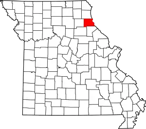
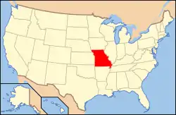
Location of Marion County in Missouri
This is intended to be a complete list of the properties and districts on the National Register of Historic Places in Marion County, Missouri, United States. Latitude and longitude coordinates are provided for many National Register properties and districts; these locations may be seen together in a map.[1]
There are 41 properties and districts listed on the National Register in the county, including 1 National Historic Landmark.
- This National Park Service list is complete through NPS recent listings posted January 29, 2021.[2]
Current listings
| [3] | Name on the Register | Image | Date listed[4] | Location | City or town | Description |
|---|---|---|---|---|---|---|
| 1 | Levi Barkley House | March 2, 1984 (#84002583) |
West of Hannibal 39°44′04″N 91°29′51″W |
Hannibal | ||
| 2 | Broadway District | 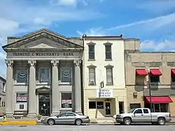 Broadway District |
August 1, 1986 (#86002128) |
Roughly bounded by S. Main, Broadway, and S. 3rd Sts. 39°42′34″N 91°21′22″W |
Hannibal | |
| 3 | Buildings at 207–209 South Main St. | 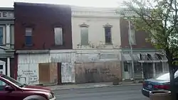 Buildings at 207–209 South Main St. |
August 1, 1986 (#86002129) |
207–209 S. Main St. 39°42′30″N 91°21′17″W |
Hannibal | |
| 4 | Central Park Historic District | 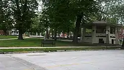 Central Park Historic District |
October 7, 1982 (#82000586) |
Roughly bounded by 4th, 7th, North, and Lyon Sts. 39°42′32″N 91°21′36″W |
Hannibal | |
| 5 | Clemens Field |  Clemens Field |
August 26, 2008 (#08000807) |
401 Collier St. 39°42′19″N 91°21′23″W |
Hannibal | |
| 6 | Culbertson-Head Farmstead | 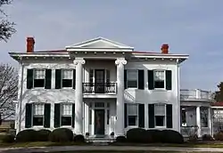 Culbertson-Head Farmstead |
September 4, 2008 (#08000838) |
7178 County Road 402 39°47′41″N 91°30′33″W |
Palmyra | |
| 7 | Davidson Building | 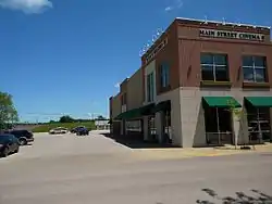 Davidson Building |
August 1, 1986 (#86002130) |
106 S. Main St. 39°42′34″N 91°21′18″W |
Hannibal | |
| 8 | Digel Block | 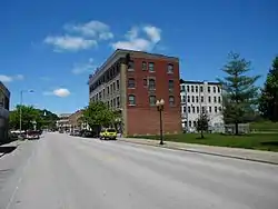 Digel Block |
August 1, 1986 (#86002131) |
218-222 S. Main St. 39°42′30″N 91°21′15″W |
Hannibal | |
| 9 | Dryden-Louthan House | 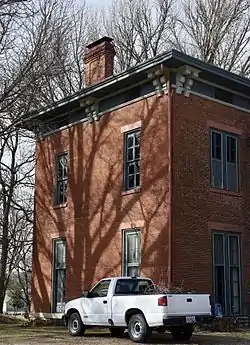 Dryden-Louthan House |
January 18, 1985 (#85000104) |
402 E. Ross St. 39°47′40″N 91°31′09″W |
Palmyra | |
| 10 | Ebert-Dulany House | 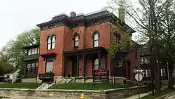 Ebert-Dulany House |
February 17, 1983 (#83001030) |
1000 Center St. 39°42′24″N 91°21′13″W |
Hannibal | |
| 11 | Eighth and Center Streets Baptist Church | 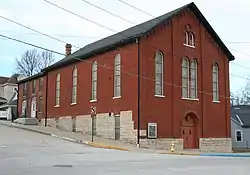 Eighth and Center Streets Baptist Church |
September 4, 1980 (#80002376) |
722 Center St. 39°42′28″N 91°21′48″W |
Hannibal | |
| 12 | Robert Elliott's Wholesale Grocery | 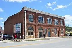 Robert Elliott's Wholesale Grocery |
August 1, 1986 (#86002132) |
116-120 S. 3rd St. 39°42′31″N 91°21′22″W |
Hannibal | |
| 13 | Federal Building | 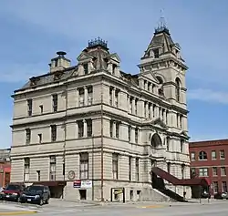 Federal Building |
October 15, 1980 (#80002377) |
600 Broadway 39°42′29″N 91°21′33″W |
Hannibal | |
| 14 | Gardner House | 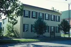 Gardner House |
March 4, 1971 (#71000470) |
421 Hamilton and Main Sts. 39°47′46″N 91°31′20″W |
Palmyra | |
| 15 | Green Double House | 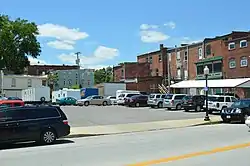 Green Double House |
August 1, 1986 (#86002133) |
113-115 S. 3rd St. 39°42′31″N 91°21′24″W |
Hannibal | |
| 16 | Hafner Grocery Warehouse | August 1, 1986 (#86002134) |
101 E. Church St. 39°42′34″N 91°21′12″W |
Hannibal | ||
| 17 | Hannibal Lime Company Office | September 6, 1984 (#84002585) |
623 Collier St. 39°42′18″N 91°21′34″W |
Hannibal | ||
| 18 | Hannibal Old Police Station and Jail |  Hannibal Old Police Station and Jail |
July 17, 1979 (#79001381) |
4th and Church Sts. 39°42′27″N 91°21′26″W |
Hannibal | |
| 19 | Hendren Farm | August 22, 1984 (#84002587) |
Route 2 39°44′59″N 91°26′27″W |
Hannibal | ||
| 20 | Hock Building | 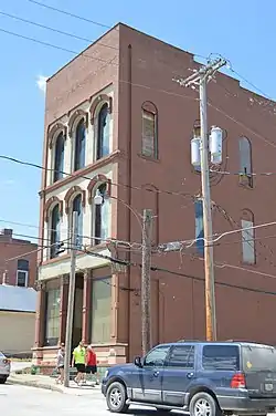 Hock Building |
December 2, 1986 (#86003588) |
312 Center St. 39°42′35″N 91°21′29″W |
Hannibal | |
| 21 | Holmes-Dakin Building | August 1, 1986 (#86002135) |
120-122 S. Main St. 39°42′33″N 91°21′17″W |
Hannibal | ||
| 22 | Benjamin Horr House | 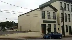 Benjamin Horr House |
December 2, 1986 (#86003587) |
308 Center St. 39°42′36″N 91°21′27″W |
Hannibal | |
| 23 | Lock and Dam No. 21 Historic District |  Lock and Dam No. 21 Historic District |
March 10, 2004 (#04000181) |
Mississippi River south of West Quincy 39°54′22″N 91°25′56″W |
West Quincy | Extends into Marion County, Missouri |
| 24 | Maple Avenue Historic District | 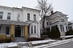 Maple Avenue Historic District |
November 21, 2002 (#02001404) |
Roughly bounded by Broadway and Center St., the alley to North St., and Dulany to Section 39°42′30″N 91°21′59″W |
Hannibal | |
| 25 | Marion County Courthouse | 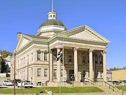 Marion County Courthouse |
October 22, 2002 (#02001194) |
906 Broadway 39°42′30″N 91°21′51″W |
Hannibal | |
| 26 | Marion County Jail and Jailor's House | 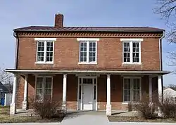 Marion County Jail and Jailor's House |
October 4, 2002 (#02001100) |
210 W. Lafayette St. 39°47′55″N 91°31′28″W |
Palmyra | |
| 27 | Mark Twain Historic District | 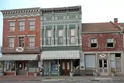 Mark Twain Historic District |
January 4, 1978 (#78003398) |
Bird, Main, and Hill Sts. 39°42′43″N 91°21′25″W |
Hannibal | |
| 28 | Mark Twain Hotel |  Mark Twain Hotel |
August 1, 1986 (#86002136) |
200 S. Main St. 39°42′33″N 91°21′17″W |
Hannibal | |
| 29 | Robert Masterson House | 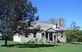 Robert Masterson House |
April 5, 1984 (#84002591) |
Northwest of Hannibal 39°46′02″N 91°28′20″W |
Hannibal | |
| 30 | North Main Street Historic District | 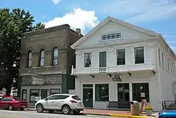 North Main Street Historic District |
August 1, 1986 (#86002137) |
Roughly bounded by Bird, N. Main, and Hill Sts. 39°42′40″N 91°21′22″W |
Hannibal | |
| 31 | Osterhout Mound Park | 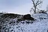 Osterhout Mound Park |
April 11, 1973 (#73001045) |
Wauneta Pl. 39°43′00″N 91°23′43″W |
Hannibal | |
| 32 | Riverview Park |  Riverview Park |
September 6, 2005 (#05000998) |
2000 Harrison Hill 39°43′29″N 91°22′18″W |
Hannibal | |
| 33 | Rockcliffe Mansion | 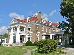 Rockcliffe Mansion |
September 18, 1980 (#80002378) |
1000 Bird St. 39°42′29″N 91°21′57″W |
Hannibal | |
| 34 | St. Elizabeth Hospital | 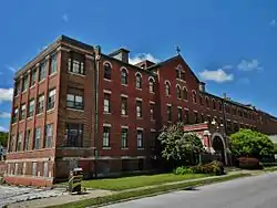 St. Elizabeth Hospital |
August 14, 2012 (#12000500) |
109 Virginia St. 39°42′14″N 91°22′51″W |
Hannibal | |
| 35 | Sharkey Mound Group | December 18, 1973 (#73001046) |
Address Restricted |
Hannibal | ||
| 36 | Peter J. Sowers House | 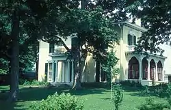 Peter J. Sowers House |
January 18, 1985 (#85000105) |
221 Home St. 39°47′52″N 91°31′12″W |
Palmyra | |
| 37 | Speigle House | 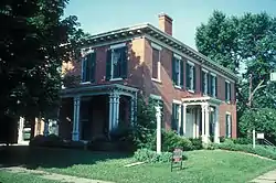 Speigle House |
February 14, 1985 (#85000283) |
406 S. Dickerson 39°47′48″N 91°31′28″W |
Palmyra | |
| 38 | Standard Printing Company | 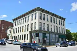 Standard Printing Company |
August 1, 1986 (#86002138) |
201 N. 3rd St. 39°42′36″N 91°21′28″W |
Hannibal | |
| 39 | Mark Twain Boyhood Home |  Mark Twain Boyhood Home |
October 15, 1966 (#66000419) |
206-208 Hill St. 39°42′44″N 91°21′28″W |
Hannibal | |
| 40 | Walker-Woodward-Schaffer House | 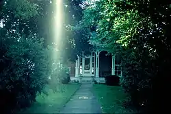 Walker-Woodward-Schaffer House |
February 16, 1984 (#84002592) |
1425 S. Main St. 39°47′13″N 91°31′23″W |
Palmyra | |
| 41 | Ephraim J. Wilson Farm Complex | December 28, 1982 (#82000587) |
East of Palmyra off Route 168 39°45′45″N 91°29′16″W |
Palmyra |
See also
References
| Wikimedia Commons has media related to National Register of Historic Places in Marion County, Missouri. |
- The latitude and longitude information provided in this table was derived originally from the National Register Information System, which has been found to be fairly accurate for about 99% of listings. Some locations in this table may have been corrected to current GPS standards.
- "National Register of Historic Places: Weekly List Actions". National Park Service, United States Department of the Interior. Retrieved on January 29, 2021.
- Numbers represent an alphabetical ordering by significant words. Various colorings, defined here, differentiate National Historic Landmarks and historic districts from other NRHP buildings, structures, sites or objects.
- The eight-digit number below each date is the number assigned to each location in the National Register Information System database, which can be viewed by clicking the number.
| Topics | |
|---|---|
| Lists by state |
|
| Lists by insular areas | |
| Lists by associated state | |
| Other areas | |
| Related | |
| |
Municipalities and communities of Marion County, Missouri, United States | ||
|---|---|---|
| Cities | Map of Missouri highlighting Marion County | |
| Townships | ||
| Unincorporated communities | ||
| Ghost towns | ||
| Footnotes | ‡This populated place also has portions in an adjacent county or counties | |
| ||
This article is issued from Wikipedia. The text is licensed under Creative Commons - Attribution - Sharealike. Additional terms may apply for the media files.