National Register of Historic Places listings in Osage County, Missouri
This is a list of the National Register of Historic Places listings in Osage County, Missouri.
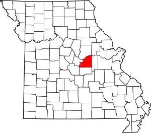
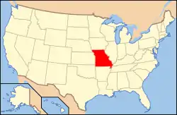
Location of Osage County in Missouri
This is intended to be a complete list of the properties and districts on the National Register of Historic Places in Osage County, Missouri, United States. Latitude and longitude coordinates are provided for many National Register properties and districts; these locations may be seen together in a map.[1]
There are 9 properties and districts listed on the National Register in the county.
- This National Park Service list is complete through NPS recent listings posted January 29, 2021.[2]
Current listings
| [3] | Name on the Register | Image | Date listed[4] | Location | City or town | Description |
|---|---|---|---|---|---|---|
| 1 | Bonnots Mill Historic District | January 21, 1993 (#92001738) |
Roughly Old Mill Rd., Riverside Dr., Highwater Rd., Iris Ave., Wildwood Ln., Hwy. A and Main, Short and Church Hill Sts. 38°34′38″N 91°57′47″W |
Bonnots Mill | ||
| 2 | Chamois Public School | June 26, 2003 (#03000295) |
402 S. Main St. 38°40′23″N 91°46′06″W |
Chamois | ||
| 3 | Dauphine Hotel | 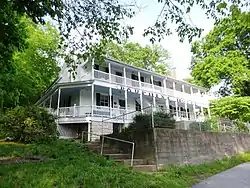 Dauphine Hotel |
November 14, 1980 (#80002386) |
Off Route A 38°34′44″N 91°57′51″W |
Bonnots Mill | |
| 4 | Huber's Ferry Farmstead Historic District | 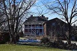 Huber's Ferry Farmstead Historic District |
January 15, 1999 (#98001609) |
Junction of U.S. Routes 50 and 63 38°29′27″N 92°00′23″W |
Jefferson City | |
| 5 | Osage County Poorhouse |  Osage County Poorhouse |
February 13, 1998 (#98000038) |
Route 621, 0.5 miles (0.80 km) south of Linn 38°28′45″N 91°51′18″W |
Linn | |
| 6 | Sacred Heart Catholic Church and Parsonage | September 9, 1982 (#82003155) |
Route U 38°23′49″N 91°52′53″W |
Rich Fountain | ||
| 7 | St. Joseph Church | 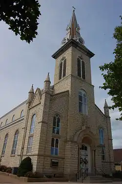 St. Joseph Church |
April 11, 1972 (#72000726) |
Main St. 38°26′28″N 91°59′45″W |
Westphalia | |
| 8 | Alvah Washington Townley Farmstead Historic District | August 5, 1999 (#99000937) |
304 S. Market St. 38°40′25″N 91°46′10″W |
Chamois | ||
| 9 | Dr. Enoch T. and Amy Zewicki House | 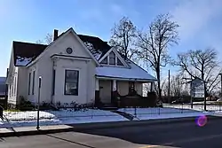 Dr. Enoch T. and Amy Zewicki House |
February 27, 2002 (#02000121) |
402 E. Main St. 38°29′06″N 91°51′02″W |
Linn |
See also
References
| Wikimedia Commons has media related to National Register of Historic Places in Osage County, Missouri. |
- The latitude and longitude information provided in this table was derived originally from the National Register Information System, which has been found to be fairly accurate for about 99% of listings. Some locations in this table may have been corrected to current GPS standards.
- "National Register of Historic Places: Weekly List Actions". National Park Service, United States Department of the Interior. Retrieved on January 29, 2021.
- Numbers represent an alphabetical ordering by significant words. Various colorings, defined here, differentiate National Historic Landmarks and historic districts from other NRHP buildings, structures, sites or objects.
- The eight-digit number below each date is the number assigned to each location in the National Register Information System database, which can be viewed by clicking the number.
| Topics | |
|---|---|
| Lists by state |
|
| Lists by insular areas | |
| Lists by associated state | |
| Other areas | |
| Related | |
| |
Municipalities and communities of Osage County, Missouri, United States | ||
|---|---|---|
| Cities | Map of Missouri highlighting Osage County | |
| Villages | ||
| Townships | ||
| Unincorporated communities | ||
| Ghost towns | ||
| Footnotes | ‡This populated place also has portions in an adjacent county or counties | |
| ||
This article is issued from Wikipedia. The text is licensed under Creative Commons - Attribution - Sharealike. Additional terms may apply for the media files.