National Register of Historic Places listings in Cass County, Missouri
This is a list of the National Register of Historic Places listings in Cass County, Missouri.
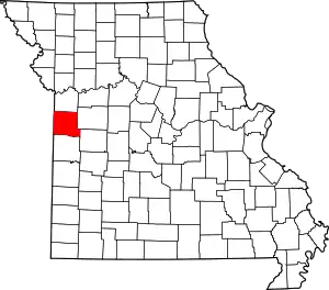
Location of Cass County in Missouri
This is intended to be a complete list of the properties and districts on the National Register of Historic Places in Cass County, Missouri, United States. Latitude and longitude coordinates are provided for many National Register properties and districts; these locations may be seen together in a map.[1]
There are 7 properties and districts listed on the National Register in the county.
- This National Park Service list is complete through NPS recent listings posted January 29, 2021.[2]
Current listings
| [3] | Name on the Register | Image | Date listed[4] | Location | City or town | Description |
|---|---|---|---|---|---|---|
| 1 | Robert A. Brown House | June 15, 1970 (#70000327) |
North of Harrisonville off Alternate U.S. Route 71 38°41′03″N 94°23′14″W |
Harrisonville | ||
| 2 | Harrisonville Courthouse Square Historic District | 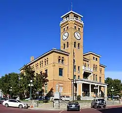 Harrisonville Courthouse Square Historic District |
April 8, 1994 (#94000315) |
Roughly Courthouse Sq. and adjacent side streets 38°39′16″N 94°20′55″W |
Harrisonville | |
| 3 | O'Bannon Homestead | July 3, 1979 (#79001356) |
Northeast of Garden City off Route NN 38°34′24″N 94°09′25″W |
Garden City | ||
| 4 | Pleasant Hill Downtown Historic District | March 23, 2005 (#04000781) |
Approximately bounded by the 200 block of Cedar St., the 100 block of Lake St., 100-115 Wyoming St., and 101-204 1st St. 38°47′17″N 94°16′25″W |
Pleasant Hill | ||
| 5 | St. Peter's Episcopal Church | September 9, 1982 (#82003132) |
400 W. Wall St. 38°39′16″N 94°21′04″W |
Harrisonville | ||
| 6 | Stumbaugh Post No. 180 GAR Hall | June 8, 2000 (#00000694) |
Route T 38°30′12″N 94°17′59″W |
Austin | Demolished | |
| 7 | Watkins Family Farm Historic District | May 2, 2007 (#07000376) |
19116 S. School Rd. 38°46′32″N 94°27′36″W |
Raymore |
See also
References
- The latitude and longitude information provided in this table was derived originally from the National Register Information System, which has been found to be fairly accurate for about 99% of listings. Some locations in this table may have been corrected to current GPS standards.
- "National Register of Historic Places: Weekly List Actions". National Park Service, United States Department of the Interior. Retrieved on January 29, 2021.
- Numbers represent an alphabetical ordering by significant words. Various colorings, defined here, differentiate National Historic Landmarks and historic districts from other NRHP buildings, structures, sites or objects.
- The eight-digit number below each date is the number assigned to each location in the National Register Information System database, which can be viewed by clicking the number.
| Topics | |
|---|---|
| Lists by state |
|
| Lists by insular areas | |
| Lists by associated state | |
| Other areas | |
| Related | |
| |
Municipalities and communities of Cass County, Missouri, United States | ||
|---|---|---|
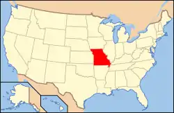
| Cities | Map of Missouri highlighting Cass County | |
| Villages | ||
| Townships | ||
| Unincorporated communities | ||
| Ghost towns | ||
| Footnotes | ‡This populated place also has portions in an adjacent county or counties | |
| ||
This article is issued from Wikipedia. The text is licensed under Creative Commons - Attribution - Sharealike. Additional terms may apply for the media files.