National Register of Historic Places listings in Cole County, Missouri
This is a list of the National Register of Historic Places listings in Cole County, Missouri.
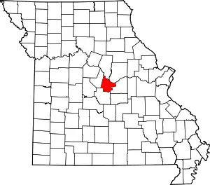
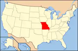
Location of Cole County in Missouri
This is intended to be a complete list of the properties and districts on the National Register of Historic Places in Cole County, Missouri, United States. Latitude and longitude coordinates are provided for many National Register properties and districts; these locations may be seen together in a map.[1]
There are 48 properties and districts listed on the National Register in the county.
- This National Park Service list is complete through NPS recent listings posted January 29, 2021.[2]
Current listings
| [3] | Name on the Register | Image | Date listed[4] | Location | City or town | Description |
|---|---|---|---|---|---|---|
| 1 | Henry and Elizabeth Bockrath House | 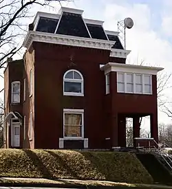 Henry and Elizabeth Bockrath House |
April 23, 2013 (#13000190) |
309 W. Dunklin St. 38°34′30″N 92°10′50″W |
Jefferson City | |
| 2 | Lewis and Elizabeth Bolton House | 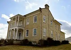 Lewis and Elizabeth Bolton House |
August 20, 1999 (#99001017) |
9514 MO W 38°26′43″N 92°09′58″W |
Jefferson City | |
| 3 | Broadway-Dunklin Historic District | 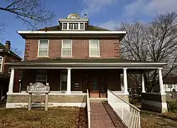 Broadway-Dunklin Historic District |
November 14, 2002 (#02001300) |
Most of 600 block of Broadway, and the 200 and 300 blocks of West Dunklin St. 38°34′30″N 92°10′44″W |
Jefferson City | |
| 4 | Nelson C. and Gertrude A. Burch House | 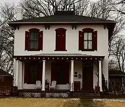 Nelson C. and Gertrude A. Burch House |
January 8, 2003 (#02001302) |
115 W. Atchison St. 38°34′15″N 92°10′49″W |
Jefferson City | |
| 5 | Oscar G. and Mary H. Burch House | 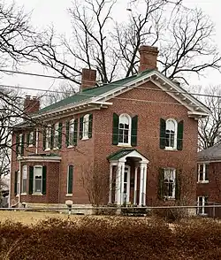 Oscar G. and Mary H. Burch House |
November 15, 2002 (#02001301) |
924 Jefferson St. 38°34′14″N 92°10′49″W |
Jefferson City | |
| 6 | Capitol Avenue Historic District | 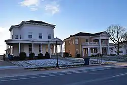 Capitol Avenue Historic District |
December 28, 2005 (#05001473) |
Roughly Capitol Ave., from Adams to Cherry Sts. 38°34′23″N 92°09′51″W |
Jefferson City | |
| 7 | Cole County Courthouse and Jail-Sheriff's House |  Cole County Courthouse and Jail-Sheriff's House |
April 3, 1973 (#73001038) |
Monroe and E. High Sts. 38°34′30″N 92°10′09″W |
Jefferson City | |
| 8 | Cole County Historical Society Building | 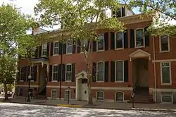 Cole County Historical Society Building |
May 21, 1969 (#69000093) |
109 Madison St. 38°34′38″N 92°10′09″W |
Jefferson City | |
| 9 | Dulle Farmstead Historic District | 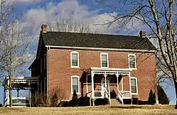 Dulle Farmstead Historic District |
December 30, 1993 (#93001468) |
1101 Hwy. 54 W. 38°31′25″N 92°13′34″W |
Jefferson City | |
| 10 | East End Drugs | 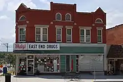 East End Drugs |
August 21, 2003 (#03000794) |
630 E. High St. 38°34′18″N 92°09′52″W |
Jefferson City | |
| 11 | Garnett Farm Historic District | May 31, 2016 (#16000305) |
7119 MO 179 38°42′32″N 92°22′57″W |
Centertown | ||
| 12 | Gay Archeological Site | January 25, 1971 (#71000466) |
Address Restricted |
Osage City | ||
| 13 | H.E. Gensky Grocery Store Building | 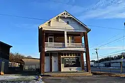 H.E. Gensky Grocery Store Building |
June 6, 2001 (#01000628) |
423 Cherry St. 38°34′07″N 92°09′54″W |
Jefferson City | |
| 14 | Claud D. Grove and Berenice Sinclair Grove House | 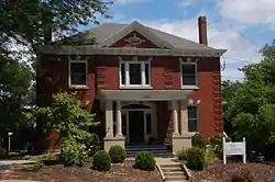 Claud D. Grove and Berenice Sinclair Grove House |
November 15, 2002 (#02001310) |
505 E. State St. 38°34′31″N 92°09′51″W |
Jefferson City | |
| 15 | Herman Haar House | 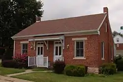 Herman Haar House |
May 2, 1997 (#97000398) |
110 Bolivar St. 38°35′02″N 92°10′43″W |
Jefferson City | |
| 16 | Philip Hess House | 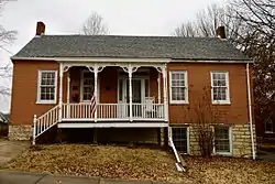 Philip Hess House |
November 15, 2002 (#02001304) |
714 Washington St. 38°34′23″N 92°10′45″W |
Jefferson City | |
| 17 | Hobo Hill Historic District | 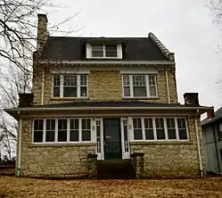 Hobo Hill Historic District |
January 2, 2013 (#12001124) |
500 blocks of E. Miller & Jackson Sts. 38°34′16″N 92°10′11″W |
Jefferson City | |
| 18 | Ivy Terrace | 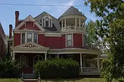 Ivy Terrace |
March 16, 1990 (#90000426) |
500 E. Capitol Ave. 38°34′26″N 92°09′57″W |
Jefferson City | |
| 19 | Jefferson City Community Center | 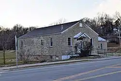 Jefferson City Community Center |
May 14, 1992 (#92000503) |
608 E. Dunklin St. 38°34′04″N 92°10′12″W |
Jefferson City | |
| 20 | Jefferson City National Cemetery | 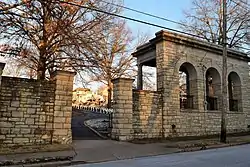 Jefferson City National Cemetery |
October 1, 1998 (#98001221) |
1024 E. McCarty St. 38°34′06″N 92°09′42″W |
Jefferson City | |
| 21 | Jefferson Female Seminary | 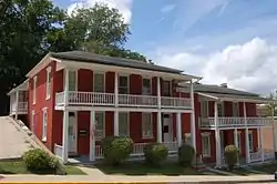 Jefferson Female Seminary |
February 24, 2000 (#00000087) |
416 and 420 E. State St. 38°34′32″N 92°09′56″W |
Jefferson City | |
| 22 | Kaullen Mercantile Company | 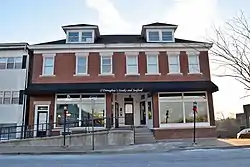 Kaullen Mercantile Company |
November 21, 2002 (#02001402) |
900 and 902 E. High St. 38°34′09″N 92°09′43″W |
Jefferson City | |
| 23 | Lansdown-Higgins House | November 12, 1999 (#99001311) |
5240 Tanner Bridge Rd. 38°30′23″N 92°12′19″W |
Jefferson City | ||
| 24 | Lincoln Univ. Hilltop Campus Historic District | 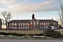 Lincoln Univ. Hilltop Campus Historic District |
April 28, 1983 (#83000978) |
820 Chestnut St.; also another part of 820 Chestnut St. 38°33′51″N 92°10′09″W |
Jefferson City | "Another part" represents a boundary increase of August 21, 2002 |
| 25 | Lohman's Landing Building | 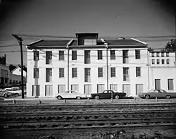 Lohman's Landing Building |
February 25, 1969 (#69000094) |
W corner of Jefferson and Water Sts. 38°34′39″N 92°10′14″W |
Jefferson City | Part of the Jefferson Landing State Historic Site |
| 26 | Missouri Governor's Mansion |  Missouri Governor's Mansion |
May 21, 1969 (#69000095) |
100 Madison St. 38°34′41″N 92°10′12″W |
Jefferson City | |
| 27 | Missouri State Capitol Building and Grounds |  Missouri State Capitol Building and Grounds |
June 23, 1969 (#69000096) |
High St. between Broadway and Jefferson Sts. 38°34′44″N 92°10′23″W |
Jefferson City | |
| 28 | Missouri State Capitol Historic District | 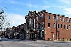 Missouri State Capitol Historic District |
June 18, 1976 (#76001109) |
Bounded roughly by Adams, McCarthy, Mulberry Sts. and the Missouri River; also the 200 block of W. McCarty St. and 406-408 Washington St. 38°34′39″N 92°10′16″W |
Jefferson City | Second set of addresses represents a boundary increase of July 17, 2002 |
| 29 | Missouri State Penitentiary Warden's House | 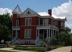 Missouri State Penitentiary Warden's House |
October 24, 1991 (#91001518) |
700 E. Capitol Ave. 38°34′20″N 92°09′47″W |
Jefferson City | |
| 30 | Moreau Drive Historic District | 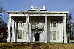 Moreau Drive Historic District |
December 11, 2013 (#13000907) |
Moreau & Elmerine Drs., Fairmount Blvd., Oakwood Ave., Fairmount Ct., Lee St., Moreland Ave. 38°33′31″N 92°10′08″W |
Jefferson City | |
| 31 | Moreau Park Historic District | 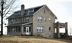 Moreau Park Historic District |
September 30, 2009 (#09000786) |
3714 Wardsville Rd. 38°31′46″N 92°09′52″W |
Jefferson City | |
| 32 | Munichburg Commercial Historic District | 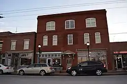 Munichburg Commercial Historic District |
July 1, 2009 (#09000477) |
114-130 (even only) E. Dunklin St., 610, 620 Madison St., 704 Madison St. 38°34′19″N 92°10′33″W |
Jefferson City | Southside Munichburg, Missouri MPS |
| 33 | Lester S. and Missouri "Zue" Gordon Parker House | 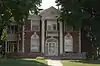 Lester S. and Missouri "Zue" Gordon Parker House |
June 15, 2000 (#00000690) |
624 E. Capitol Ave. 38°34′21″N 92°09′49″W |
Jefferson City | |
| 34 | Dr. Joseph P. and Effie Porth House | 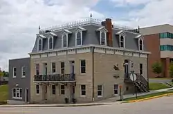 Dr. Joseph P. and Effie Porth House |
January 26, 2001 (#01000009) |
631 W. Main St. 38°35′00″N 92°10′43″W |
Jefferson City | |
| 35 | John B. and Elizabeth Ruthven House | 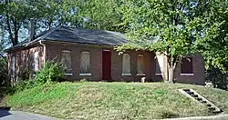 John B. and Elizabeth Ruthven House |
May 26, 2000 (#00000537) |
406 Cherry St. 38°34′09″N 92°09′55″W |
Jefferson City | |
| 36 | St. Francis Xavier Catholic Church and Rectory | 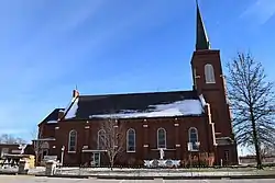 St. Francis Xavier Catholic Church and Rectory |
March 22, 2016 (#16000100) |
7319 Missouri Route M 38°30′28″N 92°04′08″W |
Taos | |
| 37 | Charles J. and Clara B. Schmidt House | 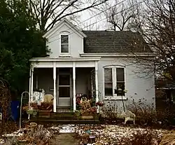 Charles J. and Clara B. Schmidt House |
January 7, 2003 (#02001303) |
215 W. Atchison St. 38°34′19″N 92°10′53″W |
Jefferson City | |
| 38 | John M. and Lillian Sommerer House | 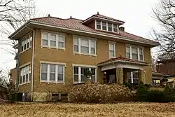 John M. and Lillian Sommerer House |
June 12, 2007 (#07000548) |
2023 W. Main St. 38°35′27″N 92°12′13″W |
Jefferson City | |
| 39 | Hugh and Bessie Stephens House | 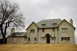 Hugh and Bessie Stephens House |
May 12, 2009 (#09000301) |
601 Jackson St. 38°34′13″N 92°10′14″W |
Jefferson City | |
| 40 | Tergin Apartment Building | 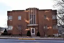 Tergin Apartment Building |
April 22, 1999 (#99000475) |
201 W. McCarty St. 38°34′37″N 92°10′31″W |
Jefferson City | |
| 41 | Albert and Wilhelmina Thomas House | 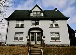 Albert and Wilhelmina Thomas House |
November 14, 2002 (#02001305) |
224 W. Elm St. 38°34′33″N 92°10′40″W |
Jefferson City | |
| 42 | Trinity Lutheran Church Historic District | February 28, 2020 (#100005004) |
13007-13013 Route C 38°30′33″N 92°26′16″W |
Russellville | ||
| 43 | Villa Panorama | 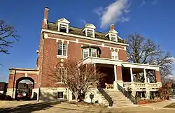 Villa Panorama |
January 3, 1985 (#85000031) |
1310 Swifts Hwy. 38°34′09″N 92°11′32″W |
Jefferson City | |
| 44 | Joseph and Elizabeth Wallendorf House | 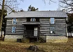 Joseph and Elizabeth Wallendorf House |
April 4, 2008 (#08000253) |
701 S. Country Club Dr. 38°34′41″N 92°15′51″W |
Jefferson City | |
| 45 | West End Saloon | 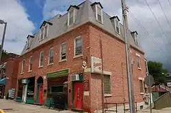 West End Saloon |
June 27, 2014 (#14000374) |
700-702 W. Main St. 38°35′01″N 92°10′45″W |
Jefferson City | |
| 46 | Woodland-Old City Cemetery | July 23, 2018 (#100002688) |
1022 & 1000 E McCarty St. 38°34′06″N 92°09′47″W |
Jefferson City | ||
| 47 | Zion Lutheran Church | .jpg.webp) Zion Lutheran Church |
November 15, 2000 (#00001374) |
2346 Zion Rd. 38°32′10″N 92°15′11″W |
Jefferson City | |
| 48 | William E. and Frederica M. Zuendt House |  William E. and Frederica M. Zuendt House |
November 15, 2002 (#02001306) |
920 Jefferson St. 38°34′15″N 92°10′48″W |
Jefferson City |
See also
References
| Wikimedia Commons has media related to National Register of Historic Places in Cole County, Missouri. |
- The latitude and longitude information provided in this table was derived originally from the National Register Information System, which has been found to be fairly accurate for about 99% of listings. Some locations in this table may have been corrected to current GPS standards.
- "National Register of Historic Places: Weekly List Actions". National Park Service, United States Department of the Interior. Retrieved on January 29, 2021.
- Numbers represent an alphabetical ordering by significant words. Various colorings, defined here, differentiate National Historic Landmarks and historic districts from other NRHP buildings, structures, sites or objects.
- The eight-digit number below each date is the number assigned to each location in the National Register Information System database, which can be viewed by clicking the number.
| Topics | |
|---|---|
| Lists by state |
|
| Lists by insular areas | |
| Lists by associated state | |
| Other areas | |
| Related | |
| |
Municipalities and communities of Cole County, Missouri, United States | ||
|---|---|---|
| Cities | Map of Missouri highlighting Cole County | |
| Villages | ||
| Townships | ||
| Unincorporated communities | ||
| Ghost towns | ||
| Footnotes | ‡This populated place also has portions in an adjacent county or counties | |
| ||
This article is issued from Wikipedia. The text is licensed under Creative Commons - Attribution - Sharealike. Additional terms may apply for the media files.