National Register of Historic Places listings in Johnson County, Missouri
This is a list of the National Register of Historic Places listings in Johnson County, Missouri.
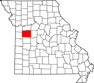
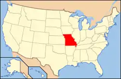
Location of Johnson County in Missouri
This is intended to be a complete list of the properties and districts on the National Register of Historic Places in Johnson County, Missouri, United States. Latitude and longitude coordinates are provided for many National Register properties and districts; these locations may be seen together in a map.[1]
There are 22 properties and districts listed on the National Register in the county.
- This National Park Service list is complete through NPS recent listings posted January 29, 2021.[2]
Current listings
| [3] | Name on the Register | Image | Date listed[4] | Location | City or town | Description |
|---|---|---|---|---|---|---|
| 1 | John A. Adams Farmstead Historic District | July 7, 1994 (#94000701) |
431 SE Y Highway 38°41′46″N 93°39′58″W |
Warrensburg | ||
| 2 | Camp Shawnee Historic District | March 4, 1985 (#85000506) |
Southwest of Knob Noster 38°44′57″N 93°37′07″W |
Knob Noster | ||
| 3 | Chilhowee Historic District | 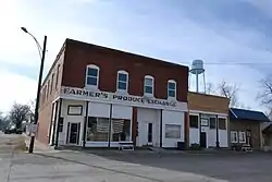 Chilhowee Historic District |
June 2, 1988 (#88000650) |
Roughly Walnut and Main Sts. 38°35′16″N 93°51′21″W |
Chilhowee | |
| 4 | Herbert A. and Bettie E. Cress House | 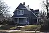 Herbert A. and Bettie E. Cress House |
October 12, 1995 (#95001174) |
222 W. Gay St. 38°45′58″N 93°44′40″W |
Warrensburg | |
| 5 | Garden of Eden Station | 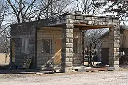 Garden of Eden Station |
April 8, 1994 (#94000313) |
Junction of MO 13 and County Road 215NW 38°47′29″N 93°44′31″W |
Warrensburg | |
| 6 | Lewis and Sophie Griebel House | 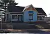 Lewis and Sophie Griebel House |
October 31, 2012 (#12000895) |
300 W. Gay St. 38°45′58″N 93°44′43″W |
Warrensburg | |
| 7 | Grover Street Victorian Historic District | 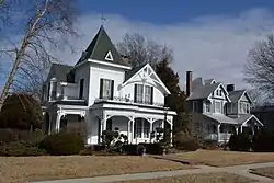 Grover Street Victorian Historic District |
July 18, 2012 (#12000417) |
209, 210, 211, 212, 214, 216, & 218 Grover St. 38°45′43″N 93°44′14″W |
Warrensburg | |
| 8 | Holden and Pine Streets Commercial Historic District | 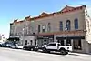 Holden and Pine Streets Commercial Historic District |
April 3, 2017 (#100000825) |
Roughly bounded by Maynard, N. College, E. Gay, W. Market, Marshall & Railroad Sts. & N. Washington Ave. 38°45′56″N 93°44′25″W |
Warrensburg | |
| 9 | Howard School |  Howard School |
February 14, 2002 (#02000046) |
400 W. Culton St. 38°45′51″N 93°43′32″W |
Warrensburg | Demolished in 2015 after the roof collapsed. |
| 10 | Johnson County Courthouse |  Johnson County Courthouse |
April 7, 1994 (#94000288) |
Courthouse Sq. 38°45′54″N 93°44′26″W |
Warrensburg | |
| 11 | Johnson County Courthouse | 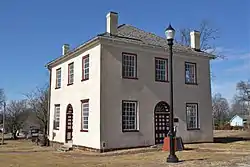 Johnson County Courthouse |
June 15, 1970 (#70000338) |
Old Public Sq. 38°45′56″N 93°45′05″W |
Warrensburg | |
| 12 | Jones Brothers Mule Barn | 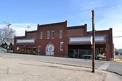 Jones Brothers Mule Barn |
February 22, 2011 (#11000045) |
101 N. College Ave. 38°45′46″N 93°44′17″W |
Warrensburg | |
| 13 | Magnolia Mills | 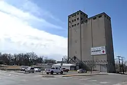 Magnolia Mills |
October 3, 1996 (#96001064) |
200 W. Pine St. 38°45′47″N 93°44′35″W |
Warrensburg | |
| 14 | Masonic Temple | 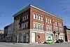 Masonic Temple |
December 24, 1998 (#98001544) |
101-103 W. Market St., and 301-303 N. Holden St. 38°45′55″N 93°44′23″W |
Warrensburg | |
| 15 | Joseph M. Miller Mausoleum | 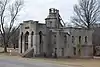 Joseph M. Miller Mausoleum |
January 29, 2018 (#100002036) |
.8 mi. N of jct. of MO 131 & 2nd St. 38°43′49″N 93°59′34″W |
Holden | |
| 16 | Montserrat Recreation Demonstration Area Bridge | 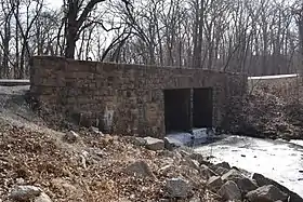 Montserrat Recreation Demonstration Area Bridge |
March 4, 1985 (#85000507) |
MO 132 38°45′13″N 93°34′36″W |
Knob Noster | |
| 17 | Montserrat Recreation Demonstration Area Dam and Spillway | 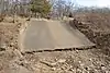 Montserrat Recreation Demonstration Area Dam and Spillway |
March 4, 1985 (#85000508) |
Southwest of Knob Noster 38°44′57″N 93°34′11″W |
Knob Noster | |
| 18 | Montserrat Recreation Demonstration Area Entrance Portal | March 4, 1985 (#85000509) |
Off MO 132 38°46′28″N 93°34′02″W |
Knob Noster | ||
| 19 | Montserrat Recreational Demonstration Area Rock Bath House | 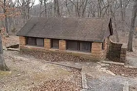 Montserrat Recreational Demonstration Area Rock Bath House |
March 4, 1985 (#85000510) |
Southwest of Knob Noster 38°44′58″N 93°34′19″W |
Knob Noster | |
| 20 | Montserrat Recreational Demonstration Area Warehouse No. 2 and Workshop | March 4, 1985 (#85000511) |
Off MO 132 38°45′11″N 93°34′43″W |
Knob Noster | ||
| 21 | Pleasant View School | 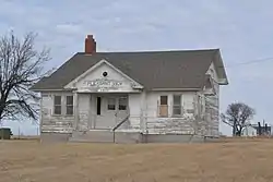 Pleasant View School |
August 5, 1999 (#99000935) |
674 SW 131 Highway 38°40′15″N 94°00′22″W |
Medford | |
| 22 | Warren Street Methodist Episcopal Church | 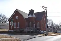 Warren Street Methodist Episcopal Church |
December 13, 1996 (#96001483) |
201 S. Warren St. 38°45′43″N 93°44′41″W |
Warrensburg |
See also
References
| Wikimedia Commons has media related to National Register of Historic Places in Johnson County, Missouri. |
- The latitude and longitude information provided in this table was derived originally from the National Register Information System, which has been found to be fairly accurate for about 99% of listings. Some locations in this table may have been corrected to current GPS standards.
- "National Register of Historic Places: Weekly List Actions". National Park Service, United States Department of the Interior. Retrieved on January 29, 2021.
- Numbers represent an alphabetical ordering by significant words. Various colorings, defined here, differentiate National Historic Landmarks and historic districts from other NRHP buildings, structures, sites or objects.
- The eight-digit number below each date is the number assigned to each location in the National Register Information System database, which can be viewed by clicking the number.
| Topics | |
|---|---|
| Lists by state |
|
| Lists by insular areas | |
| Lists by associated state | |
| Other areas | |
| Related | |
| |
Municipalities and communities of Johnson County, Missouri, United States | ||
|---|---|---|
| Cities | Map of Missouri highlighting Johnson County | |
| Townships | ||
| CDPs | ||
| Unincorporated communities | ||
| Footnotes | ‡This populated place also has portions in an adjacent county or counties | |
| ||
This article is issued from Wikipedia. The text is licensed under Creative Commons - Attribution - Sharealike. Additional terms may apply for the media files.