National Register of Historic Places listings in Montgomery County, Missouri
This is a list of the National Register of Historic Places listings in Montgomery County, Missouri.
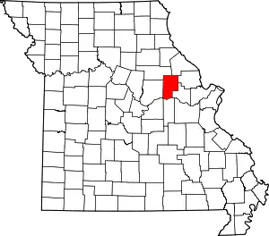
Location of Montgomery County in Missouri
This is intended to be a complete list of the properties and districts on the National Register of Historic Places in Montgomery County, Missouri, United States. Latitude and longitude coordinates are provided for many National Register properties and districts; these locations may be seen together in a map.[1]
There are 9 properties and districts listed on the National Register in the county, including 1 National Historic Landmark.
- This National Park Service list is complete through NPS recent listings posted January 29, 2021.[2]
Current listings
| [3] | Name on the Register | Image | Date listed[4] | Location | City or town | Description |
|---|---|---|---|---|---|---|
| 1 | Sylvester Marion and Frances Anne Stephens Baker House | _3.JPG.webp) Sylvester Marion and Frances Anne Stephens Baker House |
August 20, 1999 (#99001018) |
60 Boonslick Rd. 38°54′29″N 91°31′27″W |
Montgomery City | |
| 2 | Farmers Mercantile Co. Building | _1.JPG.webp) Farmers Mercantile Co. Building |
June 16, 2004 (#04000604) |
872 Boone's Lick Rd. 38°52′40″N 91°22′57″W |
High Hill | |
| 3 | Heinrich Gloe House | February 7, 2007 (#07000022) |
358 Hwy P 38°45′18″N 91°33′32″W |
Rhineland | ||
| 4 | Graham Cave | Graham Cave |
October 15, 1966 (#66000420) |
0.5 miles north of Mineola 38°54′19″N 91°34′23″W |
Mineola | |
| 5 | High Hill School | _2.JPG.webp) High Hill School |
November 14, 1980 (#80002381) |
Off U.S. Route 40 38°52′43″N 91°22′53″W |
High Hill | |
| 6 | McKittrick Farmers Mercantile | June 7, 2010 (#10000313) |
500 Washington St 38°43′58″N 91°26′39″W |
McKittrick | ||
| 7 | Mount Horeb Baptist Church | September 27, 1980 (#80002382) |
West of Mineola 38°50′40″N 91°38′31″W |
Mineola | ||
| 8 | Pinnacle Lake Rock Shelter | July 29, 1969 (#69000117) |
Address Restricted |
Big Spring | ||
| 9 | Shrine of Our Lady of Sorrows | September 9, 1982 (#82003153) |
Route P 38°44′02″N 91°33′10″W |
Starkenburg |
See also
References
| Wikimedia Commons has media related to National Register of Historic Places in Montgomery County, Missouri. |
- The latitude and longitude information provided in this table was derived originally from the National Register Information System, which has been found to be fairly accurate for about 99% of listings. Some locations in this table may have been corrected to current GPS standards.
- "National Register of Historic Places: Weekly List Actions". National Park Service, United States Department of the Interior. Retrieved on January 29, 2021.
- Numbers represent an alphabetical ordering by significant words. Various colorings, defined here, differentiate National Historic Landmarks and historic districts from other NRHP buildings, structures, sites or objects.
- The eight-digit number below each date is the number assigned to each location in the National Register Information System database, which can be viewed by clicking the number.
| Topics | |
|---|---|
| Lists by state |
|
| Lists by insular areas | |
| Lists by associated state | |
| Other areas | |
| Related | |
| |
Municipalities and communities of Montgomery County, Missouri, United States | ||
|---|---|---|
| Cities | Map of Missouri highlighting Montgomery County | |
| Village | ||
| Townships | ||
| CDPs | ||
| Other unincorporated communities | ||
| ||
This article is issued from Wikipedia. The text is licensed under Creative Commons - Attribution - Sharealike. Additional terms may apply for the media files.