National Register of Historic Places listings in Pettis County, Missouri
This is a list of the National Register of Historic Places listings in Pettis County, Missouri.
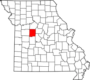
Location of Pettis County in Missouri
This is intended to be a complete list of the properties and districts on the National Register of Historic Places in Pettis County, Missouri, United States. Latitude and longitude coordinates are provided for many National Register properties and districts; these locations may be seen together in a map.[1]
There are 27 properties and districts listed on the National Register in the county.
- This National Park Service list is complete through NPS recent listings posted January 29, 2021.[2]
Current listings
| [3] | Name on the Register | Image | Date listed[4] | Location | City or town | Description |
|---|---|---|---|---|---|---|
| 1 | Bois d'Arc Cooperative Dairy Farm Historic District | September 27, 1991 (#91001407) |
MO J near junction with Bois d'Arc Rd. 38°51′40″N 93°09′16″W |
Hughesville | ||
| 2 | Building at 217 West Main Street | 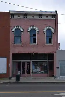 Building at 217 West Main Street |
October 24, 1996 (#96001189) |
217 W. Main St. 38°42′39″N 93°13′46″W |
Sedalia | |
| 3 | G and G Veterinary Hospital |  G and G Veterinary Hospital |
April 15, 2011 (#11000186) |
711 W. Main St. 38°42′43″N 93°14′04″W |
Sedalia | |
| 4 | William H. Gentry House | 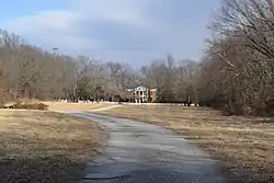 William H. Gentry House |
November 14, 1997 (#97001434) |
22970 Cherry Tree Ln. 38°44′38″N 93°15′31″W |
Sedalia | |
| 5 | Harris House | 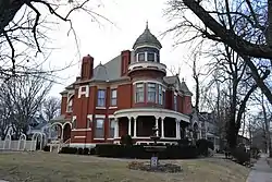 Harris House |
July 10, 1979 (#79001387) |
705 W. 6th St. 38°42′22″N 93°14′06″W |
Sedalia | |
| 6 | John T. and Lillian Heard House | 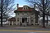 John T. and Lillian Heard House |
April 15, 2011 (#11000187) |
200 W. Broadway Blvd. 38°42′15″N 93°13′46″W |
Sedalia | |
| 7 | Hillview Cooperative Dairy Farm Historic District | September 27, 1991 (#91001399) |
Junction of MO T and Hillview Rd. 38°49′41″N 93°21′29″W |
Hughesville | ||
| 8 | Hotel Bothwell | 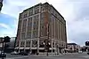 Hotel Bothwell |
September 8, 1989 (#89001406) |
103 E. Fourth St. 38°42′29″N 93°13′39″W |
Sedalia | |
| 9 | C.C. Hubbard High School | 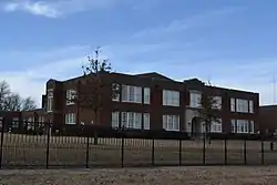 C.C. Hubbard High School |
July 3, 1997 (#97000628) |
721 N. Osage Ave. 38°42′58″N 93°13′38″W |
Sedalia | |
| 10 | Henry Jones Farmstead | December 3, 2008 (#08001129) |
17000 Hwy. EE 38°49′44″N 93°10′01″W |
Sedalia | ||
| 11 | McVey School | 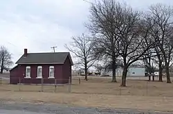 McVey School |
October 14, 1999 (#99001255) |
Junction of MO 50 and Rte M 38°41′59″N 93°11′23″W |
Sedalia | |
| 12 | Missouri State Fairgrounds Historic District | 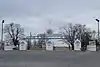 Missouri State Fairgrounds Historic District |
June 28, 1991 (#91000853) |
Roughly bounded by US 65, Co. Rd. Y, Clarendon Rd. and the Missouri-Kansas-Texas RR tracks 38°41′40″N 93°15′23″W |
Sedalia | |
| 13 | Missouri, Kansas and Texas Railroad Depot | 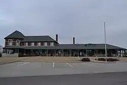 Missouri, Kansas and Texas Railroad Depot |
March 28, 1979 (#79001388) |
600 E. 3rd St. 38°42′28″N 93°13′14″W |
Sedalia | |
| 14 | Missouri/Sedalia Trust Company | 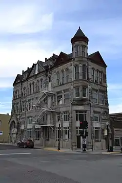 Missouri/Sedalia Trust Company |
March 29, 1983 (#83001034) |
322 S. Ohio St. 38°42′28″N 93°13′41″W |
Sedalia | |
| 15 | Osage Farms Type 315:13 Government Farmhouse | September 27, 1991 (#91001406) |
MO J near junction with Miller Chapel Rd. 38°53′20″N 93°07′37″W |
Hughesville | ||
| 16 | Osage Farms Unit No. 1 Historic District | September 27, 1991 (#91001408) |
MO D near junction with Moon Rd. 38°51′32″N 93°13′42″W |
Hughesville | ||
| 17 | Osage Farms Unit No. 25 Historic District | 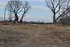 Osage Farms Unit No. 25 Historic District |
September 27, 1991 (#91001405) |
Houston Rd. near junction with Montgomery Rd. 38°53′29″N 93°15′27″W |
Hughesville | |
| 18 | Osage Farms Unit No. 26 Historic District | September 27, 1991 (#91001409) |
MO D near junction with High Point Rd. 38°51′21″N 93°14′44″W |
Hughesville | ||
| 19 | Osage Farms Unit No. 30 Historic District | 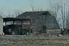 Osage Farms Unit No. 30 Historic District |
September 27, 1991 (#91001401) |
Durley Rd. near junction with MO D 38°50′59″N 93°15′29″W |
Hughesville | |
| 20 | Osage Farms Unit No. 31 |  Osage Farms Unit No. 31 |
September 27, 1991 (#91001402) |
Durley Rd. near junction with MO D 38°50′59″N 93°15′35″W |
Hughesville | |
| 21 | Osage Farms Unit No. 41 |  Osage Farms Unit No. 41 |
September 27, 1991 (#91001403) |
Hill View Rd. near junction with McCubbin Rd. 38°52′17″N 93°20′43″W |
Houstonia | |
| 22 | Osage Farms Unit No. 43 Historic District | September 27, 1991 (#91001410) |
MO J near junction with Lowry Rd. 38°51′28″N 93°10′56″W |
Hughesville | ||
| 23 | Osage Farms Units No. 5 and No. 6 Historic District | September 27, 1991 (#91001404) |
Range Line Rd. near junction with Trickum Rd. 38°54′35″N 93°16′43″W |
Houstonia | All building have been demolished. | |
| 24 | Osage Farms Units No. 8 and No. 9 Historic District | September 27, 1991 (#91001400) |
MO D near junction with MO T 38°51′48″N 93°21′33″W |
Houstonia | ||
| 25 | Sedalia Commercial Historic District |  Sedalia Commercial Historic District |
June 28, 2001 (#01000687) |
Roughly Ohio, Lamine, W. Main, E. Main, and parts of 2nd through 5th Sts.; also 700-712 S. Ohio, 200 S. Moniteau, 101-108 W. Pacific, 104-220 W. Main, 208-400 W. 2nd, 200 W. 4th, and 102-120 E. 5th. 38°42′26″N 93°13′41″W |
Sedalia | |
| 26 | Sedalia Public Library |  Sedalia Public Library |
January 10, 1980 (#80002389) |
311 W. 3rd St. 38°42′30″N 93°13′50″W |
Sedalia | |
| 27 | Gen. David Thomson House |  Gen. David Thomson House |
October 4, 1982 (#82000588) |
S of Hughesville on SR H 38°46′52″N 93°16′20″W |
Hughesville |
See also
References
| Wikimedia Commons has media related to National Register of Historic Places in Pettis County, Missouri. |
- The latitude and longitude information provided in this table was derived originally from the National Register Information System, which has been found to be fairly accurate for about 99% of listings. Some locations in this table may have been corrected to current GPS standards.
- "National Register of Historic Places: Weekly List Actions". National Park Service, United States Department of the Interior. Retrieved on January 29, 2021.
- Numbers represent an alphabetical ordering by significant words. Various colorings, defined here, differentiate National Historic Landmarks and historic districts from other NRHP buildings, structures, sites or objects.
- The eight-digit number below each date is the number assigned to each location in the National Register Information System database, which can be viewed by clicking the number.
| Topics | |
|---|---|
| Lists by state |
|
| Lists by insular areas | |
| Lists by associated state | |
| Other areas | |
| Related | |
| |
Municipalities and communities of Pettis County, Missouri, United States | ||
|---|---|---|
| Cities | Map of Missouri highlighting Pettis County | |
| Villages | ||
| Townships | ||
| Unincorporated communities | ||
| Ghost towns | ||
| Footnotes | ‡This populated place also has portions in an adjacent county or counties | |
| ||
This article is issued from Wikipedia. The text is licensed under Creative Commons - Attribution - Sharealike. Additional terms may apply for the media files.