La Murette
La Murette is a commune in the Isère department in southeastern France.
La Murette | |
|---|---|
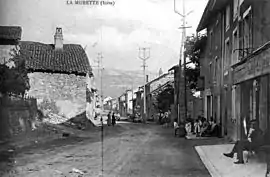 La Murette in 1908 | |
 Coat of arms | |
Location of La Murette 
| |
 La Murette  La Murette | |
| Coordinates: 45°22′54″N 5°32′26″E | |
| Country | France |
| Region | Auvergne-Rhône-Alpes |
| Department | Isère |
| Arrondissement | Grenoble |
| Canton | Voiron |
| Intercommunality | CA Pays Voironnais |
| Government | |
| • Mayor (2014–2020) | Bernadette Bourgeat |
| Area 1 | 4.22 km2 (1.63 sq mi) |
| Population (2017-01-01)[1] | 1,884 |
| • Density | 450/km2 (1,200/sq mi) |
| Time zone | UTC+01:00 (CET) |
| • Summer (DST) | UTC+02:00 (CEST) |
| INSEE/Postal code | 38270 /38140 |
| Elevation | 379–787 m (1,243–2,582 ft) |
| 1 French Land Register data, which excludes lakes, ponds, glaciers > 1 km2 (0.386 sq mi or 247 acres) and river estuaries. | |
Population
| Year | Pop. | ±% |
|---|---|---|
| 1793 | 689 | — |
| 1806 | 949 | +37.7% |
| 1821 | 877 | −7.6% |
| 1831 | 927 | +5.7% |
| 1841 | 969 | +4.5% |
| 1851 | 1,028 | +6.1% |
| 1861 | 1,105 | +7.5% |
| 1872 | 1,058 | −4.3% |
| 1881 | 1,073 | +1.4% |
| 1891 | 1,003 | −6.5% |
| 1901 | 892 | −11.1% |
| 1911 | 824 | −7.6% |
| 1921 | 675 | −18.1% |
| 1931 | 630 | −6.7% |
| 1946 | 563 | −10.6% |
| 1954 | 675 | +19.9% |
| 1962 | 679 | +0.6% |
| 1968 | 759 | +11.8% |
| 1975 | 832 | +9.6% |
| 1982 | 1,033 | +24.2% |
| 1990 | 1,322 | +28.0% |
| 1999 | 1,617 | +22.3% |
| 2006 | 1,731 | +7.1% |
| 2011 | 1,811 | +4.6% |
See also
References
- "Populations légales 2017". INSEE. Retrieved 6 January 2020.
| Wikimedia Commons has media related to La Murette. |
| Authority control |
|---|
This article is issued from Wikipedia. The text is licensed under Creative Commons - Attribution - Sharealike. Additional terms may apply for the media files.