Sainte-Anne-sur-Gervonde
Sainte-Anne-sur-Gervonde is a commune in the Isère department in southeastern France.
Sainte-Anne-sur-Gervonde | |
|---|---|
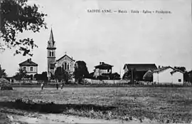 Sainte-Anne-d'Estrablin in 1931 | |
Location of Sainte-Anne-sur-Gervonde 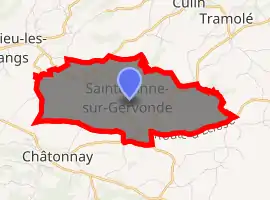
| |
 Sainte-Anne-sur-Gervonde  Sainte-Anne-sur-Gervonde | |
| Coordinates: 45°30′01″N 5°14′03″E | |
| Country | France |
| Region | Auvergne-Rhône-Alpes |
| Department | Isère |
| Arrondissement | Vienne |
| Canton | Bièvre |
| Government | |
| • Mayor (2014–2020) | Jean-Christian Piolat |
| Area 1 | 7.67 km2 (2.96 sq mi) |
| Population (2017-01-01)[1] | 692 |
| • Density | 90/km2 (230/sq mi) |
| Time zone | UTC+01:00 (CET) |
| • Summer (DST) | UTC+02:00 (CEST) |
| INSEE/Postal code | 38358 /38440 |
| Elevation | 426–546 m (1,398–1,791 ft) (avg. 500 m or 1,600 ft) |
| 1 French Land Register data, which excludes lakes, ponds, glaciers > 1 km2 (0.386 sq mi or 247 acres) and river estuaries. | |
Population
| Year | Pop. | ±% |
|---|---|---|
| 1866 | 555 | — |
| 1872 | 529 | −4.7% |
| 1881 | 528 | −0.2% |
| 1891 | 513 | −2.8% |
| 1901 | 421 | −17.9% |
| 1911 | 411 | −2.4% |
| 1921 | 362 | −11.9% |
| 1931 | 350 | −3.3% |
| 1946 | 345 | −1.4% |
| 1954 | 322 | −6.7% |
| 1962 | 305 | −5.3% |
| 1968 | 269 | −11.8% |
| 1975 | 270 | +0.4% |
| 1982 | 283 | +4.8% |
| 1990 | 337 | +19.1% |
| 1999 | 399 | +18.4% |
| 2006 | 537 | +34.6% |
| 2011 | 579 | +7.8% |
See also
References
| Wikimedia Commons has media related to Sainte-Anne-sur-Gervonde. |
- "Populations légales 2017". INSEE. Retrieved 6 January 2020.
| Authority control |
|
|---|
This article is issued from Wikipedia. The text is licensed under Creative Commons - Attribution - Sharealike. Additional terms may apply for the media files.