La Sône
La Sône is a commune in the Isère department in southeastern France.
La Sône | |
|---|---|
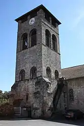 The church of Saint-Pierre, in La Sône | |
Location of La Sône 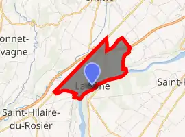
| |
 La Sône  La Sône | |
| Coordinates: 45°06′43″N 5°16′43″E | |
| Country | France |
| Region | Auvergne-Rhône-Alpes |
| Department | Isère |
| Arrondissement | Grenoble |
| Canton | Le Sud Grésivaudan |
| Intercommunality | Pays de Saint-Marcellin |
| Government | |
| • Mayor (2014–2020) | Pierre Rousset |
| Area 1 | 2.95 km2 (1.14 sq mi) |
| Population (2017-01-01)[1] | 584 |
| • Density | 200/km2 (510/sq mi) |
| Time zone | UTC+01:00 (CET) |
| • Summer (DST) | UTC+02:00 (CEST) |
| INSEE/Postal code | 38495 /38840 |
| Elevation | 160–270 m (520–890 ft) |
| 1 French Land Register data, which excludes lakes, ponds, glaciers > 1 km2 (0.386 sq mi or 247 acres) and river estuaries. | |
Population
| Year | Pop. | ±% |
|---|---|---|
| 1793 | 629 | — |
| 1806 | 527 | −16.2% |
| 1821 | 645 | +22.4% |
| 1831 | 714 | +10.7% |
| 1841 | 665 | −6.9% |
| 1851 | 687 | +3.3% |
| 1861 | 773 | +12.5% |
| 1872 | 901 | +16.6% |
| 1881 | 873 | −3.1% |
| 1891 | 731 | −16.3% |
| 1901 | 906 | +23.9% |
| 1911 | 972 | +7.3% |
| 1921 | 914 | −6.0% |
| 1931 | 972 | +6.3% |
| 1946 | 817 | −15.9% |
| 1954 | 864 | +5.8% |
| 1962 | 688 | −20.4% |
| 1968 | 641 | −6.8% |
| 1975 | 671 | +4.7% |
| 1982 | 665 | −0.9% |
| 1990 | 574 | −13.7% |
| 1999 | 590 | +2.8% |
| 2006 | 620 | +5.1% |
| 2012 | 605 | −2.4% |
See also
References
- "Populations légales 2017". INSEE. Retrieved 6 January 2020.
| Wikimedia Commons has media related to La Sône. |
| Authority control |
|---|
This article is issued from Wikipedia. The text is licensed under Creative Commons - Attribution - Sharealike. Additional terms may apply for the media files.