Saint-Maurice-l'Exil
Saint-Maurice-l'Exil is a commune in the Isère department in southeastern France.
Saint-Maurice-l'Exil | |
|---|---|
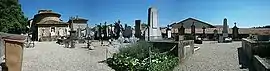 A panoramic view of Saint-Blaise church and cemetery in Saint-Maurice-l'Exil | |
Location of Saint-Maurice-l'Exil 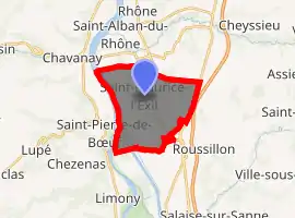
| |
 Saint-Maurice-l'Exil  Saint-Maurice-l'Exil | |
| Coordinates: 45°24′00″N 4°46′59″E | |
| Country | France |
| Region | Auvergne-Rhône-Alpes |
| Department | Isère |
| Arrondissement | Vienne |
| Canton | Vienne-2 |
| Intercommunality | Pays Roussillonnais |
| Government | |
| • Mayor (2014–2020) | Philippe Genty |
| Area 1 | 12.82 km2 (4.95 sq mi) |
| Population (2017-01-01)[1] | 6,141 |
| • Density | 480/km2 (1,200/sq mi) |
| Time zone | UTC+01:00 (CET) |
| • Summer (DST) | UTC+02:00 (CEST) |
| INSEE/Postal code | 38425 /38550 |
| Elevation | 139–265 m (456–869 ft) (avg. 120 m or 390 ft) |
| 1 French Land Register data, which excludes lakes, ponds, glaciers > 1 km2 (0.386 sq mi or 247 acres) and river estuaries. | |
Population
| Year | Pop. | ±% |
|---|---|---|
| 1800 | 545 | — |
| 1806 | 679 | +24.6% |
| 1821 | 692 | +1.9% |
| 1831 | 922 | +33.2% |
| 1841 | 970 | +5.2% |
| 1851 | 1,005 | +3.6% |
| 1861 | 1,077 | +7.2% |
| 1872 | 1,144 | +6.2% |
| 1881 | 991 | −13.4% |
| 1891 | 1,026 | +3.5% |
| 1901 | 1,084 | +5.7% |
| 1911 | 825 | −23.9% |
| 1921 | 969 | +17.5% |
| 1931 | 976 | +0.7% |
| 1946 | 1,087 | +11.4% |
| 1954 | 1,352 | +24.4% |
| 1962 | 2,568 | +89.9% |
| 1968 | 3,433 | +33.7% |
| 1975 | 3,735 | +8.8% |
| 1982 | 4,070 | +9.0% |
| 1990 | 5,218 | +28.2% |
| 1999 | 5,515 | +5.7% |
| 2006 | 5,526 | +0.2% |
| 2011 | 5,920 | +7.1% |
See also
References
- "Populations légales 2017". INSEE. Retrieved 6 January 2020.
| Wikimedia Commons has media related to Saint-Maurice-l'Exil. |
| Authority control |
|---|
This article is issued from Wikipedia. The text is licensed under Creative Commons - Attribution - Sharealike. Additional terms may apply for the media files.